Change of Plans

Day 17: 6/18/24
From: Yellowstone National Park, WY (Grant Village Campground)
To: We’ll know when we get there (Sheridan, WY by way of the Bighorn Scenic Byway, by way of Cody, WY by way of Cooke City, MT
Distance: 316 miles

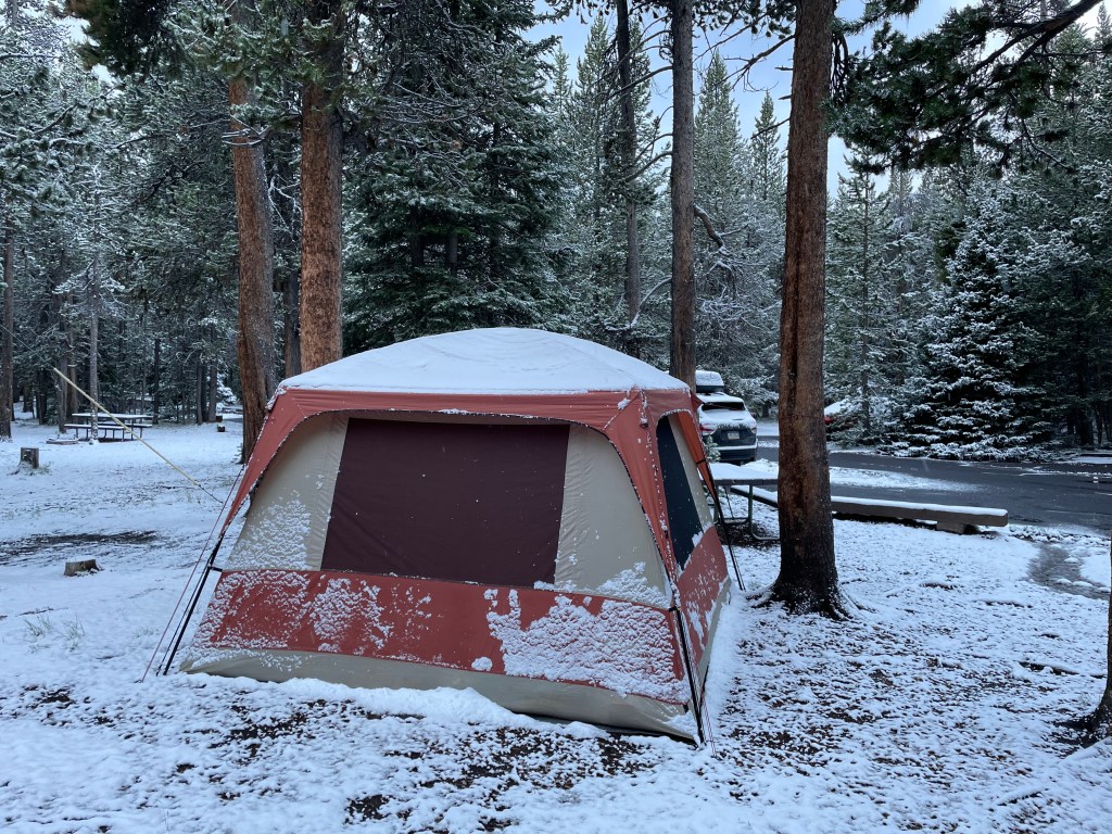
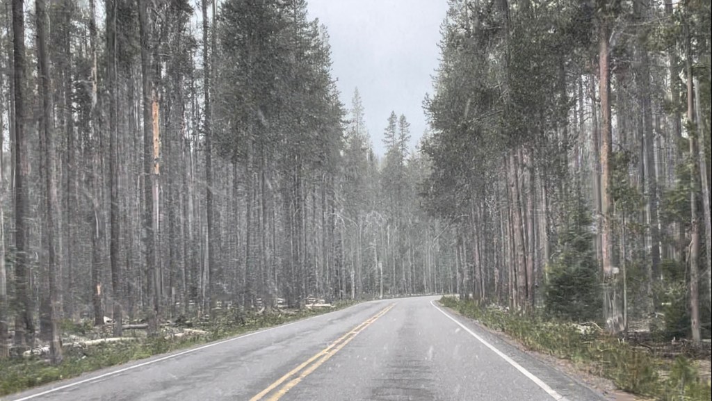
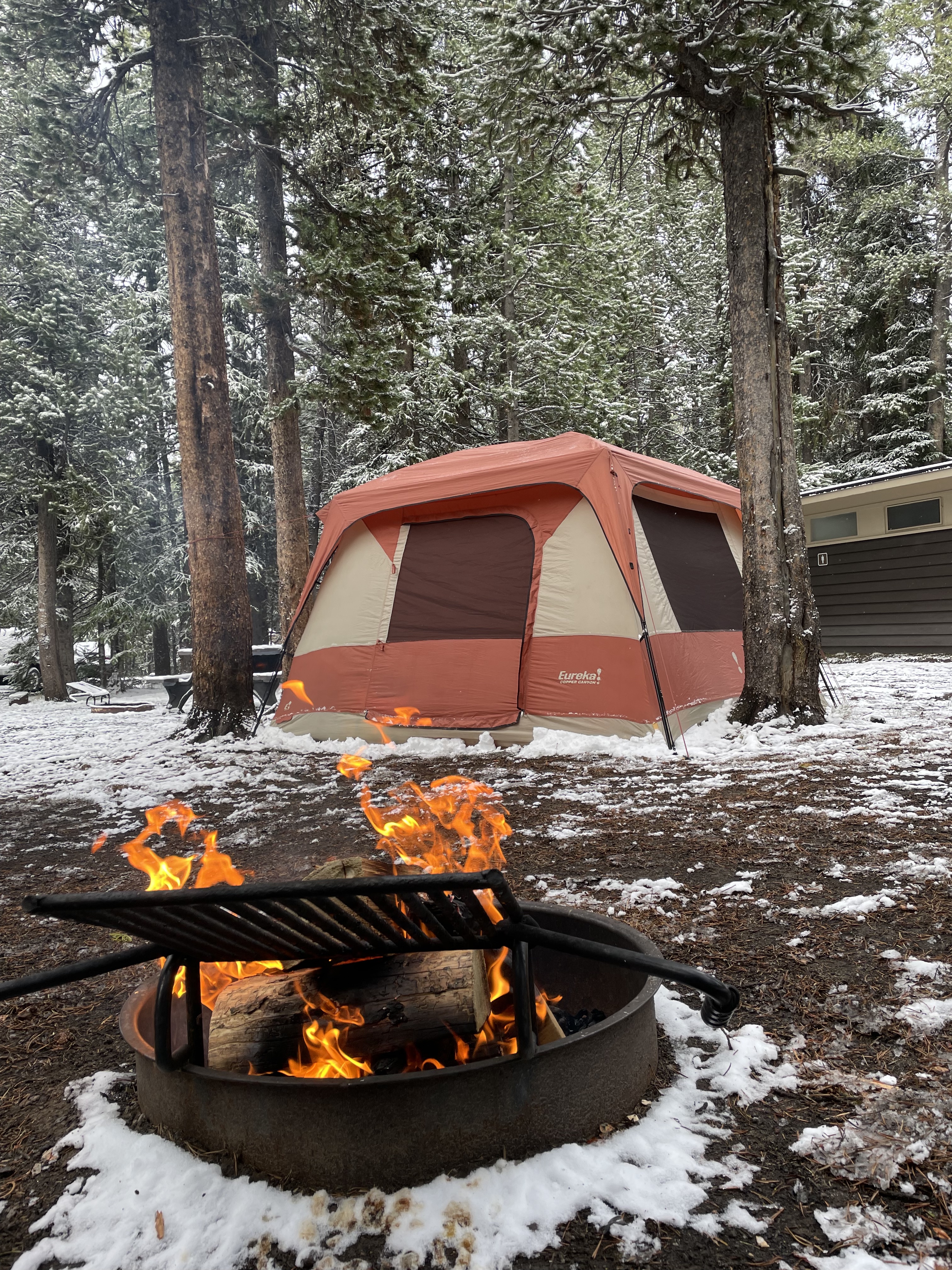
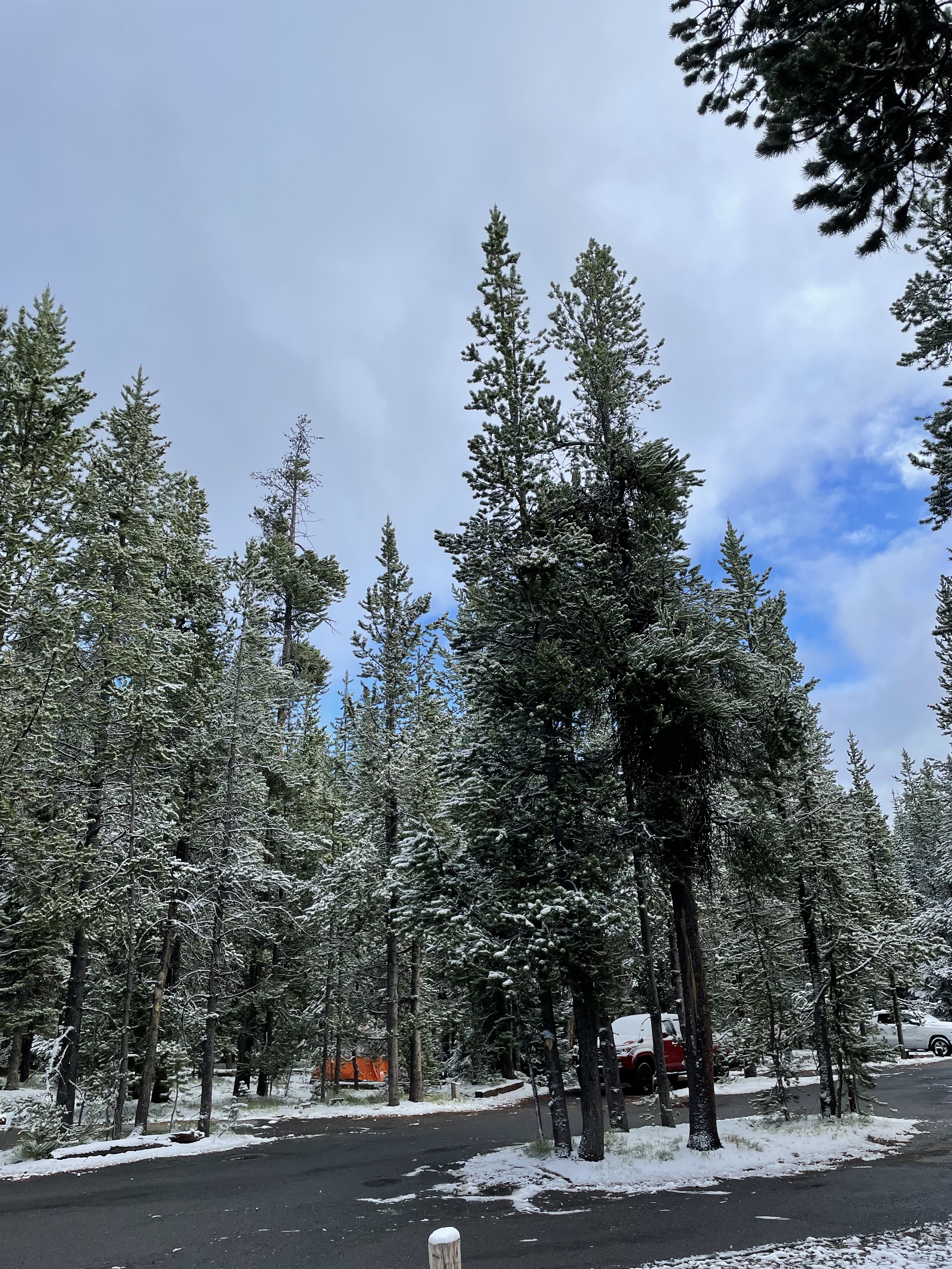
There’s an inch of snow on the ground when we wake up. The sleeping bags were warm enough with the extra blankets, but no one really wants to get out. We do anyway. But with the roads the way they are, we’re reluctant to take the drive over the continental divide again.

So we decide we’re not going to camp another night here since it’s supposed to be another 5-10 degrees colder tonight. Last night was doable. But not really a whole lot of fun. We eat breakfast, pack up camp, and check out by 8:45. We’ll still drive the park today since the weather is better (still 35 degrees!) but we’re not camping.

What will we do? <shrug> We don’t know. We’ll figure it out when we’re done sightseeing at the park and have reception again. We’ll probably drive halfway to the Badlands (which is our destination tomorrow) and book a hotel somewhere along the way. This is where being flexible pays off. 

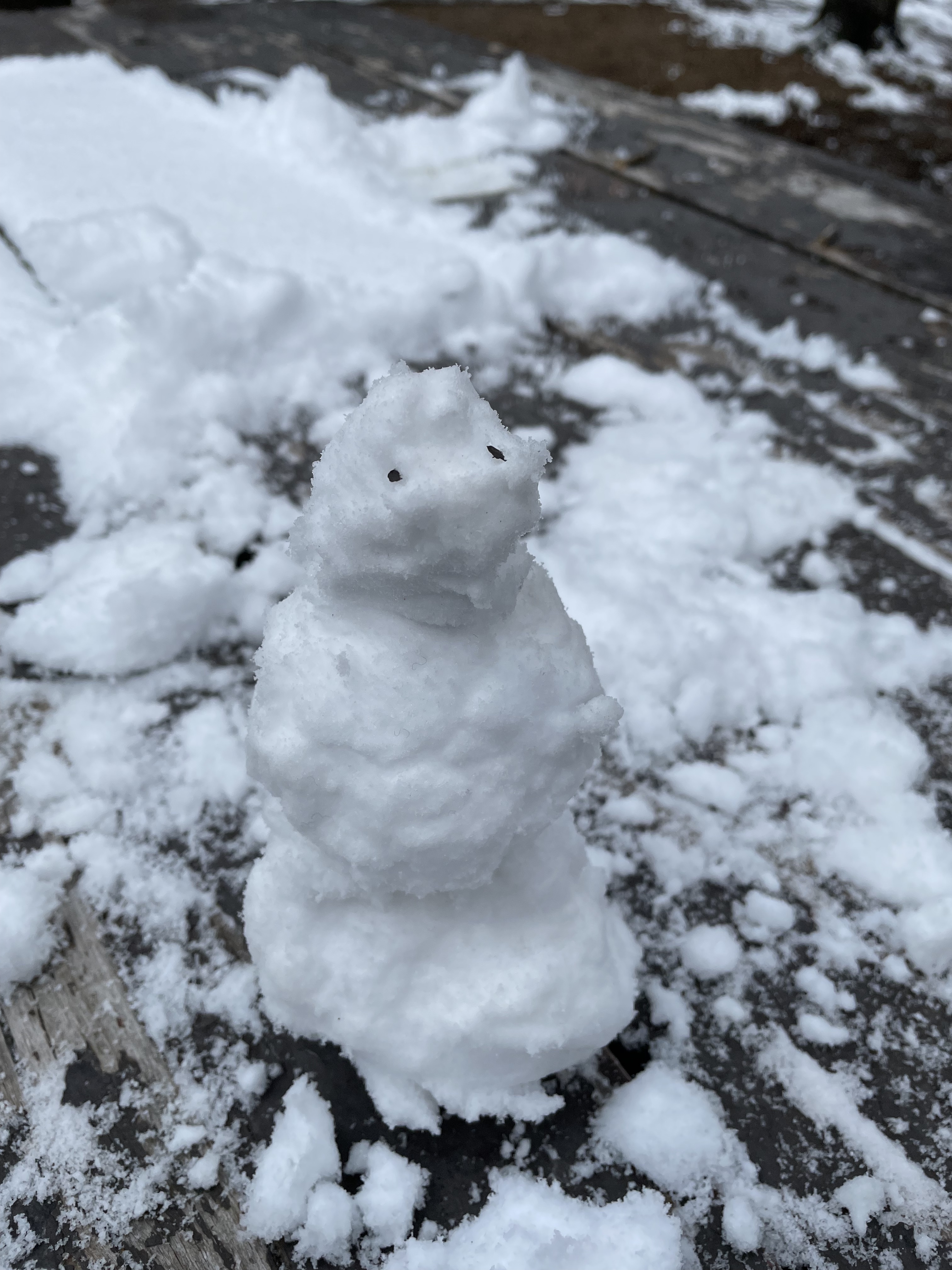
The kids? Have been real troopers. They have been so good at rolling with the punches. The kind of camping we just did with the supplies we (didn’t) have is not for the faint of heart. Still, there was laughter and joking and conversation. We had a snowball fight this morning, and I even built a little snowman. On June 18th.

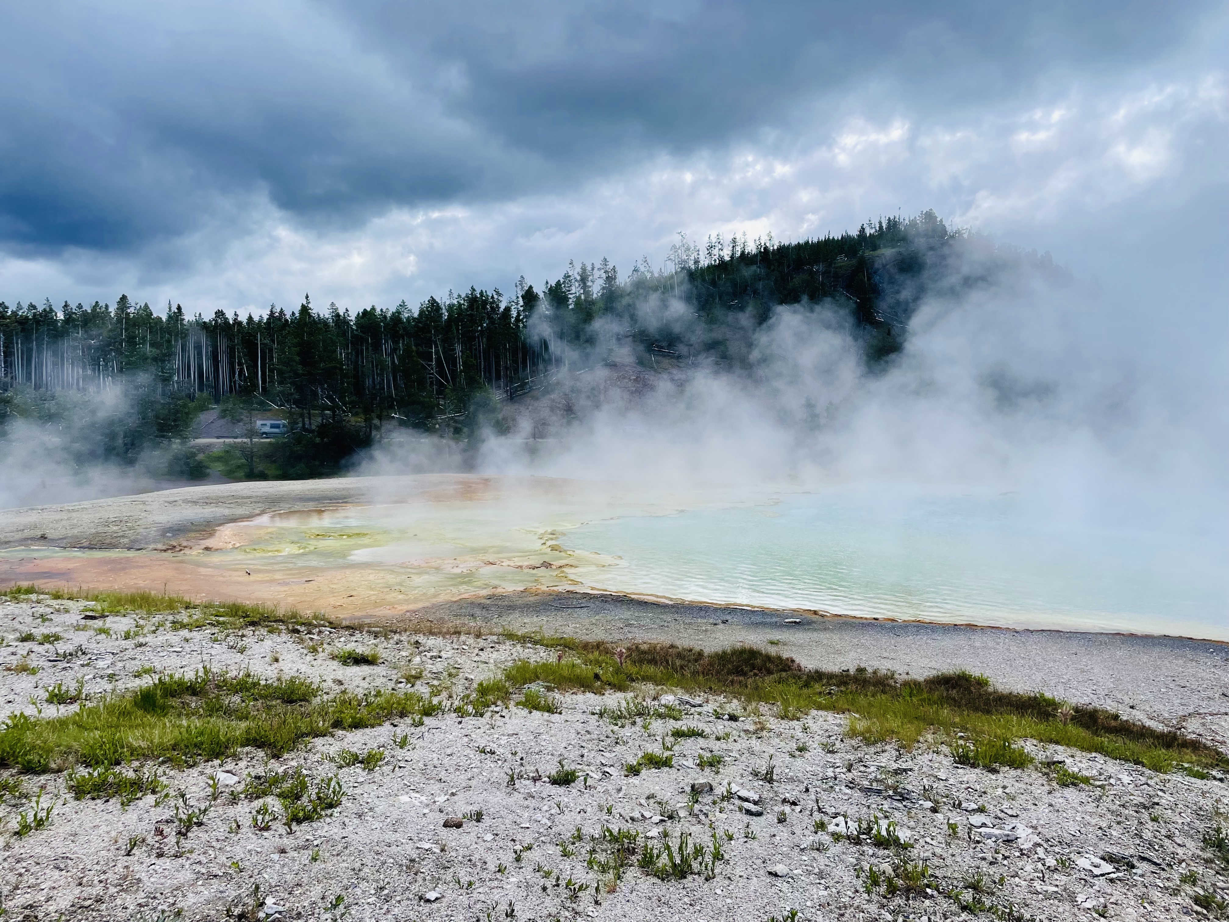
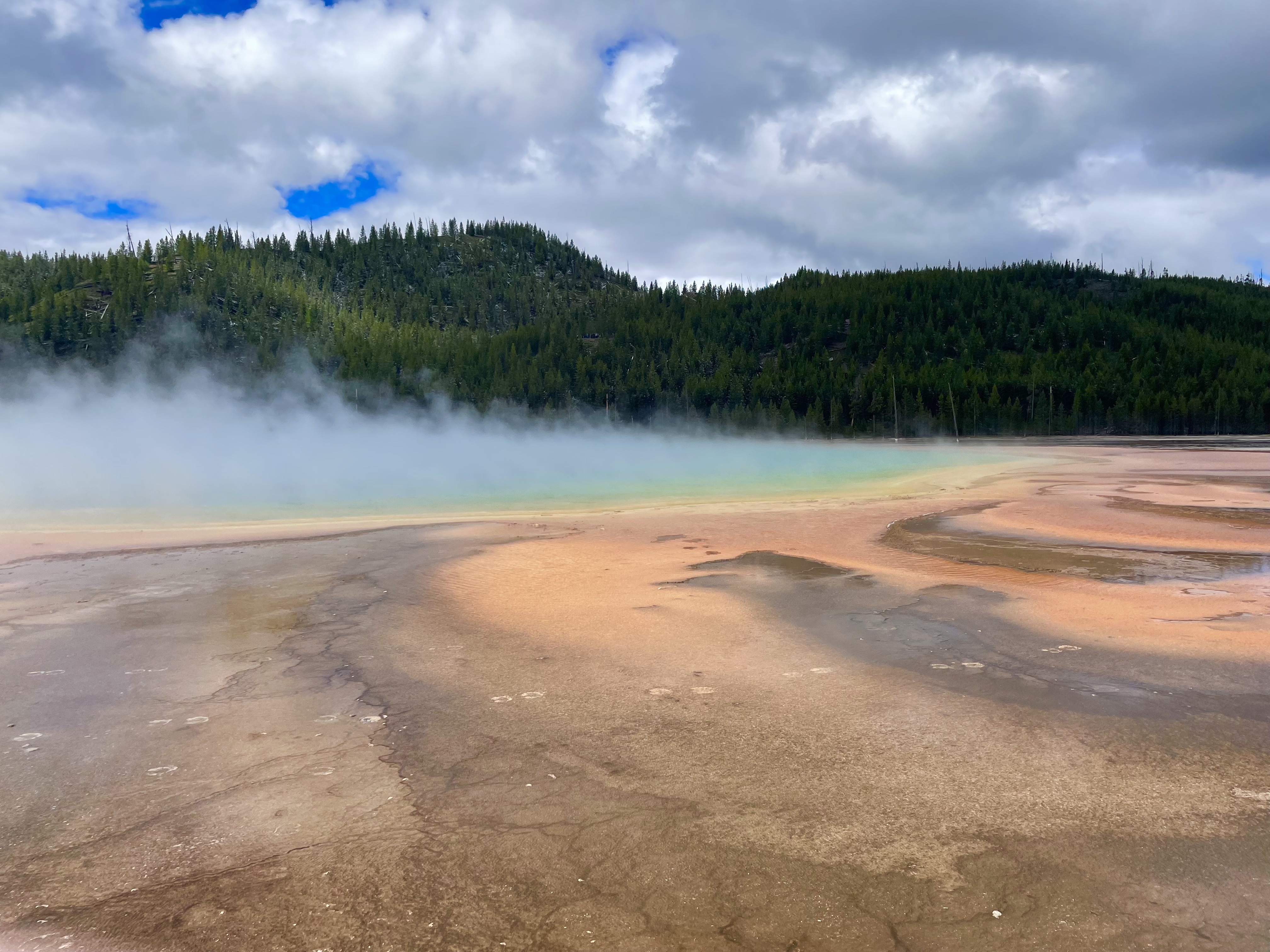
We check out early and head towards Grand Prismatic Spring to see it in the daylight hours. It’s a half-hour wait just to get into the parking lot, but it’s beautiful in the sun! Then it’s off through the rest of the park via the middle of the figure 8 of the Yellowstone roads and up through the northeast side and into the Lamar Valley.

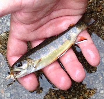
Along the way, we see bison, elk, pronghorn, mountain goats, and 4 black bears before we leave the park from the northeast entrance. We intend to follow the road into Montana and back to Wyoming again, but we’re in for a shock. As we exit the park, a sign reads “Beartooth Highway Closed.”

The map says that the Beartooth Highway is closed from October – late May for snow, but now??! Oh right, we just had snow. Panicked, we pop into the post office at Cooke City (which is adorable and probably a great place to vacation, by the way) to ask if someone can point us in the right direction since we are without cell reception and won’t have it for most of today’s drive. The postal worker at the desk is a wonderful human who helps us first with his knowledge that we still should be able to get where we want to go, and next by printing out Google Map directions for us like it’s 1998. I hug the paper to my chest and relish having real directions. And we owe this man. Because this route is way more scenic than what we might otherwise have seen.

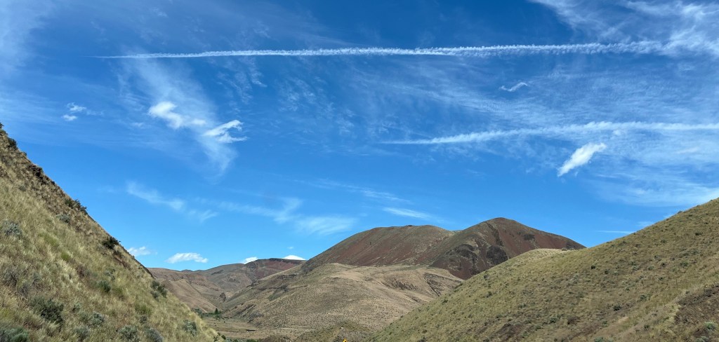
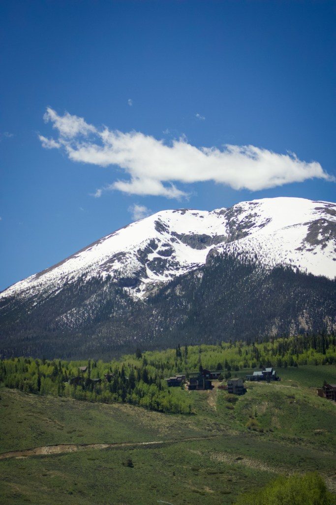
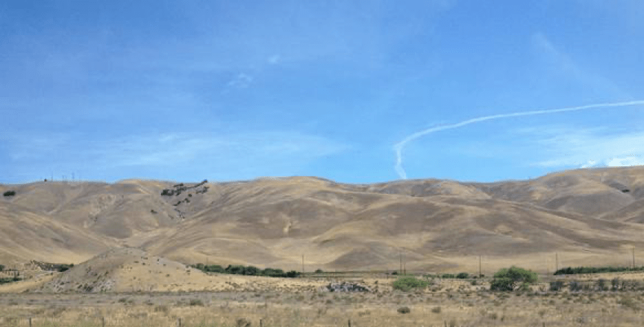
The drive is amazing. The scenery is incredible. Had we not decided to leave Yellowstone early, we never would have seen any of this. Sometimes things that go wrong are really just things going right. We drive through Chief Joseph Scenic Byway, which is a series of hairpin turns (no, not as bad as Independence Pass in Colorado, and this time there are guard rails), but the views are simply incredible. We can see the snow coming down on mountain peaks around us and the rolling hillside around us makes it seem almost like we’re in another country.

When we get to Cody, we’ve got cell reception again, so I pull up the a hotel in Sheridan, WY and book it. We are ready for hot showers and warm beds. We just have to drive 3 more hours to get there. But we’re unprepared for the continued gorgeousness of the scenery. I mean, we were just in Yellowstone, right? How could it get better? Well, I’m pretty sure Wyoming cornered the market when it comes to scenic vistas. We take the Bighorn Scenic Byway through Bighorn National Park and while we don’t see any of the famous sheep, we do see a total of 4 moose along the way, as well as numerous elk, deer, and pronghorn. The landscape is ever changing and along the way, different rock walls are marked with what period they’re from, which was super cool as we were driving past, but obviously nothing I actually retained since I can’t remember any of it now as I type. Cambrian, Pennsylvanian, and some other time periods from a really long time ago. What I do know is that the rock changes drastically in shape and color and size. But also, the landscape itself changes.

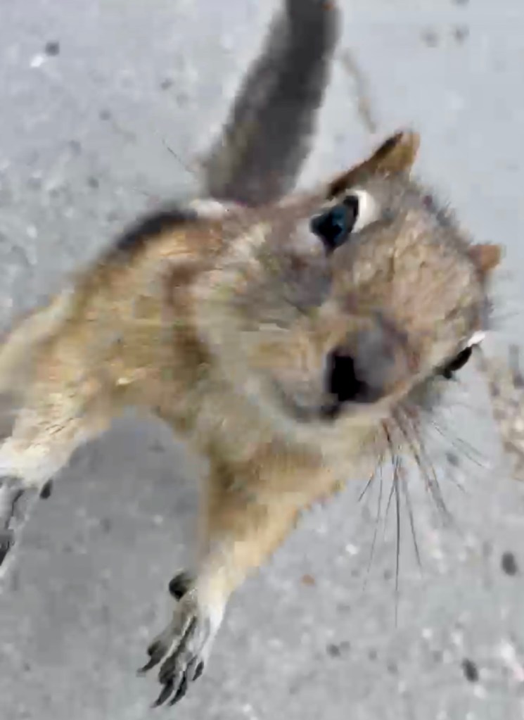
We have seen rolling meadows, green hillsides, rocky crags, and a panoramic landscape that makes us feel like we’re literally on top of the world. We stop at one scenic overlook to take photos and Husband creates a small army of chipmunks (and one golden mantled ground squirrel twice their size — he must be the general). I laugh and photograph him taking video of them. Then I decide I might have to call him Cinderella.

When we reach our hotel in Sheridan, we’re excited to find it’s a suite with a kitchenette and a free laundry room I will definitely utilize. Hot showers, fresh pizza from Powder River Pizza & Pub, and television tonight.

While doing laundry, I meet a retired woman from Florida who’s traveling with her husband across the country and visiting national parks, much like us. We also end up talking with a man from North Carolina who’s traveling cross-country on his motorcycle and who just came from Devil’s Tower earlier in the day. The three of us have conversations about the parks and the best places to visit and the best times to visit them. The laundry room is an oasis of kindred spirits tonight. It makes folding clothes so much more enjoyable.

Then bed. We pass out quickly, our many snores filling the room. Tomorrow, we head for the Badlands, and because of today, it’s half the drive it would have been. Win!

Oregon – the Land of Many Climates

Day 14: 6/15/24
From: Crater Lake, OR
To: Boise, ID
Distance: 418 miles (+ some)

Um, it’s snowing. In mid-June. We’re out the door by 8 am and the cloud cover above us is thick. But snow? I guess it *is* 32 degrees, so it’s not unprecedented. But also not exactly expected either. We’re east-coasters. June means warmth.

After a small snafu where we leave the park in the wrong direction thanks to zero reception, we head north through the Umpqua National Forest and Fremont-Winema National Forest where we continue to be snowed on for the next hour. This is surreal. When we have reception again, the Maps app turns us around again and we’ve basically taken a very roundabout way to get out of the park, but we didn’t add any time to today’s drive. Thankfully. 7 hours is 7 hours.

One thing I notice about Oregon is the purple wildflowers along the roadside. Some are close to the ground, and some grow a foot high or more. But purple seems to be the color here. As opposed to the white, pink, and red flower bushes (roses?) growing along California roads.

The surroundings quickly change as we drive back into the desert — still Oregon, but no longer woodsy and pine-filled. Sun, scrub brush, and dry hills. But it’s not hot here! It may look a bit like Arizona, but it’s definitely not. Still only 54 degrees at 11 am.

In this strange terrain we see two antelope — the first of the trip! And they dart when they see us, leaping across the desert scrub, their fluffy white butts to us.

After some time, Husband grows bored of this drive and begins to make up his own song. 

“There’s nothing out here
Nothing at all
I can’t even
Make a call

I’m just driving
In my car
I can see
So damn far”

I take over driving for the last two hours or so and we get stuck behind an enormous line of traffic for miles upon miles because of an oversized load that refuses to pull off the highway to let the mile backup pass him… Does Oregon not believe in 4-lane highways? What’s with all the secondary highways? I guess not enough people live here to make it worth it? Still, it was maddening to drive 35-45 miles an hour in a 65 mph zone for a good 15-20 minutes. 

We arrive at our hotel in Boise at 5 pm, sad because we’re officially back on Mountain Time and out of Pacific, officially on our return trip. Husband and Older Child go out for dinner while Younger Child and I stay in and catch a nap. I tweaked something in my neck today (yay), so I’m trying to give it a little bit of a rest. And a rest usually ends up meaning sleep, so… Husband comes back at 9:30 with dinner for me and Younger Child — the problem with going for dinner late on a Saturday evening is anything brought back will be brought back even later.

I  check the weather forecast for the next few days and am a bit gutted to find it’s going to be very, very cold at night for the next few nights. And we’re in a tent. So while most of my friends back home are headed into a dangerous heat wave, I hope they all think of us, shivering in our tent over the next few days.

Do I place an order for blankets at a Target in Jackson, Wyoming so we can pick them up tomorrow on our way to our next campground? Yes, I do. Because modern problems call for modern solutions and the internet is our friend.

Moving Up in the World

Day 4: 6/5/24
From: Cedar Bluff State Park, KS
To: Aspen, CO (Difficult Campground)
Distance: 528 miles

Up at 6 and out the door by 7:30 with a quick stop for groceries at Malay’s Market in WaKeeney, KS, Christmas City of the High Plains. There are three checkout lanes; This One, That One, and The Middle One. I love the humor. And friends. They bring your groceries to the car FOR you, even if you just have three bags. Hey, Kansans, I do have one question though. What is chewable nugget ice and why?

Halfway to the next stop and the kids marvel at the number of bugs splattered on the windshield. I’d forgotten about this part. Eastern Colorado is much like Kansas, but with ever-so-slightly barely rolling hills that prevent you from seeing very far.

But we spot the Rocky Mountains off in the distance to our left and that brings promise that the land will change drastically not long from now. We expect the heat of the day to give way to a chilly evening tenting at a campground not far from Maroon Bells-Snowmass Wilderness where cell reception is spotty. So if you don’t see this post until later, that’s why…

The Rockies are in sight for so long that it’s almost a shock when we’re finally close enough to really see the features. (Especially after so much flat.) I can’t help but think about what pioneers much have thought as they traveled the continent on horses and in wagons when they saw these massive looming snowcapped mountains in front of them. I’ve come to understand that I will never possess the kind of fortitude it takes to uproot your family and immigrate to a new and wild place.

We take a quick lunch break at a scenic overlook just outside of Golden, Colorado where we meet up with this little fella, who didn’t seem to mind at all that we were there.

Up into the Rockies, we go, into the Arapaho National Forest. Younger Child is amazed by the signs to beware of elk and bighorn sheep. But we don’t see any right away. Then, just as Husband is mentioning how he’s usually pretty good at spotting wildlife, we round a corner to a small herd of bighorn sheep eating grass *right* next to the white line of the road. He really IS good.

The temperature has dropped from 87 degrees F to 59, and our car A/C has switched to heat. A small stop in the town of Silverthorne for fuel and nausea relief from the curving, twisting mountain roads. Being in Silverthorne is a bit like being in the middle of the Austrian Alps. Here’s a town. And here are large, snowy peaks surrounding the town on all sides. (Not like the Alps? Here are a bunch of fast food restaurants and gas stations.)

We opt to take Independence Pass again and I have to wonder what we were thinking. By the time we pass Arkansas Headwaters, Younger Child and I keep the windows open to keep from letting the windy roads get the better of us. I remind myself that this was the hardest drive of our cross-country trip last time. These roads are tough! After this, it should be easy sailing by comparison!

I start to get excited as we near the top, though, as the birch trees have begun to show up. Aspen, soon! But first, a snowball fight at 12,095 feet. In shorts, t-shirts, and sandals. Ah, that’s right. *That’s* why we took Independence Pass! 

View from the tent

We arrive at the campground with the help of a downloaded offline map and get ourselves set up by 4 pm. (Kids are less than impressed with the campground pit toilets. This is their first encounter with them and they are underwhelmed to say the least.) But there’s just one problem when it comes to figuring out where to head next. Maroon Lake isn’t on my map and I can’t use the internet to find it. 

So we head to Aspen for dinner (and cell service) to discover that Maroon Lake is actually an hour away. Which…just isn’t in the cards after an 8 hour drive that included Independence Pass today.

We’ll have to be content shopping in Aspen and hanging at the campground this evening. And when I say “shopping,” know that I mean dinner at the Silverpeak Grill and gelato from the Paradise Bakery. Plus a couple of souvenir stickers. Certainly, we didn’t pick up goods from Prada, Ralph Lauren, Dior, Gucci, or any of the other posh stores we can’t afford. It turned out to be a good afternoon despite having to reroute  our original plans.

Older Child is a little disappointed about missing Maroon Bells, but they don’t really want to spend another 2 hours driving there and back. No one does. When we get back to the campground, Husband and Older Child head out for a hike in the day use area of the White River National Forest while Younger Child and I relax in the tent. Sleep will hit hard tonight.

Oh. 

And did I mention we need to drive back over Independence Pass again tomorrow on our way to New Mexico?

<sobs>

To See a Giant

Original Post: August 11, 2015

Though we could have enjoyed the coast forever (And really, who couldn’t?), we packed up early and hit the road for Sequoia National Park to meet with The General.  (Sherman, that is.)  We were on our way early and fully prepared for hitting LA traffic in full-on rush hour.  Yeah. Well. It’s one thing to say that and another to do it.  We weren’t really prepared.

How can you be prepared for this?  See those red dashes?  That’s a delay.

Los Angeles traffic only added an extra hour to the trip and I guess we should have been grateful for that.  It could have been worse.

One thing we discovered along the way was that most of California looks like this:

With the exception of the times it looked like this:

Or like this:

Seriously – weird, grassy, rolling hills or orange orchards or vineyards.  That was it.  I’m certain there must be more to California than this, but in all the miles we traveled (from San Diego to the Redwoods) this was, more or less, what we saw.

We reached Sequoia National Park at three in the afternoon and headed straight for the world’s largest tree. But first, a massive downpour.  It was hard to imagine that California was in a drought when the view through our windshield was hardly visible at all.

When we finally got to into the park and had our first views of Sequoias, our jaws dropped.  There is nothing that can prepare one for the sheer mass that is a few-thousand year old Sequoia.  They are awesome in the true sense of the word. The gorgeous rust-hued trunks are not what you would expect.  I put my hand on one and expected to feel a tree trunk (duh, right?), but I was shocked to feel a soft texture, almost spongy.

We made our way down the path to General Sherman, and while he was not the most gorgeous specimen, he was regal nonetheless.  There was a line to take photos next to him.  Dutifully, I stood in line so that Nate could get a picture of me with the tree, but no camera could really capture the stunning presence that these trees have.  (So go see them in person!  You won’t be sorry!)

If Sequoias can convince Nate to hug a tree, they can convince anyone.

We made our way to Lodgepole Campground, which was, hands down, one of the best sites we booked on the trip.  The park ranger who checked us in quickly reminded us that we were in bear country and that just the night before, they’d had to shoo away a black bear from the campgrounds.  This made me somewhat nervous, as I’d booked a campsite on the outskirts of the grounds.  Oh well.  You only live once, right?  And that’s what bear boxes are for.

The campsite was perfect, and right next to the Kaweah River (which was more like a creek at that point in time) and you know exactly where Nate went.  Fishing, of course.

The native brook trout, though tiny, were feisty and Nate caught several.  Since they weren’t used to people, Nate discovered that some stealth was required to catch them.  If they saw you, they were gone…  

Of the woods, Sequoia National Park was one of my favorites.  It’s a long and windy drive to get to (But unlike the Rockies, there were guard rails and stone walls!) and it’s a hike to see General Sherman (although there is handicapped access available), but it was worth every second. 

And we managed to avoid a bear encounter.  Woohoo – that’s two for two in bear country!  Safe!