Small Miracles

Day 9: 6/10/24
From: Bryce Canyon, UT
To: Grand Canyon National Park, AZ
Distance: 158 miles

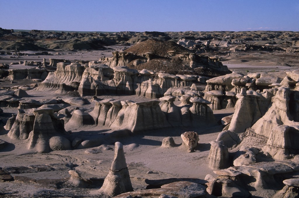
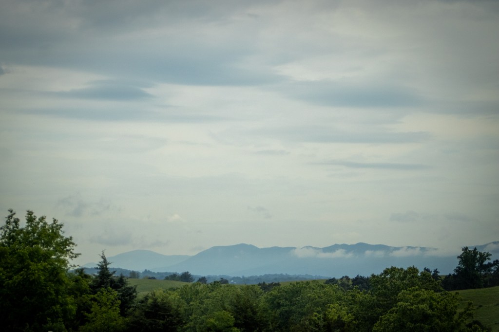
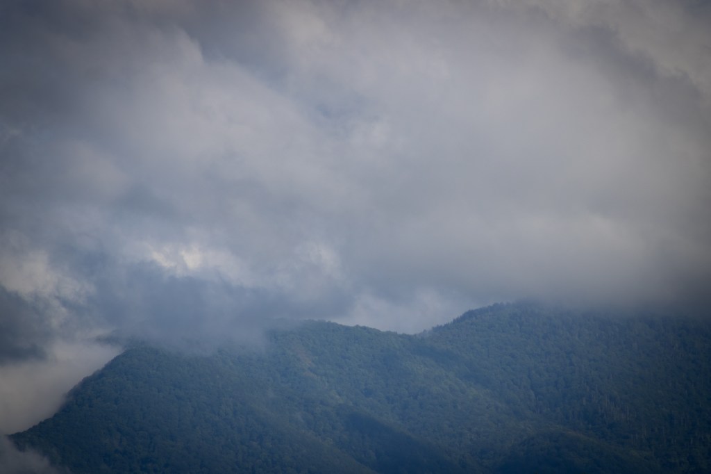
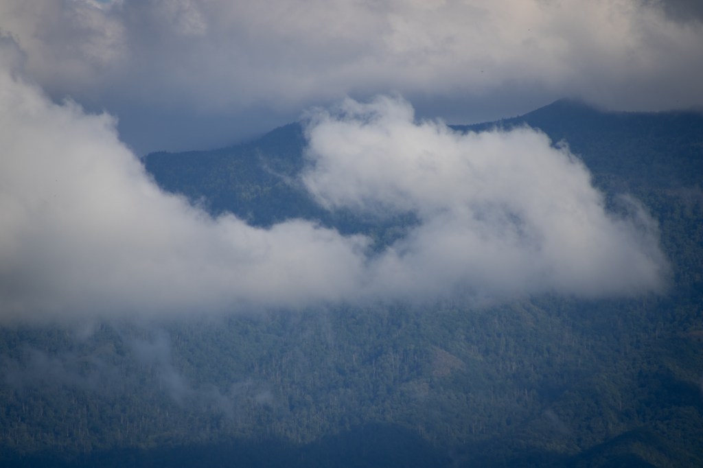
I wake at 5:30, very glad I took my sky photos last night because this morning is all cloud cover. The clouds that have rolled in end up preventing us from seeing sunrise over the hoodoos as we had hoped. We still take a 2 mile hike along the rim regardless, just taking in the scenery. On the way back to our campsite, we spot a raven who decides to have a conversation with us, clacking his beak, cawing, and cooing. Older child caws back. They go on like this for a few minutes in an unexpected interaction that put smiles on all of our faces.

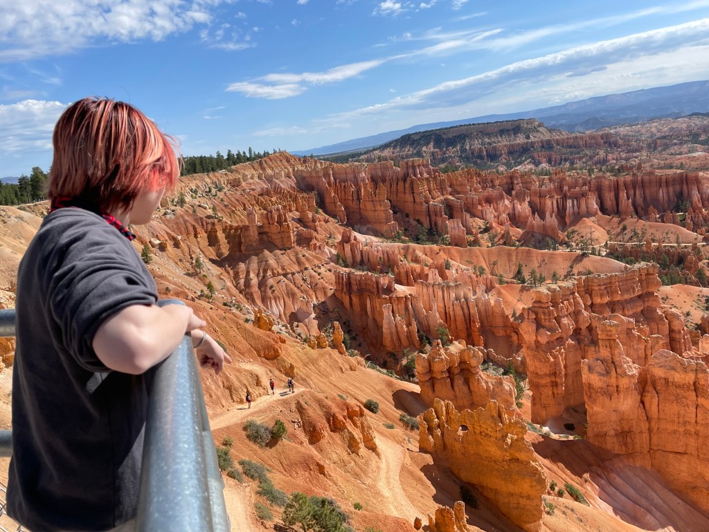
Back to the tent for a nap before we leave Bryce. Later? A short trip to the Grand Canyon. (Short = 3 hours in the car) The naps only last about an hour before we get up and break down camp. And because the sun is now shining (where was it before?!) we take a walk to Sunrise Point again. But Husband wants to visit the lookout point we saw last time we were here, so we head to Sunset Point, where the kids enjoy the same view and become as entranced with the canyon as we are. It takes effort to pull them away and get on the road. How to leave behind those towering orange spires and the ravens that soar among them… it’s oh-so-difficult.

We stop to buy car stickers from a souvenir shop nearby and say hello to the saddled up horses waiting for riders to show up for their trail rides. It takes everything in me not to hop out of the car and pet them.

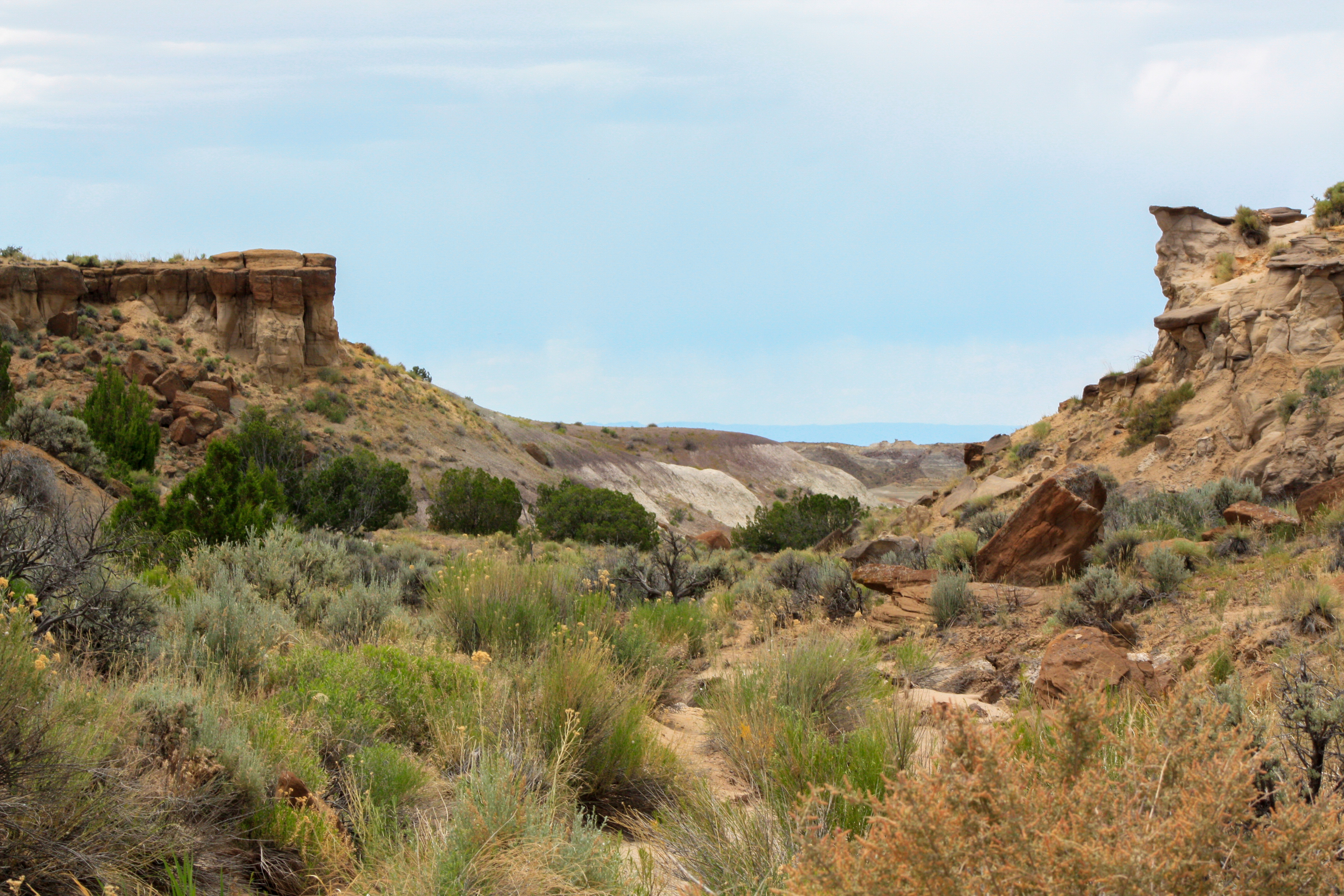
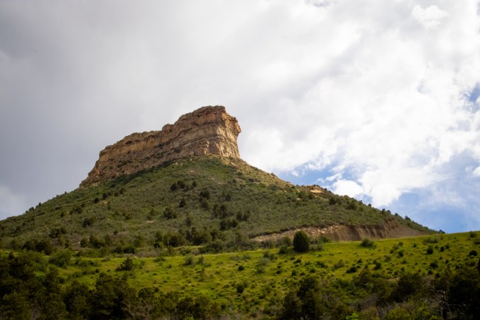
We make one more stop at a rock shop and an antique place in Orderville, UT before we get into the heavy driving for the day. And we still manage to reach the Grand Canyon by 1 pm because time change. Again. Arizona doesn’t do daylight savings time. Bison greet us shortly after we enter the park. And something we didn’t realize last time (because we’d never seen wild bison before) — these bison are MUCH smaller than the bison in Yellowstone. 

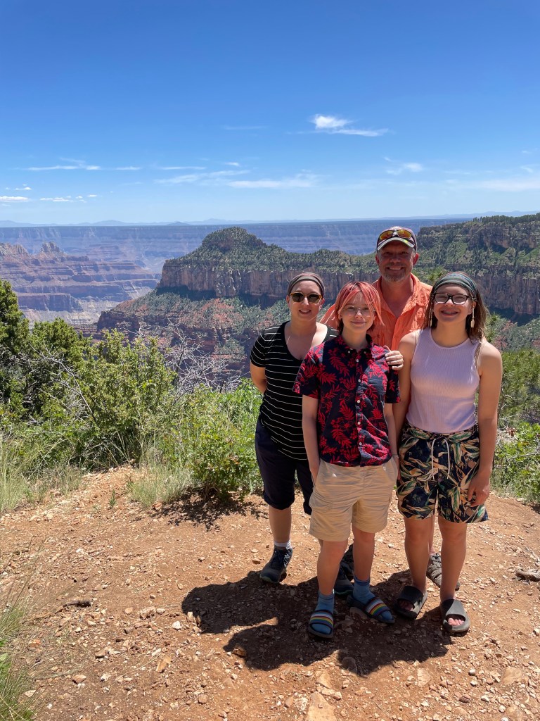
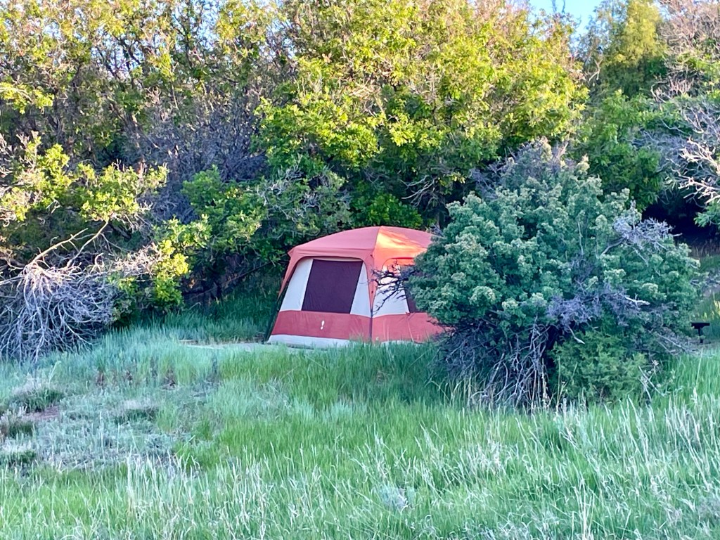
We get to our campsite and set up, but since the tent is in direct sun and will be for hours, we head out to the closest lookout point to take in the view, and get a family photo taken by a French-Canadian from Montreal who just finished hiking 400 miles from Phoenix to the Grand Canyon. My aching joints can’t even comprehend that this is possible.

Kids marvel at how wonderful most fellow campers are/have been over the last few days. Everyone leaves their stuff their campsites and trusts that no one will “mess with it.” In fact, along one hike, we end up talking with other hikers at the lookout point and everyone chimes in on their favorite national parks. The kids agree that the kind of person who camps the National Parks is generally a kindred spirit and we relish that we’ve had pleasant conversations with so many people we’ll never meet again, but who kind-of-sort-of make us like humanity again. 

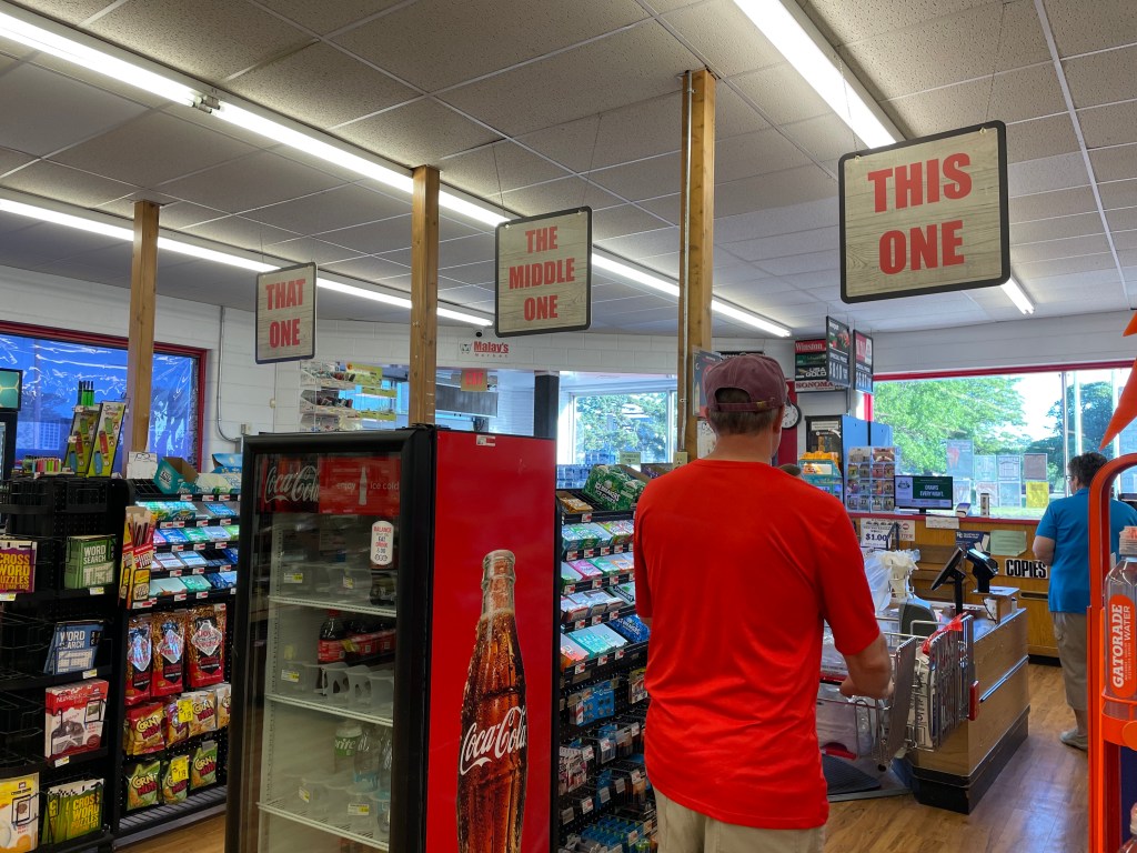
After a stop by the local store to pick up lunch and taking much needed showers, we play a game of Oregon Trail, where 2/4 of us make it to the end this time. Then we head to the lookout points at the lodge. We opt to take the Angel Point trail, which is generally paved, but is also a very steep grade downward which is tough on my joints, so I bail about halfway to the end, sit on a rock, and take a selfie. Because why not?

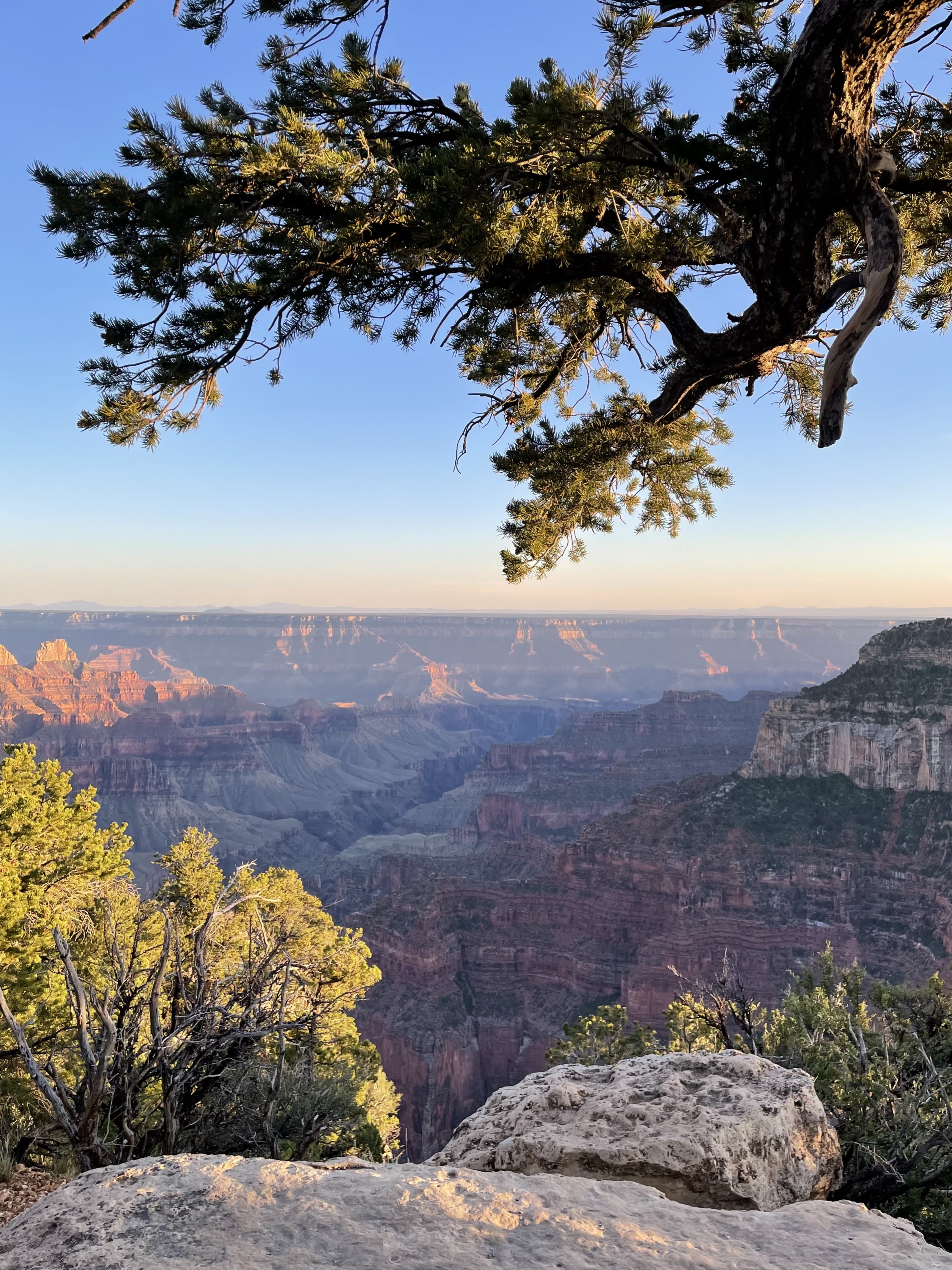
The Grand Canyon is as it ever was — large and impressive, its distance almost incomprehensible. I’ve hiked 5 miles today on mostly dirt trails, something I haven’t done in several years, something I haven’t been *able* to do. I am elated. Exhausted, but elated. Having a dynamic disability makes it difficult to plan ahead. Sure, I planned to stop in all these different locations over the course of three weeks, but I had no idea whether or not I’d be able to full enjoy them the way I wanted to. Even now, I still have no idea what the next two weeks will bring. But I am grateful, so, so grateful right now that I have been able to get out and immerse myself in these oh-so-miraculous places that exist on this planet we call home. 5 miles may not be much for most people, but for me? It’s worth celebrating like it’s 500.

As it gets dark, our family heads back to camp. Sadly, Husband is coming down with a cold. At least I know it wasn’t the same one I had right before we left, so I can avoid feeling guilty. But I still feel bad. Maybe this is the real reason behind the terrible snoring?!? One can hope.

Even if it didn’t stop him from hiking Bryce Canyon this morning and the Grand Canyon this evening. Husband even ventures out with me before bed to take a few night sky photos (See? Even sick, he’s still my hero.) and then it’s time for bed. 

Fingers crossed he feels better in the morning! 

Into the Fire

Day 6: 6/7/24
From: Santa Fe, NM
To: Mesa Verde National Park, CO by way of Bisti/De-Na-Zin Wilderness Area, NM
Distance: 318 miles

Up at 7, but Husband was up half the night with a migraine brought on by the IPA he had with his shrimp tacos last night. Maybe there’s some obscure rule that says we can’t *all* get good sleep at the same time. Because I slept like a baby. It was amazing.

We head to the breakfast buffet at the inn, which is delicious and loaded with an array of southwestern goodies. Pinto beans, mixed veggies, chili, plus your regular fare like eggs, biscuits and gravy, fresh fruit, cereal, pastries, and oatmeal. We eat in the beautiful courtyard where I’ve decided I’d like to set up permanent residence.

Then we’re on the road to Cabela’s for a seamless pickup of the air mat I ordered yesterday. Mat in hand, we head northward to the Bisti/De-Na-Zin Wilderness Area, the land changes drastically again. We drive through several reservations which are nothing more than rock, dirt, and scrub brush from the road. Breathtaking and lonesome.

Along the way, we pass someone in the desert who’s riding a bike loaded with supplies. “Where is he going?” I ask. “Where is he *coming* from???” He’s coming from the same whole lot of nowhere we just came from. I can’t imagine riding a bike on a desert highway. We soon figure out he’s heading towards the town of Cuba, NM just a few miles down the road.

By the time we’re 45 minutes from our destination, the surrounding land is low grass and scrub. Younger Child says it’s “Minecraft terrain.” Indeed. A half hour out and we start pointing out angry alien faces in rocks. 

We travel twelve miles down a dirt and gravel road to the Bisti/De-Na-Zin Wilderness Area and park, load up on sunscreen and water, and head out into the wilderness in hopes of seeing this:

What we didn’t plan on: Being there at the beginning of the hottest part of the day, there being NO maps at all of the trails, and the distance would would have to travel to see what we were hoping to see. 

So in the end, we didn’t see it. But we still walked 2 miles in blistering heat with no shade and got some cool pictures regardless, plus saw 75 million year old petrified wood. Still, everyone is surely wondering what Mom was thinking putting this one on our list, but when Mom planned this in January, it wasn’t a real feel temperature of 100 degrees.

We get back to the car, down more water, and blast the A/C for the next hour, stopping at lunchtime not to eat lunch, but to eat ice cream at a gas station. Because ice cream is the only food that even remotely sounds good right now. 3/4 of us have heat-related headaches. Older Child says Dad must have played his headache card last night.

We did get to see some horses in the wilderness area. Wild? Or Navajo owned? We don’t know. And without cell service, we can’t find out…

Older Child and I drank several bottles of water to try to get rid of the heat headaches…and found out later we both desperately had to visit a restroom but there’s nothing nearby. It was a fun hour.

We got to Morefield Campground in Mesa Verde National Park and were immediately greeted with stunning 360 degree views. There is no direction that isn’t incredible.

A short time later, we set up camp in a beautiful site with sun and shade and trees. A gust of wind tries to take our tent away before we have it staked down, but we hold on.

Minutes after we arrive, both kids are approached by a kid from another camp site who asks if they want to play tag with him. They help us finish setting up and then head over to play for a half hour before dinner. Older Child jokes they want to play snake tag, where you run around in the grass with no shoes on and see who gets bitten by a snake first. Yes, my kids are weird. They ended up not playing any kind of tag, snake or otherwise. Instead, they played Mancala and lost twice to an 11-year-old named Caleb.

A quick camp meal and some local exploring for Husband and kids, while I play with photos on my computer at the camp picnic table and receive a visit from a sweet black-tailed doe. At 9, we head to the amphitheater for a presentation by a park ranger about some of the animals in the park.

When we get back to our campsite, Mom makes another *very* bad decision. Older child is concerned about a noise in the grass and trees behind our tent so I take a flashlight behind to look and then fake freaking out at a bear. The kids *lose* it and it’s a mixture of laughter and tears for the next hour as adrenaline clears system. I am an awful mother. This is the kind of prank their dad would pull, not me… I may never get over feeling guilty over this one.

To try to ease the tension, I pull out my camera and show the kids the earth’s rotation by focusing on the North Star and keeping the shutter open to create star trails. They are intrigued and we agree we’ll try it again tomorrow night with a little more preparation beforehand.

For now, bed. An early wake up so we can head out to see the Pueblo dwellings along the mountain in the morning. Animals are also most active early in the morning, so who knows? If we’re lucky, maybe we’ll see a bear on the way…

Moving Up in the World

Day 4: 6/5/24
From: Cedar Bluff State Park, KS
To: Aspen, CO (Difficult Campground)
Distance: 528 miles

Up at 6 and out the door by 7:30 with a quick stop for groceries at Malay’s Market in WaKeeney, KS, Christmas City of the High Plains. There are three checkout lanes; This One, That One, and The Middle One. I love the humor. And friends. They bring your groceries to the car FOR you, even if you just have three bags. Hey, Kansans, I do have one question though. What is chewable nugget ice and why?

Halfway to the next stop and the kids marvel at the number of bugs splattered on the windshield. I’d forgotten about this part. Eastern Colorado is much like Kansas, but with ever-so-slightly barely rolling hills that prevent you from seeing very far.

But we spot the Rocky Mountains off in the distance to our left and that brings promise that the land will change drastically not long from now. We expect the heat of the day to give way to a chilly evening tenting at a campground not far from Maroon Bells-Snowmass Wilderness where cell reception is spotty. So if you don’t see this post until later, that’s why…

The Rockies are in sight for so long that it’s almost a shock when we’re finally close enough to really see the features. (Especially after so much flat.) I can’t help but think about what pioneers much have thought as they traveled the continent on horses and in wagons when they saw these massive looming snowcapped mountains in front of them. I’ve come to understand that I will never possess the kind of fortitude it takes to uproot your family and immigrate to a new and wild place.

We take a quick lunch break at a scenic overlook just outside of Golden, Colorado where we meet up with this little fella, who didn’t seem to mind at all that we were there.

Up into the Rockies, we go, into the Arapaho National Forest. Younger Child is amazed by the signs to beware of elk and bighorn sheep. But we don’t see any right away. Then, just as Husband is mentioning how he’s usually pretty good at spotting wildlife, we round a corner to a small herd of bighorn sheep eating grass *right* next to the white line of the road. He really IS good.

The temperature has dropped from 87 degrees F to 59, and our car A/C has switched to heat. A small stop in the town of Silverthorne for fuel and nausea relief from the curving, twisting mountain roads. Being in Silverthorne is a bit like being in the middle of the Austrian Alps. Here’s a town. And here are large, snowy peaks surrounding the town on all sides. (Not like the Alps? Here are a bunch of fast food restaurants and gas stations.)

We opt to take Independence Pass again and I have to wonder what we were thinking. By the time we pass Arkansas Headwaters, Younger Child and I keep the windows open to keep from letting the windy roads get the better of us. I remind myself that this was the hardest drive of our cross-country trip last time. These roads are tough! After this, it should be easy sailing by comparison!

I start to get excited as we near the top, though, as the birch trees have begun to show up. Aspen, soon! But first, a snowball fight at 12,095 feet. In shorts, t-shirts, and sandals. Ah, that’s right. *That’s* why we took Independence Pass! 

View from the tent

We arrive at the campground with the help of a downloaded offline map and get ourselves set up by 4 pm. (Kids are less than impressed with the campground pit toilets. This is their first encounter with them and they are underwhelmed to say the least.) But there’s just one problem when it comes to figuring out where to head next. Maroon Lake isn’t on my map and I can’t use the internet to find it. 

So we head to Aspen for dinner (and cell service) to discover that Maroon Lake is actually an hour away. Which…just isn’t in the cards after an 8 hour drive that included Independence Pass today.

We’ll have to be content shopping in Aspen and hanging at the campground this evening. And when I say “shopping,” know that I mean dinner at the Silverpeak Grill and gelato from the Paradise Bakery. Plus a couple of souvenir stickers. Certainly, we didn’t pick up goods from Prada, Ralph Lauren, Dior, Gucci, or any of the other posh stores we can’t afford. It turned out to be a good afternoon despite having to reroute  our original plans.

Older Child is a little disappointed about missing Maroon Bells, but they don’t really want to spend another 2 hours driving there and back. No one does. When we get back to the campground, Husband and Older Child head out for a hike in the day use area of the White River National Forest while Younger Child and I relax in the tent. Sleep will hit hard tonight.

Oh. 

And did I mention we need to drive back over Independence Pass again tomorrow on our way to New Mexico?

<sobs>

The Storms Take America Part 2

Day 1: 6/2/24
From: Reading, PA
To: Pigeon Forge, TN
Distance: 610 miles

After nine long years, we’re doing it again! We’re going cross-country. This time with four of us in the car. Did I mention it’s a smaller car than last time? Never mind that. We’re going anyway!

Up bright and early. Out of the house by 7:30. The fam was in good spirits despite having two teens intent on sleeping most of the drive.  And they did. They really did. The time they didn’t sleep was filled with laughter, so that’s a win, right?

10 hours later, we arrived at Pigeon Forge, TN. A mashup of Niagara Falls (minus the waterfall) and Las Vegas (minus the casinos) set against a backdrop of the beautiful Smoky Mountains. (Seriously. The photos say it all.) This place? You could spend a week here and not do everything there is to do or see everything there is to see. You would, however, probably be broke after all that.

The highlight of our destination? Alcatraz East Crime Museum, at the request of Younger Child. I dreaded the visit, but it ended up being an exceptionally interesting experience. See also: bizarre, fascinating, sad, and very, very disturbing. Older Child got to meet up with a longtime online friend who drove four hours from Alabama to meet them, which made the day that much more special.

For Day 1, we’ll call this a success! Happy kids, happy family. We’re ready to make this trip as wonderful as our first trip from 2015.