There came a point in our trip when we knew it would be time to turn around and head back home. Crater Lake didn’t really count (even though we’d changed directions), as it was still an amazing destination that I’d planned as part of the itinerary.
Idaho, however, was…well…
Idaho.
Before leaving for the trip, I’d asked a few friends who lived out west whether it was better to travel northern Idaho or southern. We needed to get to Yellowstone and I wanted to do it as quickly as possible, but what’s a few extra hours on the road if the scenery is nice, right? So we added an extra hour and a half and took the northern route as recommended. Why? Because it was pretty.
Or so I was told.
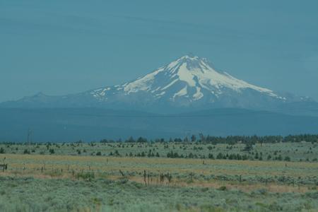
As I’m really not being very fair to Idaho, I should probably clarify. Northern Idaho is beautiful. (I’d been told the southern route was all desert, and we’d really seen quite enough of that.) Eastern Oregon and Washington, however, are not. Having seen the west coast of Oregon on a past trip, I pictured all of Oregon to be full of the amazingly green, incredibly dark piney forests that make western Oregon such a draw to nature lovers and neohippies everywhere.
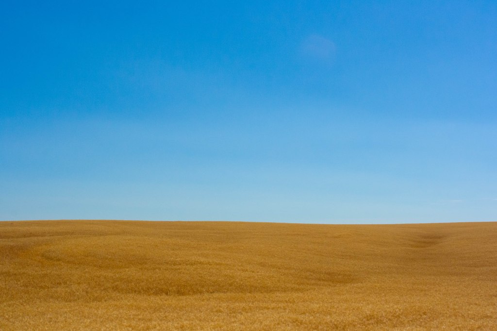
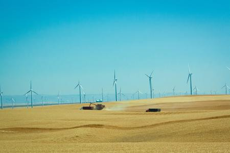
In fact, I couldn’t have been more wrong. After the mountains faded into the distance, eastern Oregon looks the way I expected Kansas to look. (For the record, I was wrong there, too. Kansas is not grain. Kansas is corn. Oregon is grain. Lots of it.) And eastern Washington is very much the same.
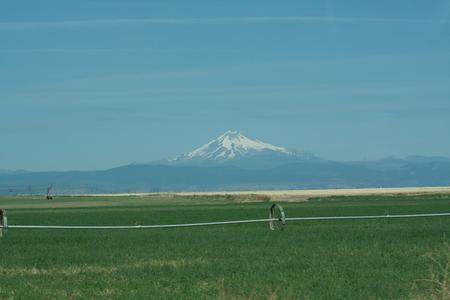
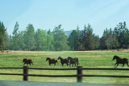
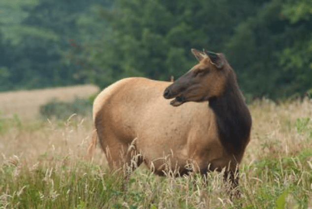
Okay, so this part was pretty amazing. Mountains, horses, and beautiful blue skies, and miles and miles of road to travel.
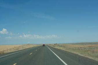
But this part?
On film, stunning. In reality, breathtaking.
For an hour or so.
Hours upon hours? Not so much.
Oh, come on. You knew we had to stop.
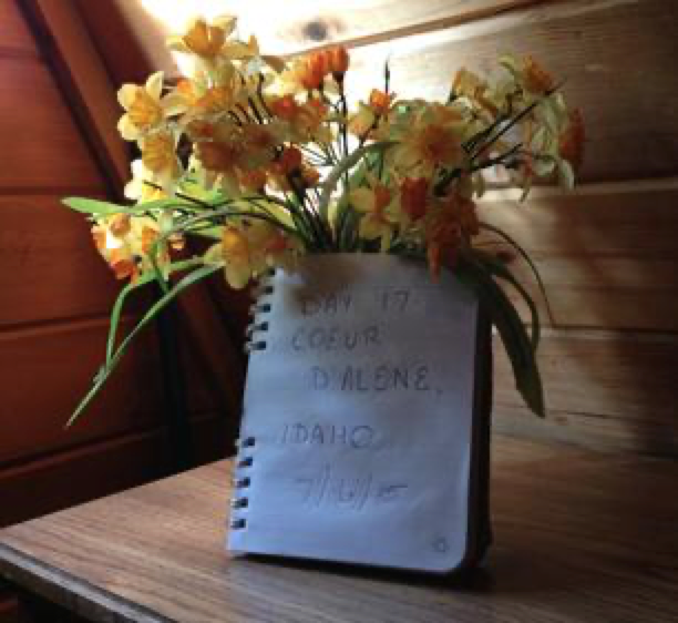
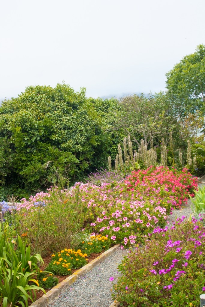
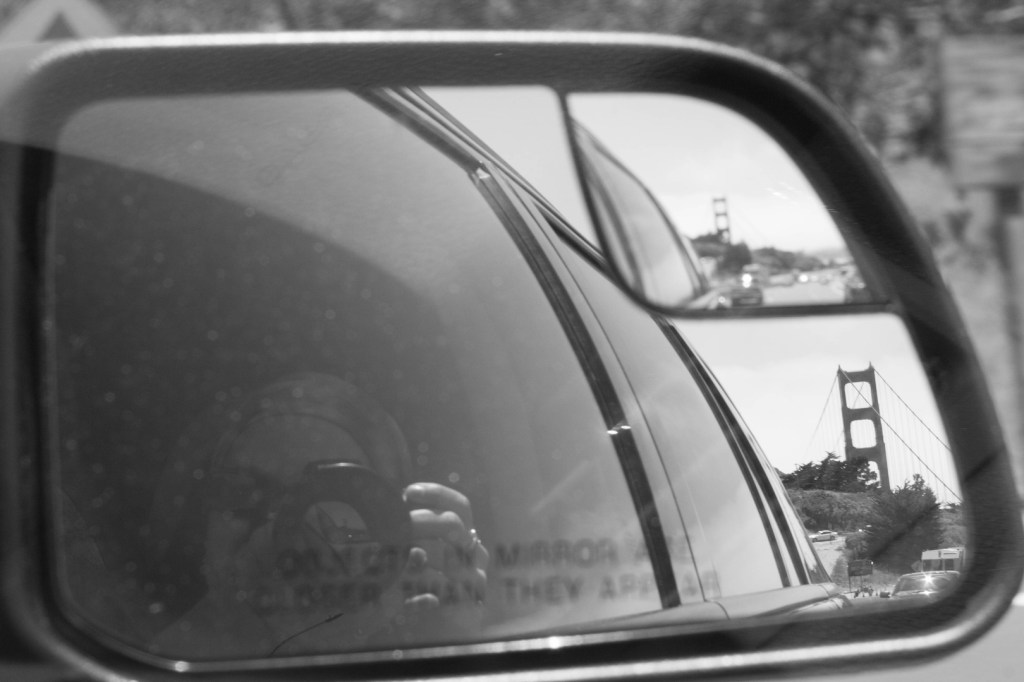
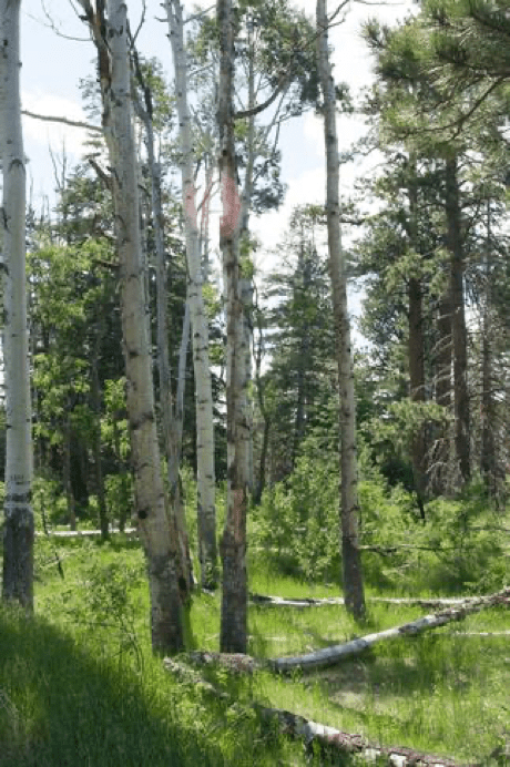
By the time we reached our cabin in Coeur d’Alene, I was very much contemplating the wisdom of my decision to travel northern Idaho, but Coeur d’Alene itself, particularly the lake, is beautiful. Our first stop in Idaho, naturally, was this –>
You can take the boy out of Cabela’s (in Hamburg), but you can’t take Cabela’s out of the boy…hence why we ended up in Cabela’s (in Coeur d’Alene).
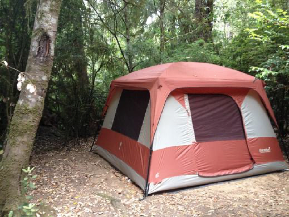
A few dehydrated meals later, we were back on our way and reached the Osprey Perch Cabin at the Wolf Lodge Campground within a half hour. Nestled against the back of a mountain, it was a positively charming little A-frame…even if it did slant uphill and made me feel as though I was a little tipsy. Seriously, It’s odd the way a slight incline outdoors does nothing to your equilibrium, but the same slant inside is downright disturbing. Still, it didn’t detract from the charm.
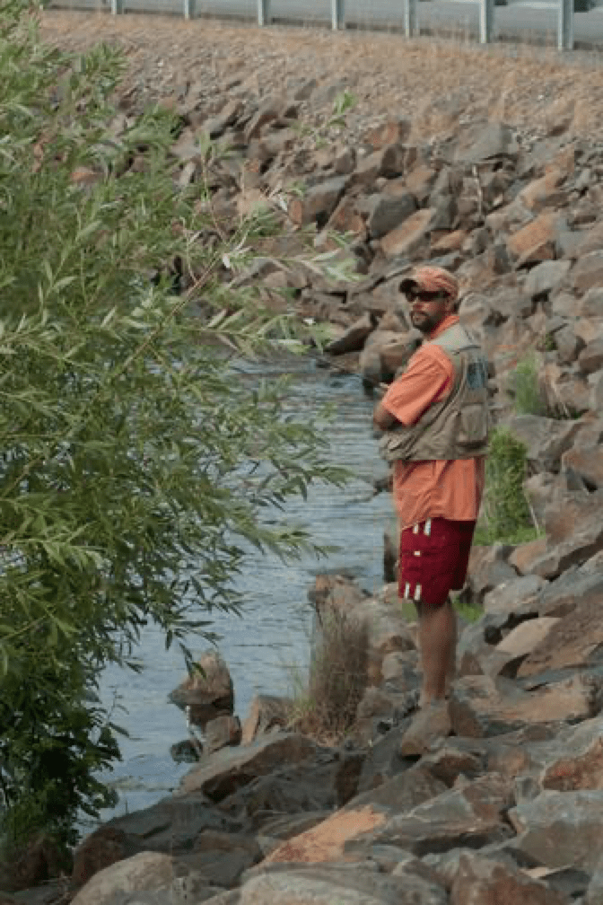
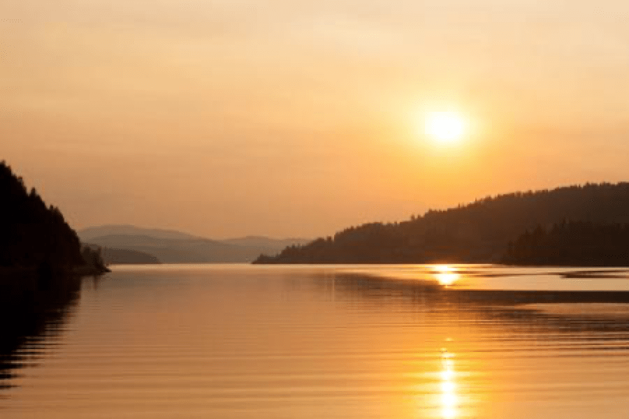
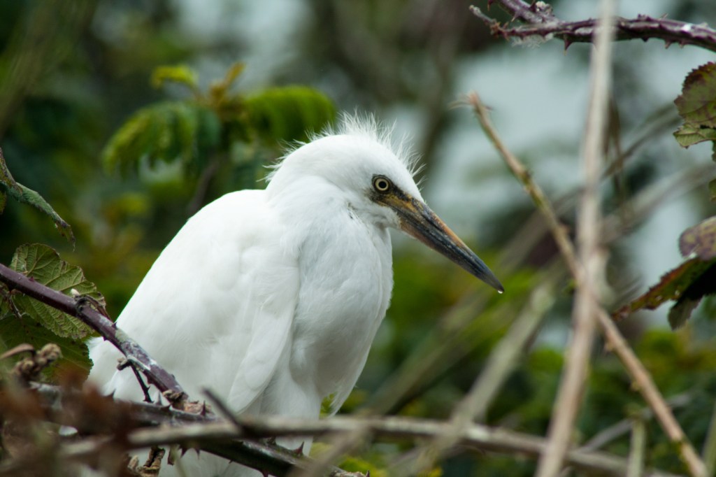
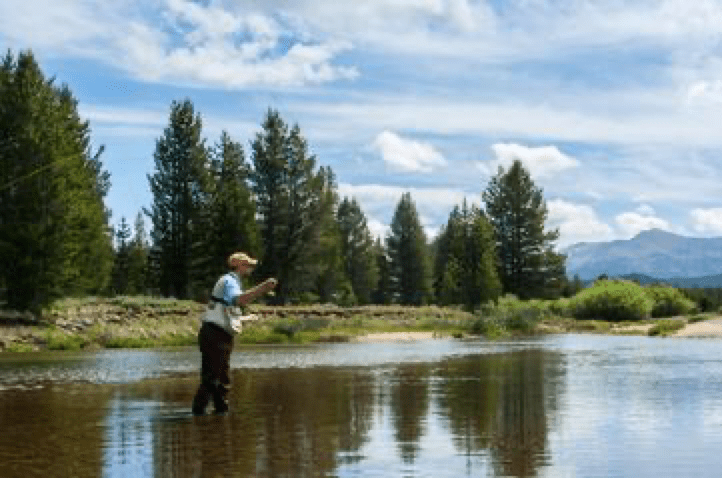
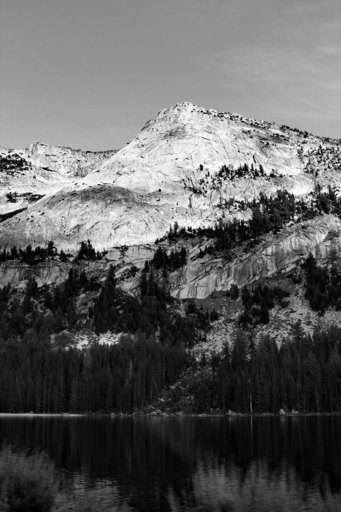
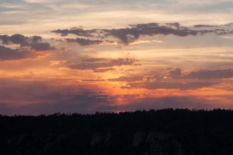
We finally had a slow evening to ourselves, so we headed to Lake Coeur d’Alene for Nate to try his hand at fishing. I sat with camera at the ready, hoping to capture a bald eagle or two in the area, but to no avail. However, I did manage to capture a spectacular sunset!
Lake Coeur D’Alene
Back at the cabin, we ate another dehydrated meal, shared a couple of mugs of hot tea and enjoyed the stars as they begin to dot the sky. At least until the mosquitoes showed up. Then it was inside and time for fun on the computer. We actually had a few hours to load photos and view them. Throughout the trip, I would try to download photos to my laptop every few days, but now I finally had time to look at them. (Imagine that!)
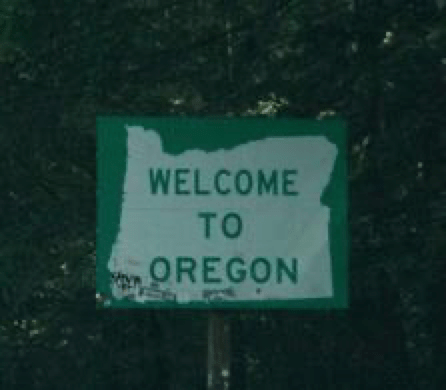
In the end, I was glad we took the northern Idaho route instead of southern, but those 9 hours in eastern Oregon and Washington was quite the test. A test of patience, a test of willpower, or a test of sanity – I’m not sure. But it was a test.
But I did discover that there was more to Idaho than just potatoes.
Come to think of it, I didn’t see a single potato. Maybe I should write the Idaho bureau of tourism.
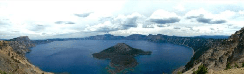
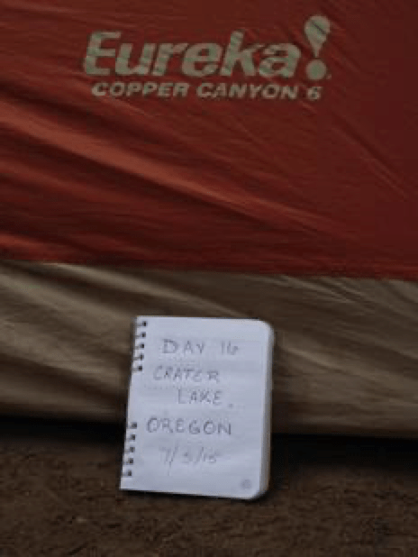
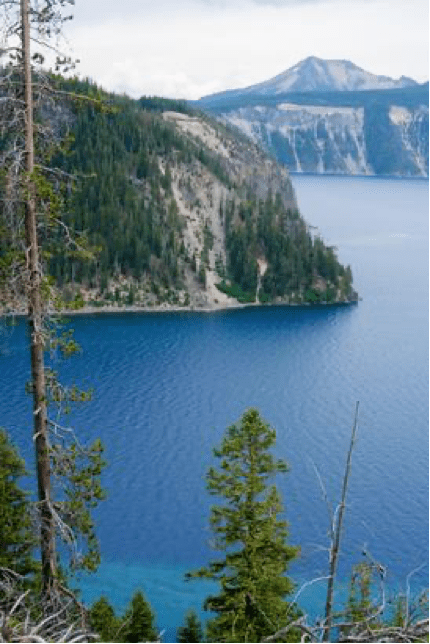
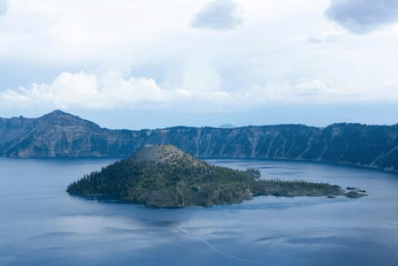
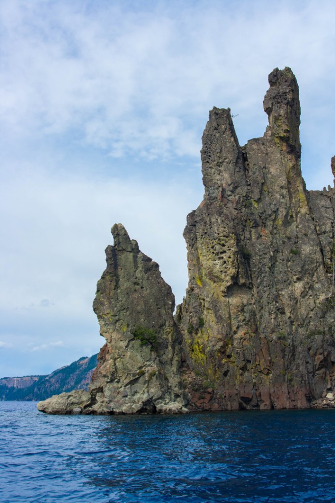
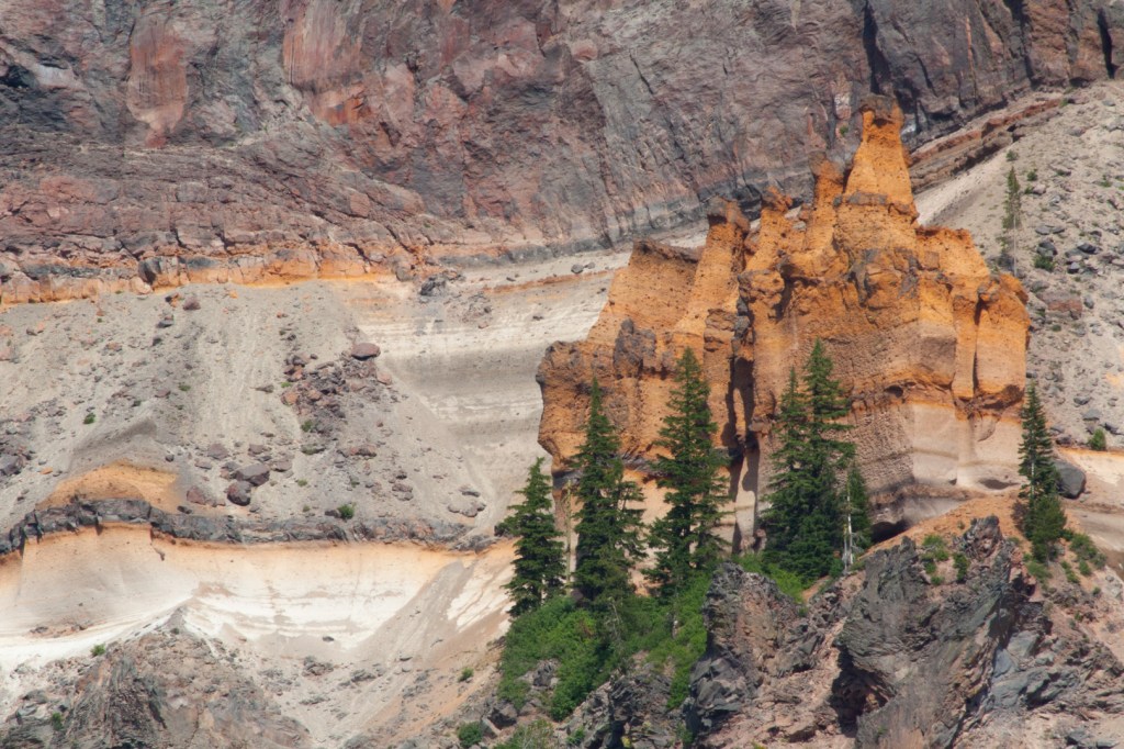
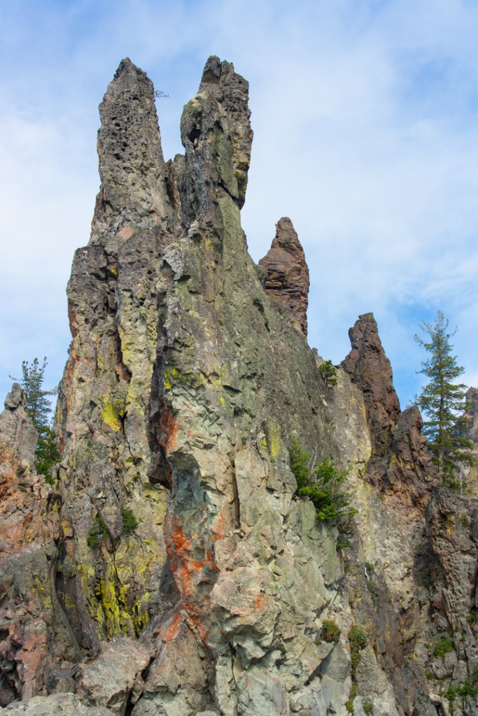
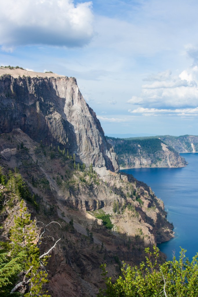
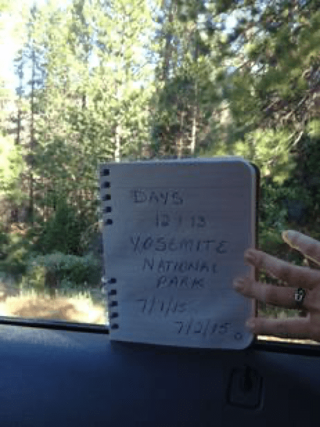
Day 16 – Crater Lake! It was “only” a 3 1/2 hour drive from the Redwood National Forest, but it’s funny how on this trip, the shorter drives felt longer. We arrived at the campground at 12:30, set up camp, ate some lunch, and realized it was already time to get moving again. Our reservations for the boat tour of Crater Lake were for 3:30 and all of the guidebooks and info say to arrive at the top of Cleetwood Cove at least an hour prior. That’s because it’s a 1.1 mile switchback trail with an 11% grade down to the lake below. “Insane” is not enough to describe the parents we saw who were carrying toddlers both down and back up this path, although “miserable” was pretty accurate.
This was the hike I was worried about as the website claims that the “trail is recommended only for those in good physical condition.” Having screwed up my ankle less than a week prior, I was concerned, but there was no way I was missing out on a boat tour of Crater Lake. (Two boats in two days? Whoa!) Wrap it up! Thanks Mr. Ace Bandage. After all, it’s only an ankle. If I screwed it up further, at least it would be 100% worth every second. We took our time, taking about 45 minutes to reach the bottom of Cleetwood Cove Trail. Oddly enough, it wasn’t my ankle that bothered me at all, but rather my knees. It’s always something. My joints have always been weak and I’ve frequently suffered bouts of tendonitis from time to time in ankles, wrists, and knees. If that’s my lifelong “condition,” though, I’ll take it. It may not be great fun, but it’s bearable and I’m lucky! (And I still made it to the bottom of Cleetwood Cove! WITHOUT my knees buckling on me!)
A view from Cleetwood Cove Trail
While we waited for our tour to be called, we met an adorable family with two young boys who made us a bit homesick for our own little girls. (You know, the little brats who didn’t want to talk to us because they were having too much fun with my parents. Why do I love them so much!?) For the purpose of this blog, we’ll call the boys Adam and Taylor and their parents Mel and Tim Johnson. Though they seemed impressed with our journey, they were on quite the journey of their own (and with kids no less!). While we waited for the boat, we found out that they were from the San Francisco bay area and that they, too were headed to Yellowstone and the Grand Tetons next. What are the chances? It was nice to meet kindred spirits who felt the same draw to nature and the desire to pass that love onto the next generation. I regretted not having the girls with us. (And then I remembered that they hate car rides and that though the destinations were amazing on this trip, the car trips were rides from hell.)
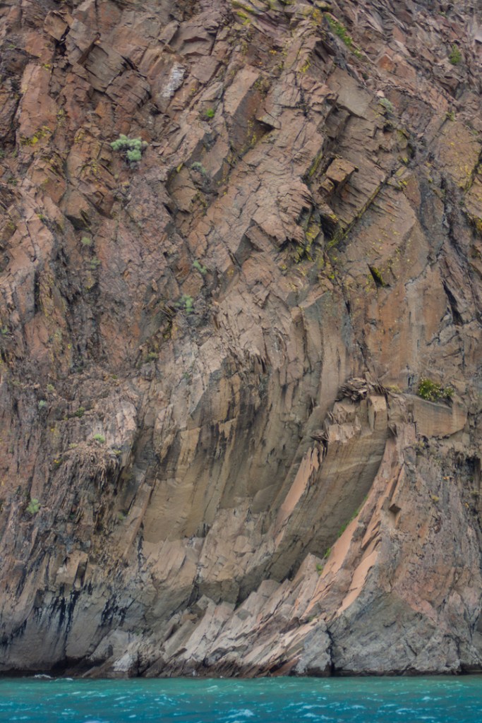
Even with cloudy skies, you could tell the water clarity was positively amazing! I fervently hoped the sun would show up.
The boat tour started off with chop and cloudy skies, instantly dashing my hopes of capturing the amazing water shots. I had seen images online of Crater Lake waters glinting with amazing clarity – turquoise and deep blue hues typically only seen in the tropics. We were pleasantly surprised, therefore, when the sun emerged from the clouds and we had the chance to see how blue the waters of Crater Lake really could be. Maybe a few “tropical” shots after all!
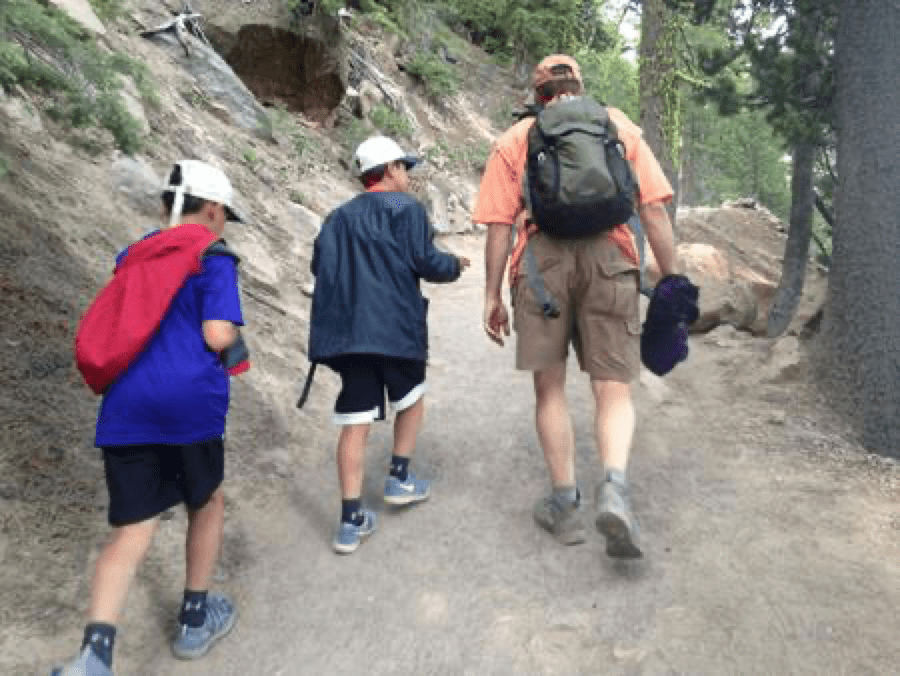
After the tour, we headed back up Cleetwood Cove Trail. And if the walk down was strenuous, the hike back up was twice that. (But at least my knees didn’t threaten to buckle going uphill.) I was ready for a slower pace, but as it turns out Adam and Taylor were quite enamored of Nate and glued themselves to his side. It was positively endearing…especially as I huffed and puffed from 100 feet behind them. Every now and again, Nate would pause to wait for me to catch up and I’d get to hear the extensive and intense conversation regarding the latest and most important video game. I’ll be honest. My asthma hasn’t acted up in 8 years, but this hike definitely had me struggling. Frequent stops helped. Still, we made it to the top in a half hour. (Faster than I could have imagined thanks to the kids, who despite the steep grade still managed to chatter nonstop. How do kids do this? What superpower do they possess?)
Nothing cuter than men bonding over talk of video games.
Once we reached the top, we bid the Johnson family farewell, hoping to see them again in Yellowstone, but knowing the odds were likely against it. As we trekked to our car, their van pulled up and we exchanged cell phone numbers. Perhaps we’d meet in Yellowstone after all, or at least compare funny stories along the way!
By the time we arrived at the Mazama Campground, we were starved and headed to Annie Creek grill for food. One lame “fake” pizza later, we were full. Following up the meal with chocolate “bear claws” improved the dinner considerably.
Another early night for us, but a fully satisfying day. So, it was only an ankle. And I didn’t make it any worse by hiking the Cleetwood Cove Trail. Just don’t ask me how it feels today, nearly two months later. (Hint: The answer is not “better.”)
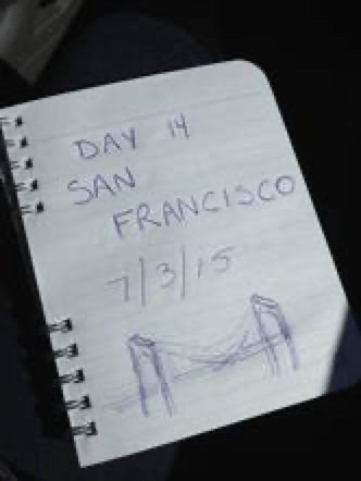
Call it what you will, but I think San Francisco gives Chicago a run for its money as The Windy
City. Geez!
But I’m ahead of myself.
Last I wrote, we were still stuck in Yosemite. Dismal, stormy, not-what-it-was-supposed-to-be Yosemite.
We were poured on again the night before, ensuring that we’d be not-so-happy campers packing up a very wet (and grossly yellow) tent. The weather in Yosemite was nearly 100% uncooperative and we hated Tioga Pass Road. Suffice it to say that we were happy to be leaving (even if it meant taking Tioga Pass Road…again).
When we finally arrived in San Francisco, it was one pm and we were about two hours early for check-in at the Sheraton at Fisherman’s Wharf. Exhausted and tired of being outside, we called the hotel just to see if they had a room ready. They did. One room. We got it.
Whew.
And if you haven’t sensed a pattern yet, I’ll give you a hint. It was snooze time. We showered and passed out for several hours, getting up in time for a stroll by the bay, some entertainment (WOW! We bought two cds!), and dinner. The weather had cleared and it looked beautiful, so we skipped the sweatshirts.
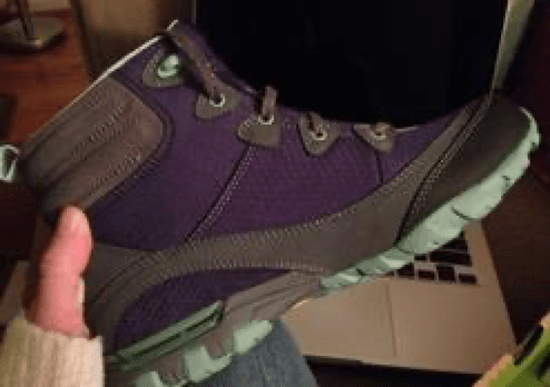
The infamous waterproof purple hiking boots (by Ahnu). 100% worth every penny. And they are, indeed, waterproof. I had tested them when I stepped nearly ankle deep in Maroon Lake back in Colorado.
It was a regrettable decision that later resulted in my purchasing a windproof, waterproof jacket from a completely packed souvenir shop at Pier 39. But, hey, at least now I own a purple jacket to go with my purple hiking boots… A fierce wind had kicked up and I won’t lie. It made me nervous. I had checked weather reports and I knew there was no storm in the area, but for the life of me, it certainly felt like it was about to storm! Weird as can be!
Dinner at the Eagle Cafe – yum, yum, and more yum. Soon after, we retired back to the hotel and did something we hadn’t done in weeks.
We watched television.
We treated ourselves to a Friends marathon. It was a nice little escape from our reality (which is sort of ironic since our reality, in this case, was an escape from actual reality).
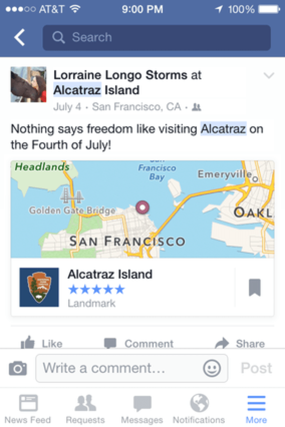
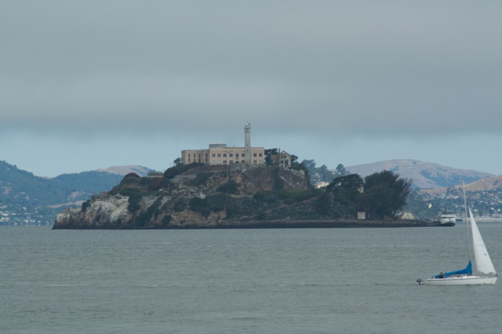
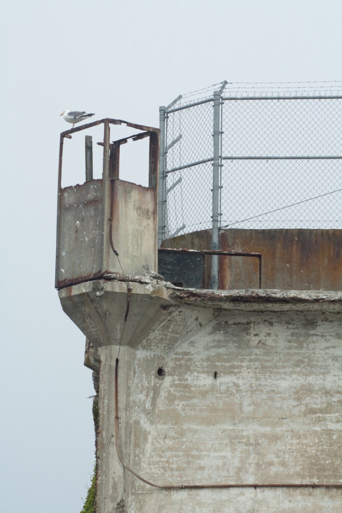
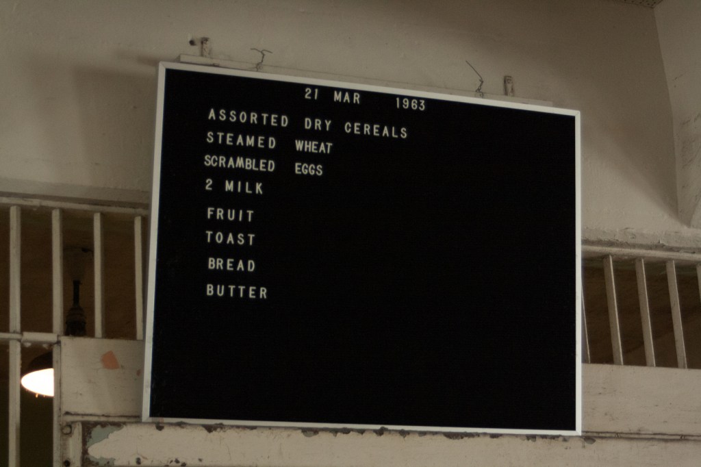
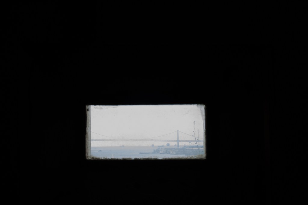
The next morning, we were up early to catch our ride to Alcatraz. The weather had very thankfully cleared and I was relieved that the bay was not nearly as choppy as it had been the day before.
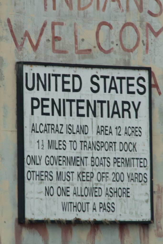
Where better to spend Independence Day than touring a famous prison on an isolated island?
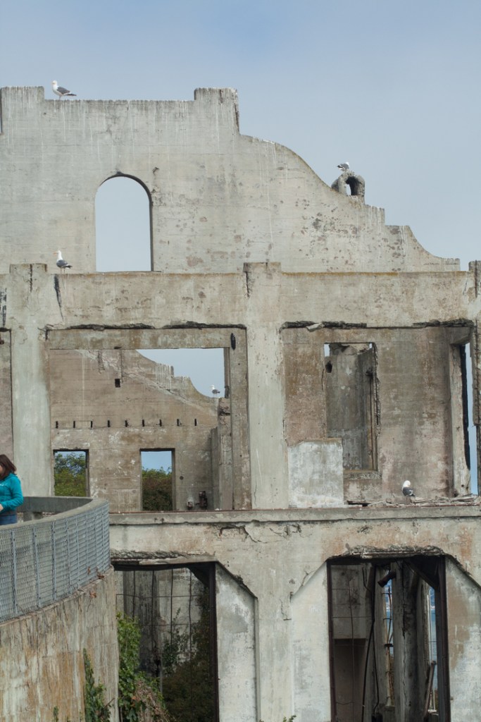
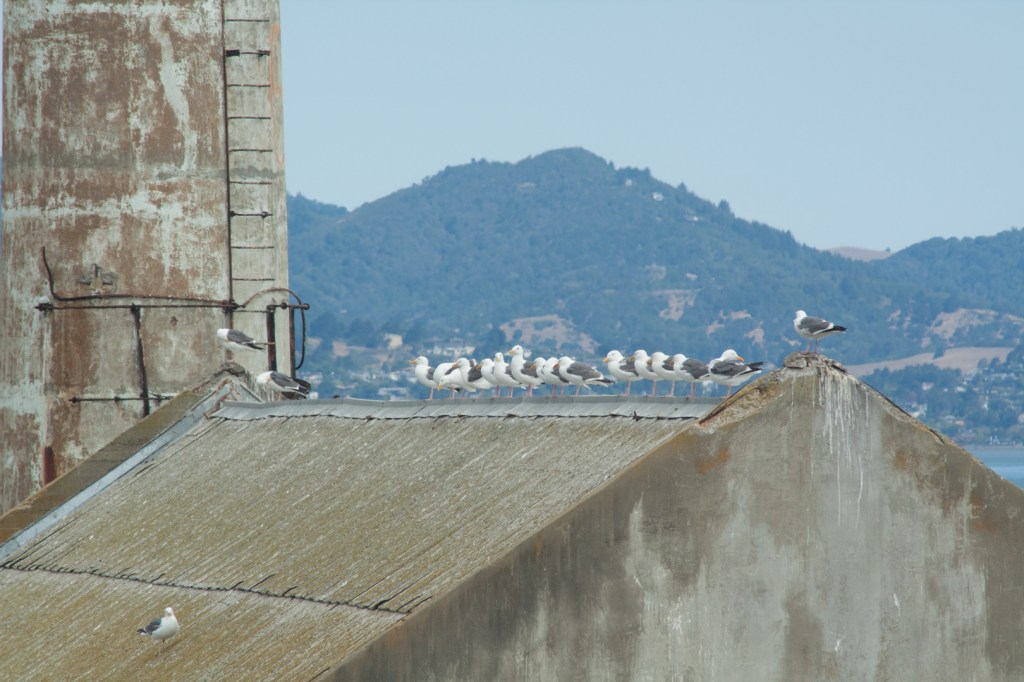
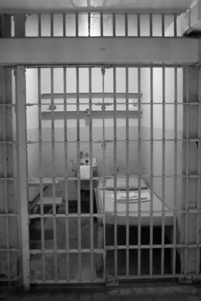
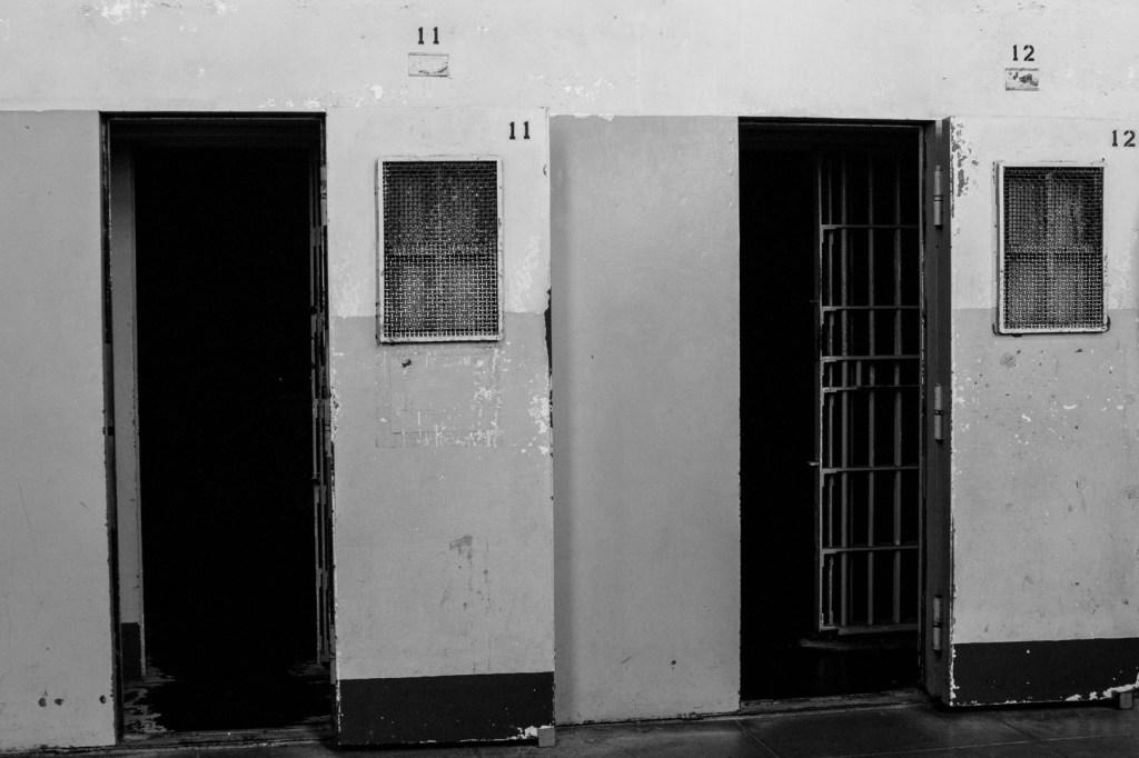
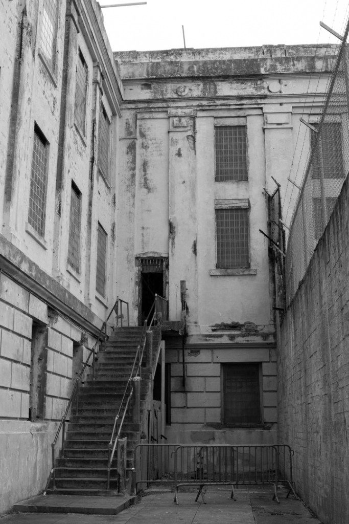
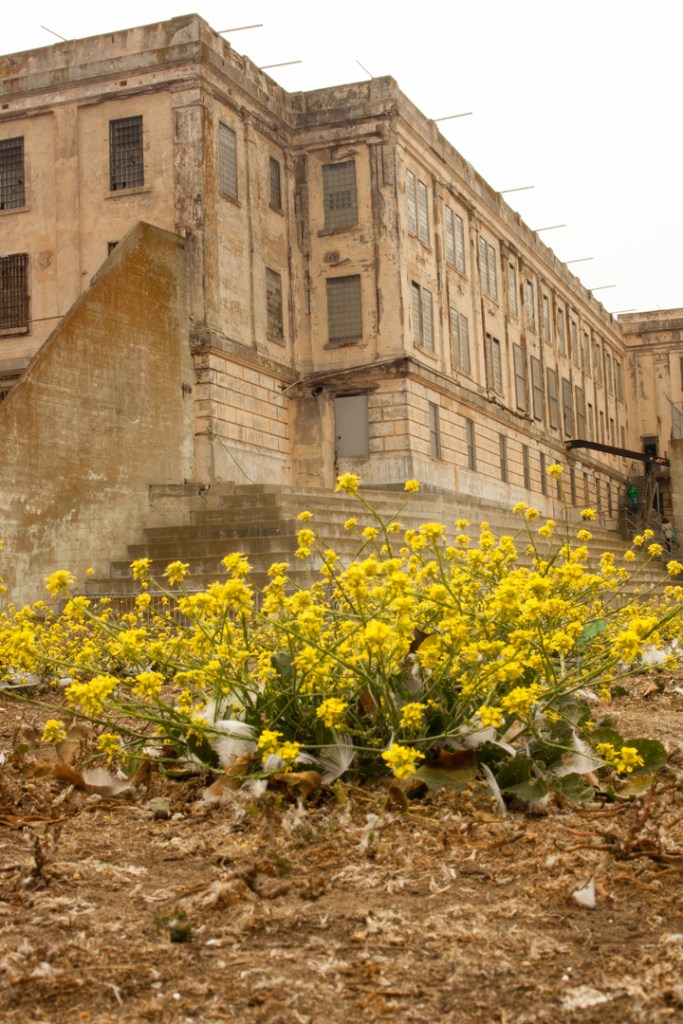
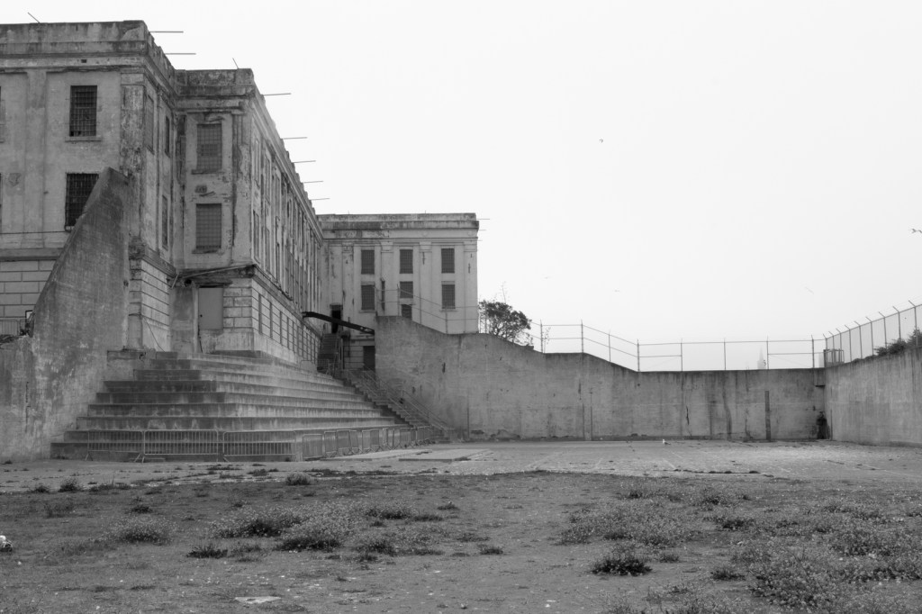
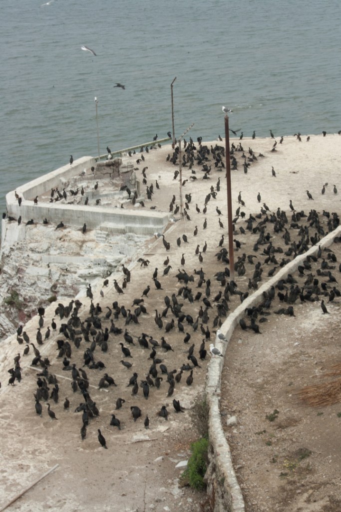
Once on Alcatraz, we wandered the halls and the yards, imagining what it must have been like for those sentenced there. The isolation cells are in complete darkness and they are very intimidating – especially for someone who never even got detention as a kid. Yep, looked scary enough to me. We were told that the longest anyone ever spent in isolation was 19 days. I had a hard time imagining ten minutes. It was pretty much what you would expect of Alcatraz. Never mind that the entire island smelled like fish and bird poop. Sweet!
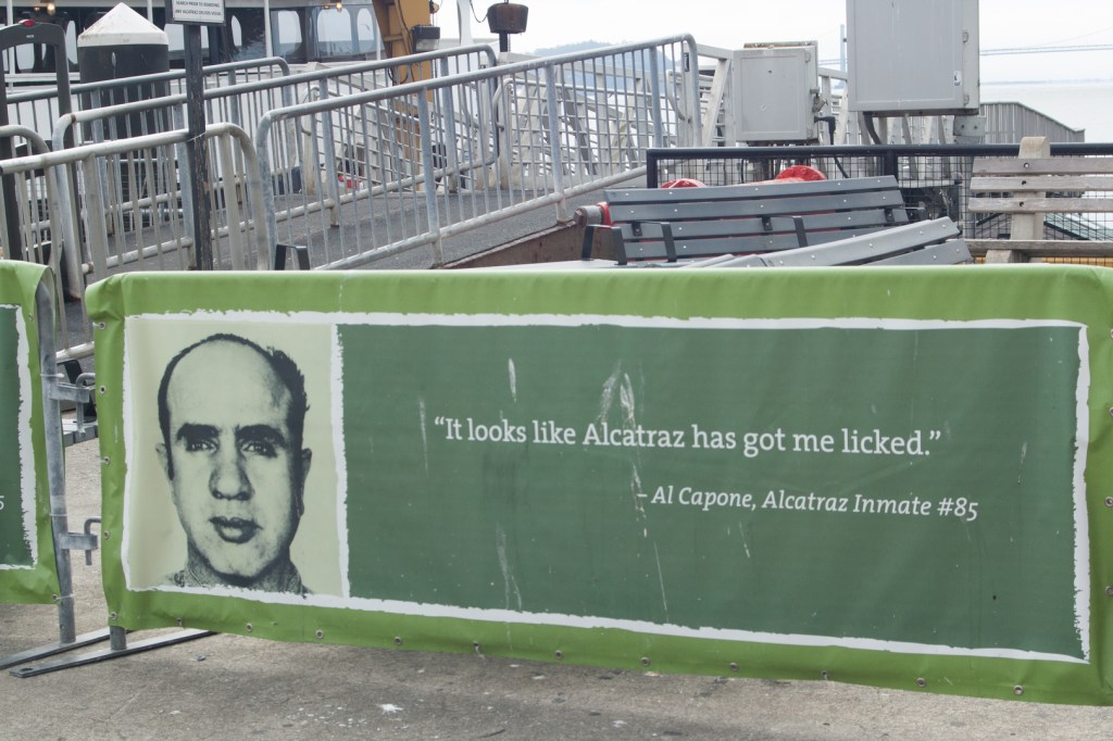
On our way out, we discovered that a former inmate, Robert Louck, #1118, was signing autographs. I had had just about enough of the very claustrophobic gift shop that was filled with people and I made a beeline for the door. But, I’d lost Nate somewhere along the way.
He was, you guessed it, chatting up a storm with Mr. Louck. Turns out that Louck was former military who was sent to a penitentiary in Leavenworth for attempting to rob a bank while still in the army. When he unsuccessfully tried to escape, he was transferred to Alcatraz. Upon hearing the story, I was amazed that he ever came back. Autographs or not.
Also, once released from prison, Mr. Louck fished professional bass tournaments with his wife, who had accompanied him to Alcatraz, as his teammate. Only Nate would manage to work this into a conversation with a former inmate. Only Nate.
We left with Nate’s Cabela’s hat signed by former inmate #1118.
We hit the road shortly after noon, but our next destination was farther than we wanted it to be. It was a long drive to the Redwood National Forest! To break up the road, we stopped at a roadside store dedicated to Bigfoot. The shop had a variety of amazing carvings made from Redwood trees and Nate and I made several purchases.
At the Big Foot shop.
We stopped once again for a late lunch/early dinner right next to a Redwood tree on the Avenue of the Giants in Myers Flat, a “town” so small if you sneezed you’d miss it. It boasts a drive-through tree, but we noticed that the tree was no longer alive and consequently, we decided to skip it. (Plus, there was a fee involved and who wants to pay to drive through a tree?)
When we got back on the road again, we swore – SWORE – there would be no more stopping until we reached our campground.
But.
Ten minutes from our destination, we encountered a herd of elk and, you guessed it.
We stopped.
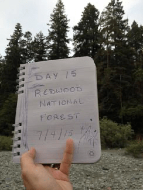
When we finally arrived at the Jedidiah Smith Campground, it was 7:30 pm, Nate was fighting a headache, and we were exhausted. We briefly contemplated driving to Crescent City about ten minutes away for fireworks since it was, after all, the 4th of July. But, we thought better of it and fell asleep before 9 pm. I don’t even think I heard the fireworks. Shameless.
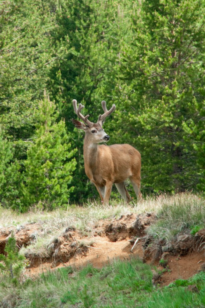
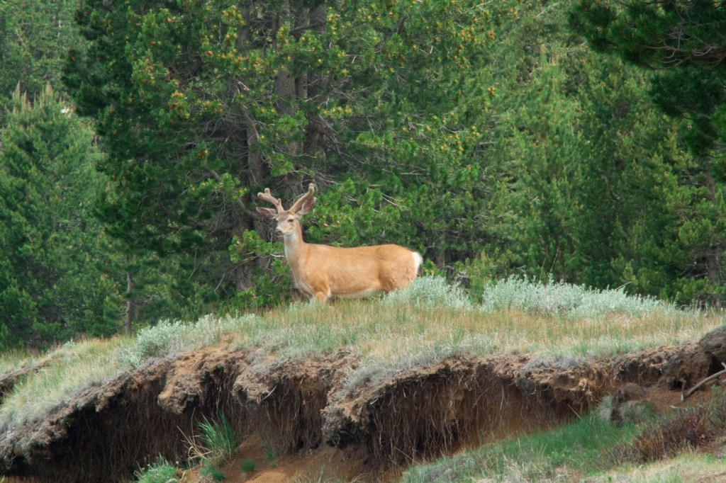
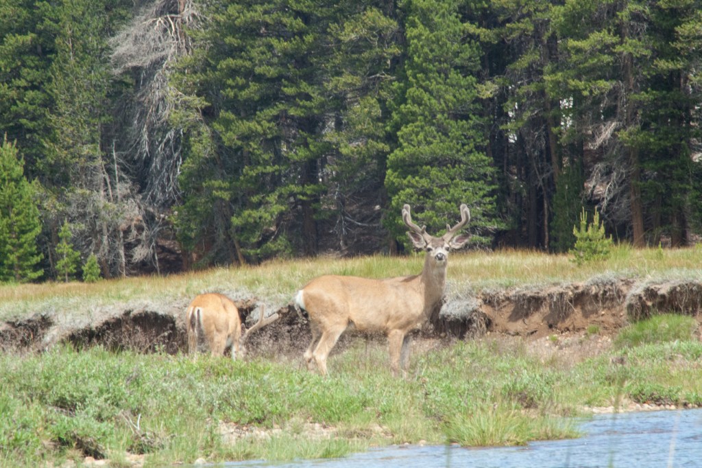
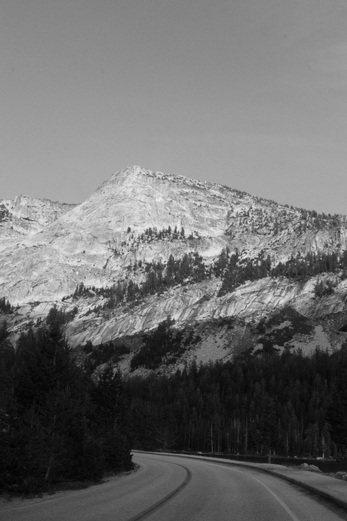
Day 2 at Yosemite. At least we were prepared for Tioga Pass Road today. We woke early, figuring we’d start the day off right. That meant fishing in the stream in the meadow directly across from the campground, of course. Nate caught several cutthroat trout, hooting and hollering each time he reeled one in. And while we (ahem, Nate) were fishing, I sat by the shore, photographing and generally appreciating the solitude. Until these guys showed up.
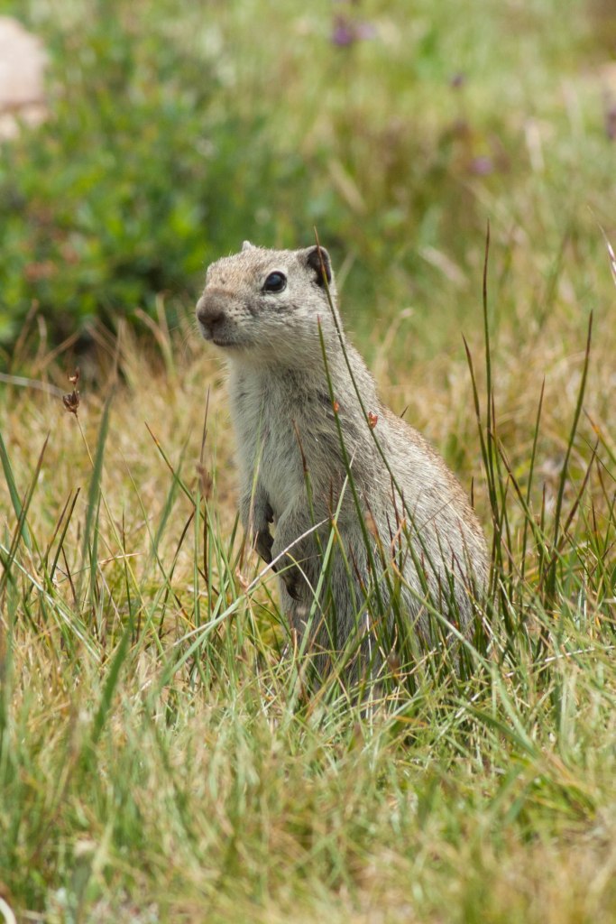
Okay, so they were pretty welcome and I’d hardly say that they ruined my solitude. They checked us out for several minutes before deciding we were no threat and that the meadow looked like better eating on the opposite bank. They splashed in and waded across to the other side. (With one stopping to pee in the middle of the stream. Really??? What a boy thing to do.) I was really just in awe at how close they were to us, without a concern that we were near. When two additional frisky deer showed up about twenty minutes later, the entire spunky herd took off together. At a distance of 30 yards, it was a pretty spectacular sight. And the Belding’s ground squirrels were pretty darn cute, too (even if they might be filthy little plague-carriers).
This guy took several minutes before coming out of his burrow. I’m sure he wanted to make sure I wasn’t a coyote ready to pounce on him.
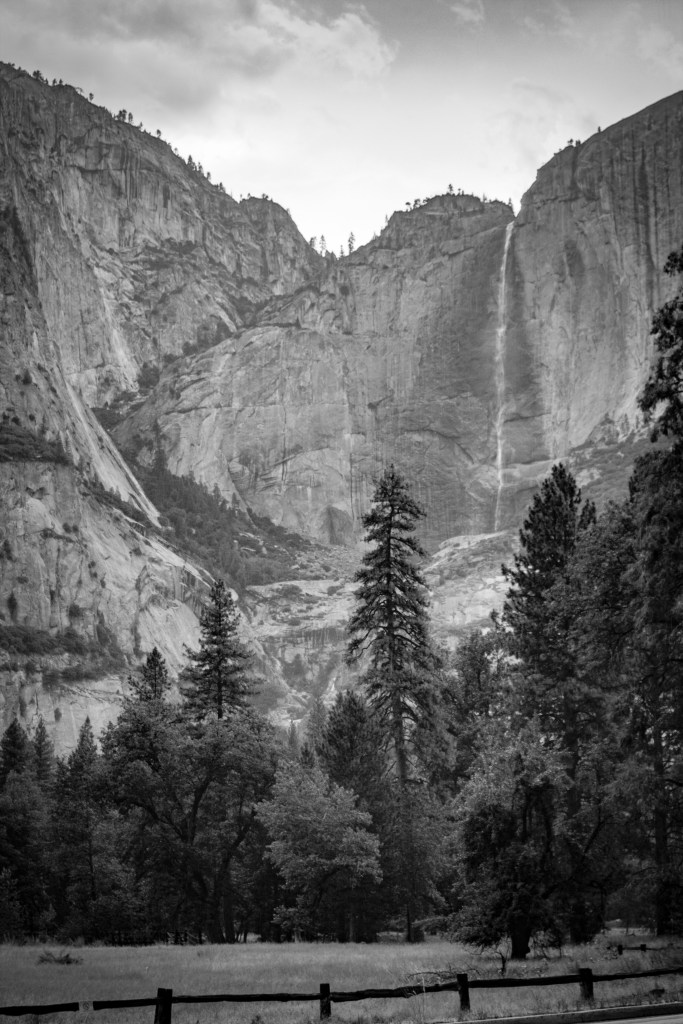
Since Tioga Pass Road threatened to be long and exhausting again today, when we’d finished with our morning in the meadow, we headed to Tenaya Lake on the way to the falls. I didn’t need to see Yosemite Falls until the evening anyway.
We just figured we’d make a day of the journey. So, on we went to picnic at Tenaya Lake, when we realized that the place was not as deserted as it had seemed.
Nate tried throwing in a line, but caught nothing. The lake is far too deep and there was nothing to be caught from the rocky shore. Mid-afternoon at this point, we head onward to I had begun to think of as “The Main Attraction.” But, we were tired and Tioga Pass Road is ridiculously long. Does this road ever end? And it was drizzling again. Hmm, a pull off… (Or “pull out” or “turn off” depending on what park and what state you’re in.) Off we go, to take a fifteen minute nap.
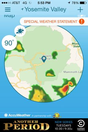
Back on the road, we finally reached the visitor center in the midst of a horrible traffic jam. The rain had picked up steadily and nearly everyone wanted to get out of the very poorly laid out parking lot. Let me restate that. VERY. POORLY. LAID. OUT. Add to that the ridiculous chaos of travelers from all over the world who probably don’t read the signs so well and it’s a mess. Oh, but wait, that’s right, the signs weren’t there to read… One thing we discovered (belatedly) about Yosemite was that the signage within the park was awful. The only saving grace was that I had a park map from when we’d first entered the park. Otherwise, I think it’s safe to say that we would have been turned around quite a number of times!
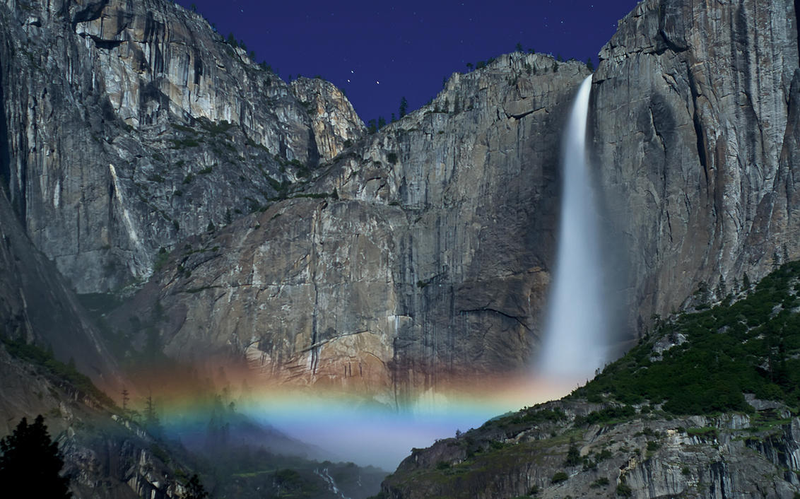
We finally found a parking spot just as the sky really began to pour on us. It was about 4 pm by this point and we figured we’d just wait out the storm. Storms can’t last forever, right? Lots of wicked lightning and one hour later and we were still sitting in the car. Then – a break! Hooray! We got out and figured it would be a good time to do a little shopping in the gift store, particularly since it was still too early to try to hike to the falls. (By my calculations, the sky had to clear, the sun had to set, and the moon had to rise for the moonbows to show their faces…)
We finished shopping and made it back to the car in time to see this:
What?
To say I was frustrated would have been a severe understatement. It wasn’t as though we could wait out the storms forever, particularly if they just kept forming and lingering. How could we be HERE, in Yosemite, during the perfect time for moonbows and be foiled by the weather of all things? I swore I heard the soup nazi in my head, only instead of no soup for me, he was screaming, “No moonbows for you!”
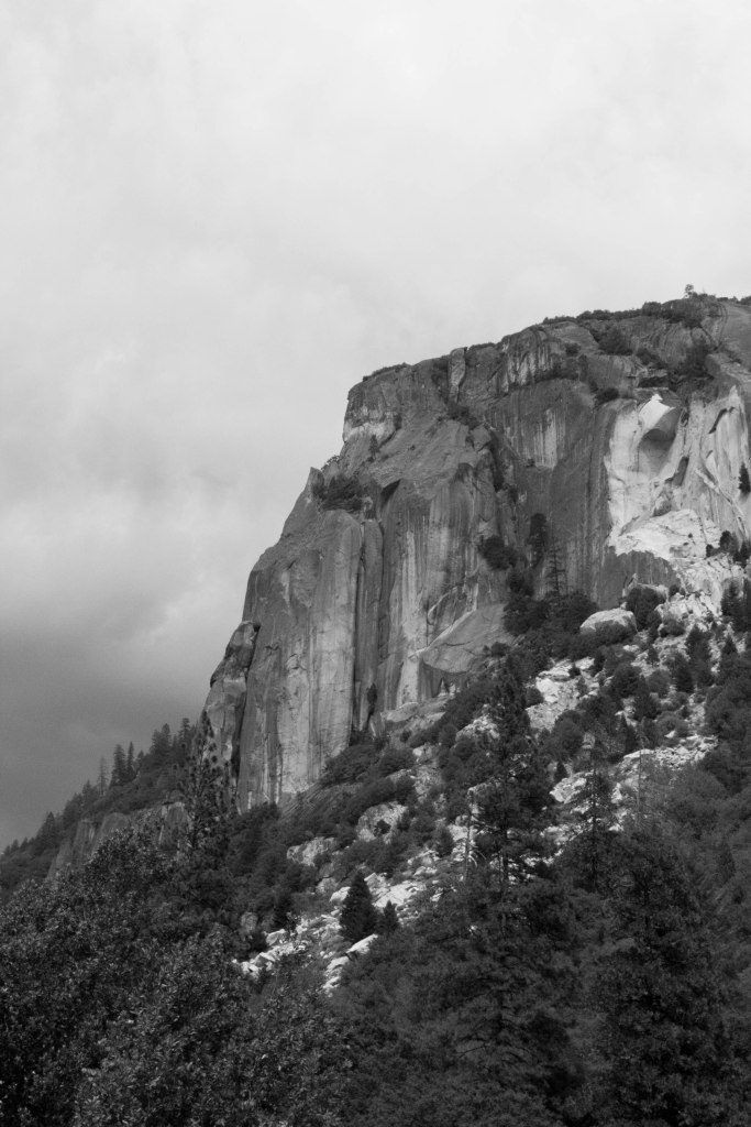
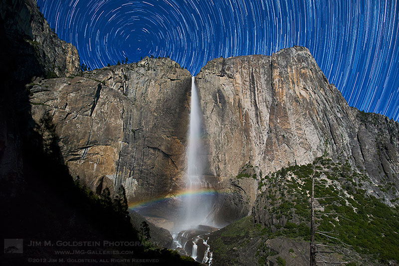
Disappointed, we decided to throw in the towel rather than wait another several hours in the car. You know what this meant, of course. Back to Tioga Pass Road. But, on the way out, we saw at least a few sights that made the trip to “The Main Attraction” worth it. Here and there the sky cleared for just an instant and the sun set the peaks on fire, the low-hanging clouds only making the scene more dramatic.
For all that Yosemite skunked us, I’m still surprised that I managed to pull off a few photos I hadn’t thought were all that great when I was out in the field, but at the computer discovered that they weren’t nearly as bad as I’d thought!
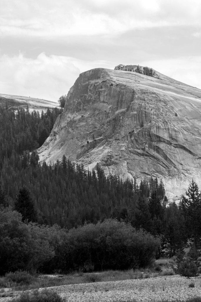
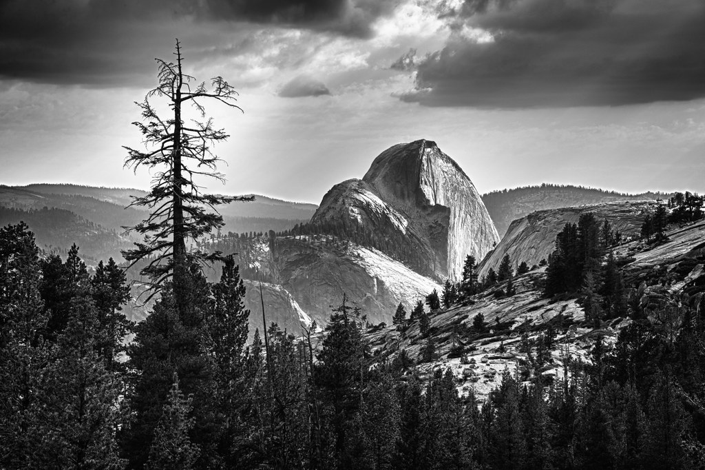
Leaving Sequoia National Park, I was excited to head to Yosemite. Yosemite. That amazing park where Ansel Adams produced so many phenomenal photographs. Images that influenced my love for photography, perhaps even images that fueled my insatiable love for nature. (Though I admit, early childhood hikes with family had already sparked that fire.) When I “discovered” Ansel Adams, I was a freshman in high school and my Intro to Photography class with Mr. King taught black and white film photography. We learned to develop our own 35 mm film, used the dark room to produce photo prints, and broke into the photo room like James Bond with our school ID cards – a skill all of the photo students at Freedom High possessed. How else were we supposed to get our work done if we couldn’t find Mr. King to open the photo room for us? Given the digital age, I wonder if that class is still offered.
In a short 2-hour drive, I would soon be in the very park that had inspired my love of landscape photography.
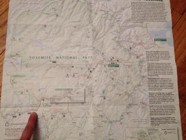
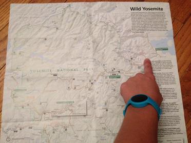
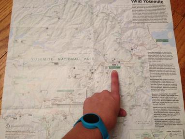
Oh, but I should have known by now that no anticipated drive time was ever truly accurate. 2 hours to Yosemite, yes, but another 3 beyond that to the campground we had booked. Outside of the park. To the east.
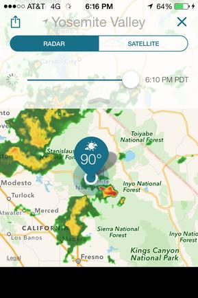
Let me present this image to you to make our dilemma even clearer:
Where we entered the park from the west, where our original campsite was booked (nice job, Lorraine!), and our refuge campsite at Tuolumne Meadows (snicker…)
But, that wasn’t all of the fun! No! Tioga Pass Road (i.e. The Road from Hell) is the ONLY road through the park. And it was under construction. One lane closed on a two lane road. You don’t have to be a genius to figure what fun that brings. It means…you guessed it, we sat and waited for 20 minutes while the traffic coming the other way followed a pilot vehicle (a very slow-moving pilot vehicle) through the construction zone, before the pilot vehicle would turn around and lead traffic in the opposite direction. But we didn’t get to experience this fun just ONCE. We went through two large sections of road like this, adding about an extra hour to the trip.
Our only bonus, we got to see a bear butt. No, not a bare butt (although he wasn’t wearing clothes), but a bear butt. The black bear had just crossed the road as we arrived and we got to gawk as a he continued on into the woods, having really only been able to see his rear thanks to the line of cars that had stopped before us to watch him cross.
By the time we passed Tuolumne Meadows Campground, we were beat and in no mood to drive another hour to our campground. So, we decided to ignore the “Full” sign by the roadside and check to see if they had any availability. We were in luck (Or were we? More on that later.) and they had a single site available. Relieved, particularly since it had started to rain, we headed to our site.
Oh, but the camp site.
We arrived to a large puddle of water covered in a delightful chartreuse-colored slime. I’m still not sure to this day whether it was pollen (from pines?) or just a slime residue from the trunks, but the stuff was everywhere. The puddle leading to our campsite was just the most offensive build-up of it.
We set up the tent in the steady rain, hurrying to get it done before the real downpour began and to our amusement (yes, that’s a little sarcasm), the rain stopped the instant the tent was set up. Lovely.
Part of the reason we had chosen to stop at Tuolumne Meadows instead of continuing on to our previously booked campground had to do with the fact that I wanted to capture photos of moonbows, a phenomenon that only happens at a certain time of night, at a certain time of the month, with very specific conditions needed. In order to capture moonbows (yes, that’s a new link), I needed to be able to be at Yosemite falls at night during this very specific time. By fate or by simple good fortune, we were at Yosemite during a full moon. Condition number one was met. And we could be at the falls when the moon was no higher than 42 degrees in the sky. Condition number two – check. And, of course, the sky needed to be clear.
Oh, right, the rain. Well, the forecast still looked optimistic, so I just hoped that it was true and I could look forward to the sky clearing.
The drive back to the falls was at least an hour and a half from Tuolumne Meadows. Add in the extra hour to the campground we should have been staying in and you’ve got a 2 1/2 hour drive in the middle of the night on a winding road in pitch black that we would have been taking. Not my idea of a good time, though let it be duly noted that I was up for whatever it took to get the moonbows on film. Er, make that on my SD card. Whatever.
We were prepared to drive it.
We were not, however, prepared for the unpredictable weather. It stormed the entire night, a storm that produced lots of lightning and thunder and pouring, pouring rain. Hooray, more chartreuse slime to look forward to! (And all over our tent nonetheless!)
Yes, it was safe to say that night number one for Yosemite was a bust. But I still had high hopes that perhaps night two would fare better. Thank goodness I’d thought ahead to plan TWO nights at Yosemite. (Can you hear me snickering in that statement?)
On a side note, does Tuolumne Meadows Campground sound familiar to you? If you keep up to date on the news, you should be well-aware that it was closed down this very week due to the discovery of two dead squirrels who had been infected with…the plague. That’s right. The plague. The one that killed 25 million people in the 14th century. This one.
Well, we’ve been plague-free for over a month now, so I think we’re probably in the clear. They say that fleas are the only way to become infected (and the primary route of transmission between animals and people), but I’m still left pondering that creepy, yellow slime. Perhaps the fleas are a coverup…
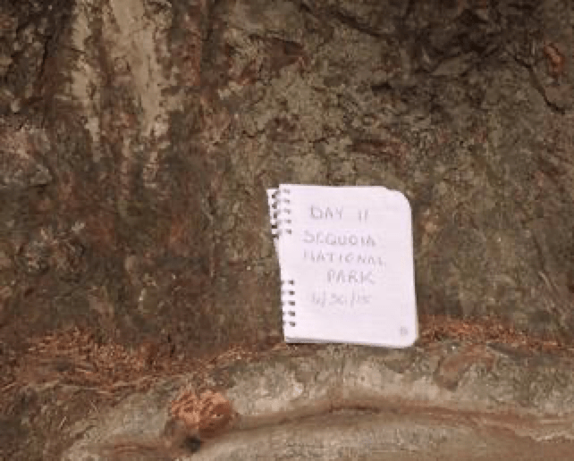
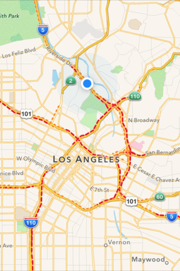
Though we could have enjoyed the coast forever (And really, who couldn’t?), we packed up early and hit the road for Sequoia National Park to meet with The General. (Sherman, that is.) We were on our way early and fully prepared for hitting LA traffic in full-on rush hour. Yeah. Well. It’s one thing to say that and another to do it. We weren’t really prepared.
How can you be prepared for this? See those red dashes? That’s a delay.
Los Angeles traffic only added an extra hour to the trip and I guess we should have been grateful for that. It could have been worse.
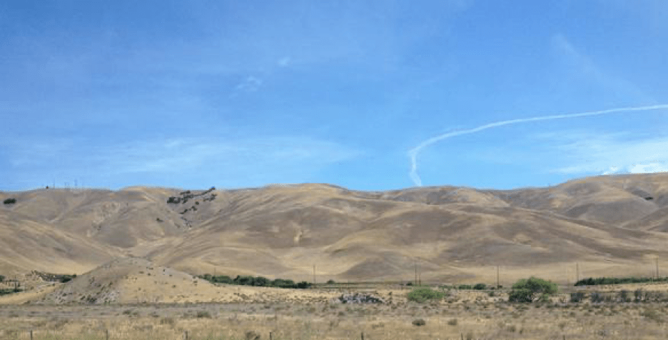
One thing we discovered along the way was that most of California looks like this:
With the exception of the times it looked like this:
Or like this:
Seriously – weird, grassy, rolling hills or orange orchards or vineyards. That was it. I’m certain there must be more to California than this, but in all the miles we traveled (from San Diego to the Redwoods) this was, more or less, what we saw.
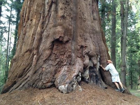
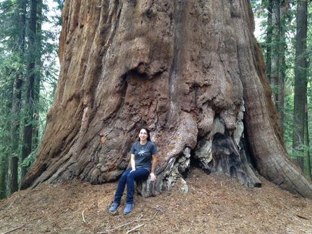
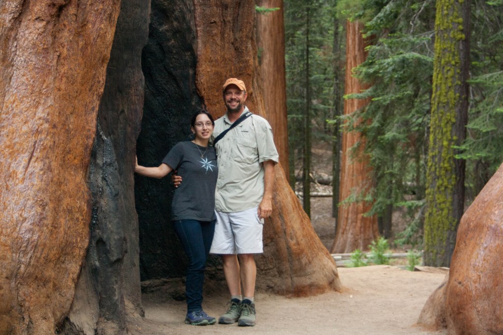
We reached Sequoia National Park at three in the afternoon and headed straight for the world’s largest tree. But first, a massive downpour. It was hard to imagine that California was in a drought when the view through our windshield was hardly visible at all.
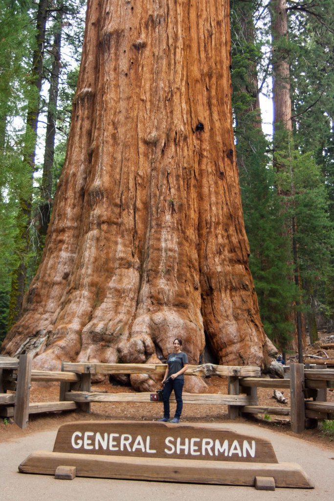
When we finally got to into the park and had our first views of Sequoias, our jaws dropped. There is nothing that can prepare one for the sheer mass that is a few-thousand year old Sequoia. They are awesome in the true sense of the word. The gorgeous rust-hued trunks are not what you would expect. I put my hand on one and expected to feel a tree trunk (duh, right?), but I was shocked to feel a soft texture, almost spongy.
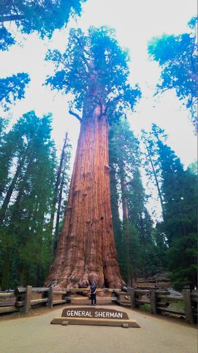
We made our way down the path to General Sherman, and while he was not the most gorgeous specimen, he was regal nonetheless. There was a line to take photos next to him. Dutifully, I stood in line so that Nate could get a picture of me with the tree, but no camera could really capture the stunning presence that these trees have. (So go see them in person! You won’t be sorry!)
If Sequoias can convince Nate to hug a tree, they can convince anyone.
We made our way to Lodgepole Campground, which was, hands down, one of the best sites we booked on the trip. The park ranger who checked us in quickly reminded us that we were in bear country and that just the night before, they’d had to shoo away a black bear from the campgrounds. This made me somewhat nervous, as I’d booked a campsite on the outskirts of the grounds. Oh well. You only live once, right? And that’s what bear boxes are for.
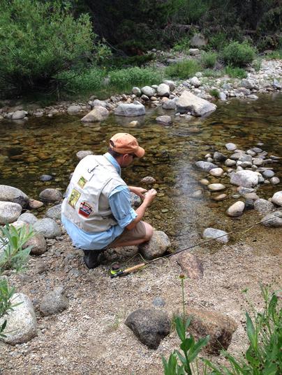
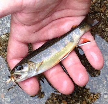
The campsite was perfect, and right next to the Kaweah River (which was more like a creek at that point in time) and you know exactly where Nate went. Fishing, of course.
The native brook trout, though tiny, were feisty and Nate caught several. Since they weren’t used to people, Nate discovered that some stealth was required to catch them. If they saw you, they were gone…
Of the woods, Sequoia National Park was one of my favorites. It’s a long and windy drive to get to (But unlike the Rockies, there were guard rails and stone walls!) and it’s a hike to see General Sherman (although there is handicapped access available), but it was worth every second.
And we managed to avoid a bear encounter. Woohoo – that’s two for two in bear country! Safe!
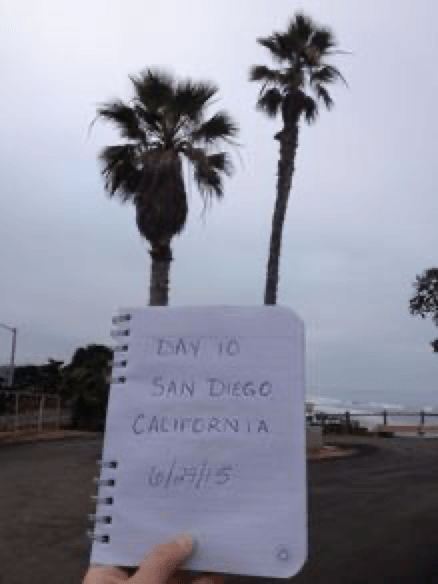
We headed out on Day 10, eager to be leaving Las Vegas. (Hey, isn’t that a movie?) A “quick” stop at McDonald’s for breakfast, but oh, that’s right. That’s where we discovered, yet again, that nothing in Vegas is as quick as the reputation. We got to the drive-through lane at 10:15, to be told when we got to the speaker at 10:30 to order that they were out of breakfast. What? How is this remotely possible at a McDonald’s? Now, we were stuck in the drive through, boxed in by curbs they have absurdly placed to lock you in. It was after 10:45 by the time we were finally able to leave the McDonald’s parking lot…without food. Nate, to say the very least, was in a foul mood. (It was already bad enough that they don’t offer bagel breakfast sandwiches at McDonald’s after you cross the Mississippi River, but to have to wait a half hour, get no breakfast, and no real apology, well that was a whole new level of aggravation.)
But some mishaps are blessings in disguise. Once on the highway to California, we passed more than one sign for the Ghost Town Cafe – “Serving Breakfast All Day.” Seeing as it was nearly noon by this point, we figured ‘why the hell not?’ and followed the signs to the exit. But, the cafe was actually located six miles from the exit and Nate, in his mood of Hangry Desperation, was ready to turn right back on the highway and forget it all. I managed to convince him that breakfast was worth it, and off we went, down a dusty, close-enough-to-dirt road for six miles. And aren’t we glad we did?
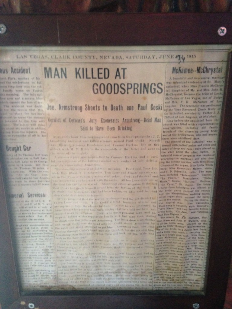
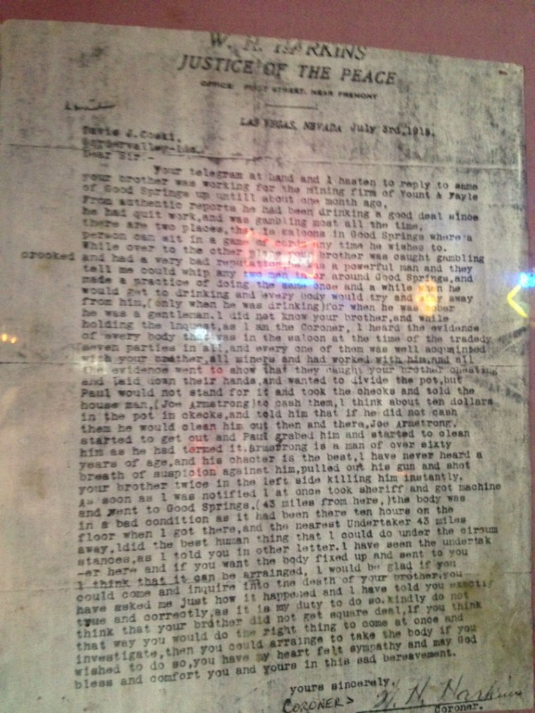
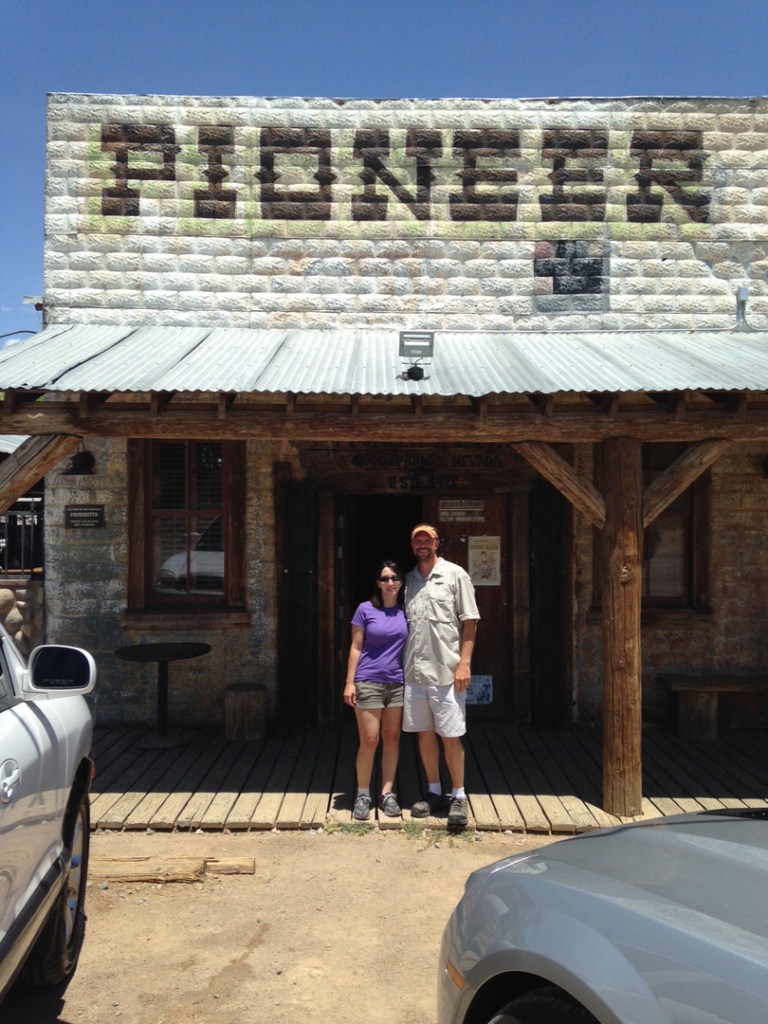
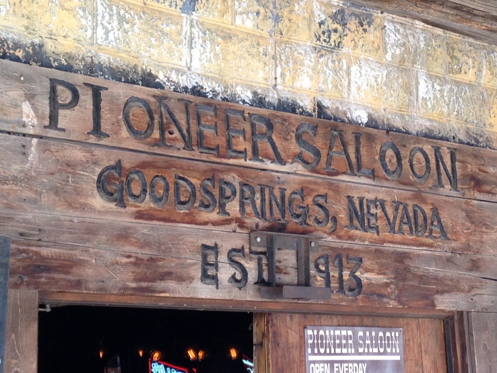
We arrived at The Pioneer Saloon and Ghost Town Cafe in Goodsprings, Nevada, and it looked every bit what you would think. There was a single car out front and Nate made a half-hearted comment as we entered that no one would ever find our bodies. Once seated at the bar in the Ghost Town Cafe, we ordered a delicious, if greasy, breakfast and while we waited, the manager began to chat with us. He asked how we’d heard of the place and we had to confess that we really hadn’t. Signs on the highway had led us in desperation.
He seemed somewhat surprised and cued up the 3 televisions on the wall to play a recorded segment of Ghost Hunters. It appears The Pioneer Saloon, established 1913, had a handful of ghosts and a dicey history. Who knew? (A few million people who watch Ghost Hunters, surely, but not me.)
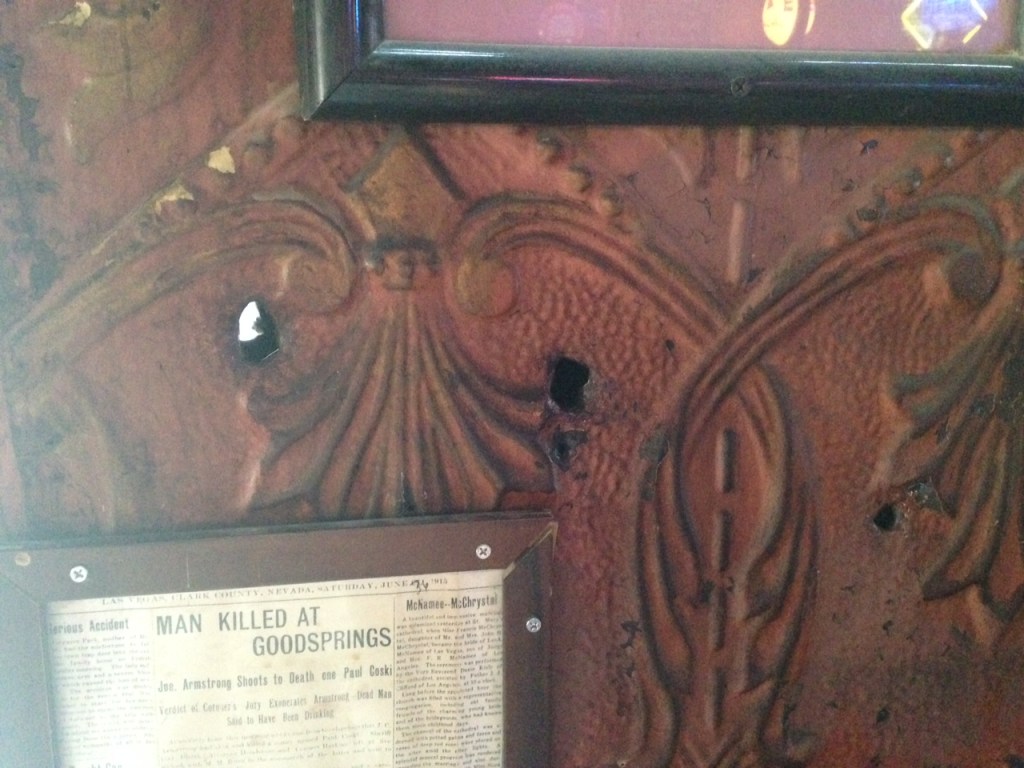
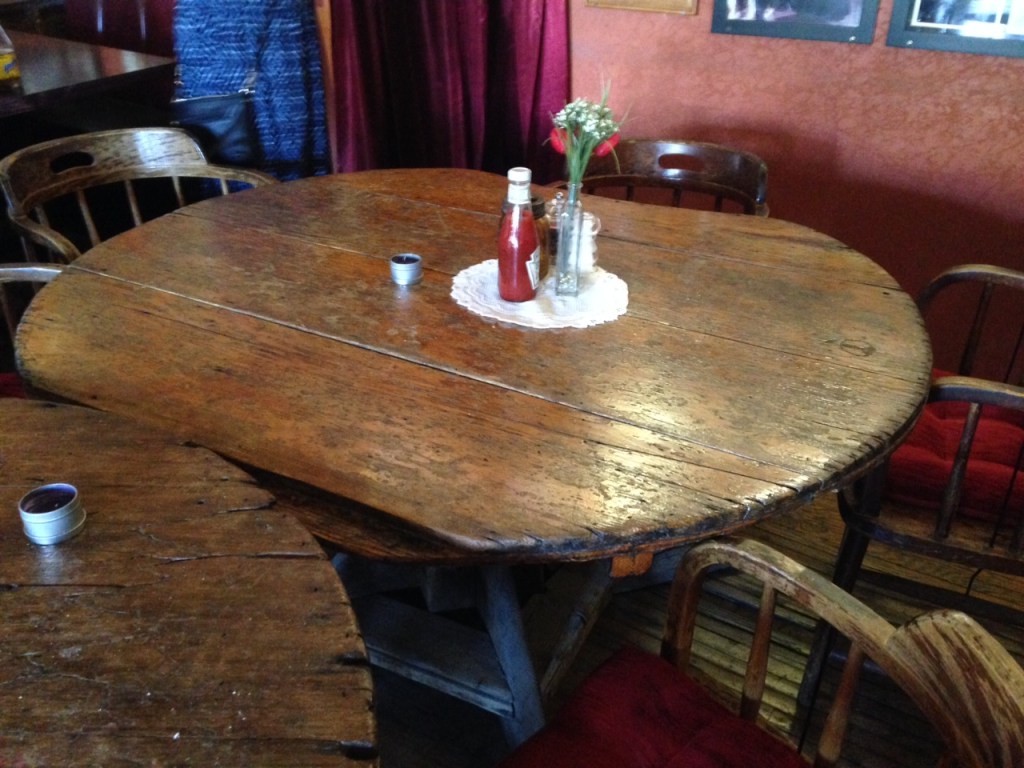
After our breakfast, and our educational update on The Pioneer Saloon, we perused into the saloon to take a good look around. Sure enough, three bullet holes still remain in the original tin wall where a man was killed after cheating at poker. The floor and tables are original to the building and there’s definitely a creepy ambience despite the friendly bartender and the patrons that were now wandering through the door for lunch.
Before we got back on the road, we used the restrooms, one of which was reputed to be haunted. Guess which one? The ladies, naturally. So, yes, I peed in a haunted bathroom. If I had any ghostly audience, they thankfully remained silent, but I still booked it out of there as fast as I could while still trying to maintain my “cool.”
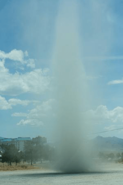
Back down the dusty road, we encountered the biggest dust devil we’d seen to date, right before getting on the highway. Truly fascinating and, well, just plain weird. I wonder if that sight ever gets old to those who live in the desert area.
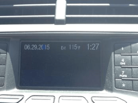
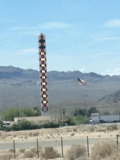
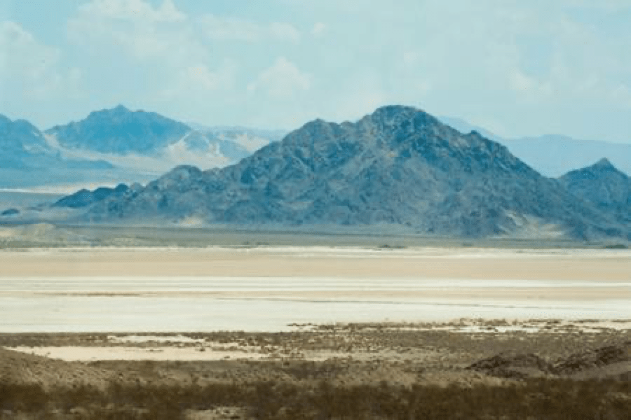
It was 108 degrees when we got back to the highway and I was incredibly relieved that by the end of the day our “Desert Tour” would be fairly well over and we would enjoy the coastal breeze. But both Nate and I started to get a bit nervous when the temp was steadily rising. In fact, the car registered that it was 115 degrees F around the time we passed the world’s largest digital thermometer (why is that even a thing?), reading 111 degrees. And about five minutes after that, Nate noticed the radiator temp was beginning to climb. Enough to make me nervous.
And ding!
There goes the alarm, letting us know that the car is close to overheating. We pulled over, opened the windows and shut off the car for five minutes. Being stuck in the Mojave Desert was not my idea of fun and I hoped it wouldn’t happen. Thankfully, once we started the car and got on the road again, the decision to drive with the windows down and no a/c proved to be a wise one. We managed to keep the car from coming close to overheating. A half hour later, we rolled up the windows and turned the air back on, but not near full-blast, and that seemed to be okay. Whew. If there was ever a time that I’d felt I’d dodged a bullet, this was it. To the dozen people we passed on the side of the road in the next hour, I am sorry you did not think to do the same… Yikes!
Aside from Independence Pass in the Rockies, this ranks as one of the scariest roads I’ve driven on. The sheer vastness of the surrounding desert and the inescapable heat is terrifying. To this day, I am very relieved we were able to keep from breaking down!
When we finally arrived at South Carlsbad State Park in California at 6 pm, we knew that we had to set up camp quickly. I had managed to secure the very last spot (physically) in the camp about a year prior, so that we were on the end, facing the beach, with only one campsite near ours. At the time I had booked it, it seemed ideal. But, as we navigated through the seemingly endless line of campsites, with oblivious children riding bikes and skateboards right in front of the car without even a glance, it was an excruciatingly slow drive to the end site. Seriously, what was with these kids? And why didn’t their parents seem to care?
When we finally reached the end, there was a truck parked in our spot. The neighbors next to us (you know, the ONE site next to us) had parked their truck there since no one was there. They were thankfully kind enough to move it quickly once approached, but it was obvious later why they had no room at their site. Aside from their 30 foot RV and the truck they used to tow it, they had a tent (for the kids), two full 6 ft fold-out tables with pop up canopies, the picnic table provided by the campground, and about fifteen bicycles. Okay, it was more like four. But, still. I can’t imagine traveling with that much junk!
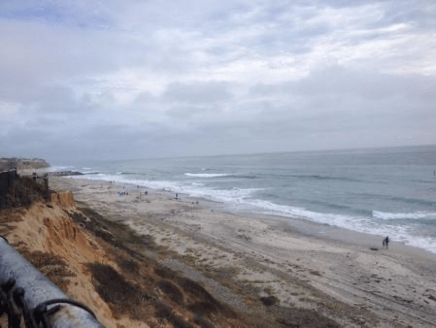
We had the tent set up in ten minutes and, even though Nate didn’t want to get back in the car, even though it was the very epitome of what he dreaded the most, he got in anyway, and drove us to Scripp’s Pier in San Diego so I could get the photos I’d hoped for in Southern California. I was certain that it wasn’t the right time of year where the sun lines up perfectly at the end of the pier, but I couldn’t wait to see the sunset from beneath the pier anyway.
As an east-coaster, there’s something almost magical about watching the sun set over the ocean, like I’m in a fantasy world on another planet or something. Where I come from, that just doesn’t happen. The sun doesn’t set over the ocean. It rises over it. Everyone knows that.
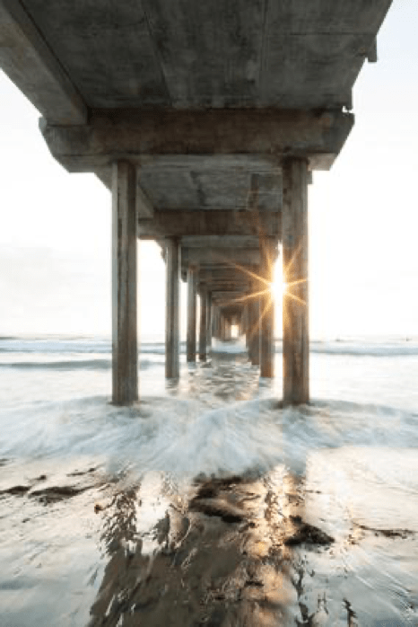
So, off we went, and got to the pier in time to illegally park in a 20-minute only parking zone at the institute… Heh. This was, perhaps, maybe the one time I didn’t yell at Nate for doing something we weren’t supposed to do. I wanted my photos and I was game for whatever it took to get them. Including gimping my way through the sand to get to the pier.
To my dismay, there was already a photographer onsite. I had heard that this would happen. I had read that photographers flock to the pier and that on any given evening, there could be a half dozen sitting beneath the pier, waiting for the sun to set.
I guess I should have been happy that there was just one. I was also disappointed that it appeared to be a higher tide, so I was going to get wet and there wasn’t much way around it. The bandage around my ankle didn’t stay dry for long. And for the nearly 100 shots I took, I got a handful that proved to be decent.
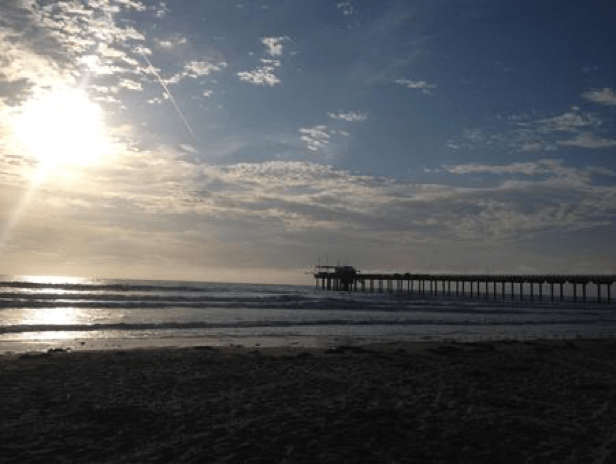
I was just glad that the sun was visible at all, since it looked like this when we’d first reached the west coast:
It was a good way to spend my birthday. Yep, my birthday. On the beach at sunset, breathing in the salty air and enjoying the sound of the waves. The culmination of many years wanting, and a whole year planning, the vacation of a lifetime. Had it not been for the foreign photographer who was slowly and steadily creeping closer toward me and encroaching on my space, it would have been positively perfect. To add insult to injury, his camera and his lens were both bigger than mine. Jerk.
And where was Nate during this adventure? While he had started by my side, he disappeared at some point to check on the car, and I began to wonder if he’d been arrested and had his car towed away. When I texted him, I received no immediate response. Hmmm.
After I’d put my camera away and dumped as much sand from my tripod as I could, I found Nate a while later, chatting with two guys who maintain the aquarium at Scripp’s Institute. It figured. If there was a way to talk about fish, Nate would find it. If there was a person alive who would want to discuss it, Nate would manage to locate him.
We headed back to car, to a (non-candlelit) dinner at Subway, and for a little grocery shopping. Then, back to the campsite. For Nate, a walk in the sand to hunt for anything cool in the dark on the beach. For me, bed. Plain and simple. Bed.
Well. Sleeping bag.
Pure exhaustion had finally caught up with me after so many days on the road and hiking, pushing ourselves to the limit every day. I passed out to the sound of the surf, a fabulous end to a fabulous day.
The sun isn’t supposed to set over the ocean. Everyone knows that!
Hauntings, Indeed Day 10, part 2
Original Post: August 10, 2015
No, I don’t usually add to the blog once I have it all written and published, but this was one video that needed to be shared. Nate and I finally sat down to look at some of the video we had taken along the trip. Of all of the hours of video we captured, there was only one video that had a problem. This one.
So much so that I had to record the computer playing it just to put it on the web. YouTube wouldn’t load the original. The file claims to be 0.4 seconds long, but it continuously loops and the blue progress bar on the bottom of the window jumps all over. Nate tried to film The Pioneer Saloon starting at the bullet holes and panning around to the bar. But, all we have are bullet holes. And jumpy ones at that. Creepy! (And now you might have to share it with someone so you don’t die a horrible death. No? Not that movie?)
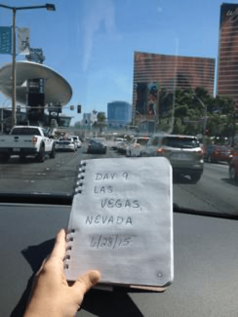
Bring on the crazy! Day 9 meant Vegas time. Life in Las Vegas is supposed to be pretty fast, right? Everything on television and in the books, at least, seems to imply that’s the case.
Oh, but didn’t your mother ever tell you that not everything you see on TV is true?
But before I get ahead of myself…
We left the Grand Canyon, with me still on Ibuprofen, and headed to Vegas. I was still bummed that my ankle was in pain, but by my calculation, I had several days for it to heal before I intended to use it in any sort of vigorous activity. We were ready to live city life for a bit, culture shock though it might be.
And it was. But first, a stop for car maintenance.
We stopped at Jiffy Lube to get an oil change and tire rotation as we’d now traveled our 3,000 miles (what responsible car owners we are). But, Jiffy Lube was anything but jiffy. Over a torturous hour later (spent watching golf on their mini-tv, snooooooooze), we were on our way to the hotel. Despite the delay, we still arrived at the hotel an hour earlier than check in, but the hotel had a room available. Thank goodness. This scored The Mirage major points in my book.
The lobby of The Mirage is everything a Las Vegas hotel lobby should be. Gorgeous and reeking of money (and stale cigar smoke from the casino). But, we soon discovered that that appears to be the case for everything in Las Vegas.
We were too tired to worry about the lunch that we skipped, so we headed to our room on the 19th floor for a nap. A glorious nap. In an even more glorious bed. We hadn’t slept in a real bed since St. Louis (although there was a cabin bed in Kansas) and the feeling of sinking into pillows was divine.
When we woke up, we were more than ready for dinner and I practically salivated in anticipation of In-and-Out Burger, which I had been told by a coworker was the best burger I’d ever have. I was ready to put her words to the test. Finally ready to leave, we exited the room and entered the hallway only to hear a strange noise. Pausing, we waited.
Wait.
Really?
Yes, the person (Um, people? One would likely assume.) was having a good time doing exactly what you think should be going on in a Las Vegas hotel mid-afternoon.
Moving on.
We headed to the elevators, giggling a little on the way. It’s true. Some of us never really do grow up.
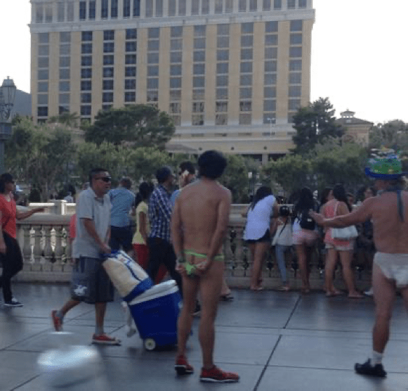
Remember that culture shock I mentioned? Our drive to the local In-and-Out was enough of a shock in weirdos alone.
Where else can you see this:
Ass-less chap-wearing Native American. Where else, I ask you?
And this:
If you’re going to wear a diaper in public (and he had a pacifier, too), you’d better be prepared for the ultimate wedgie.
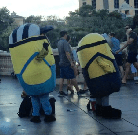
And this:
At least these guys are wearing clothes.
There are no words.
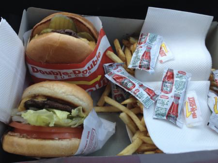
Onward to dinner. Best. Damn. Burger. I’ve ever had. Yum. Why on earth don’t these exist on the east coast? Why are we resigned to eating McDonald’s and Burger King when west-coasters dine on gourmet fare such as this?? Something here is wrong. In the name of equality, I urge you all to rise up. Rise up and help to bring the In-and-Out Burger to the east coast. We deserve this. You deserve this. (More importantly, I WANT it.)
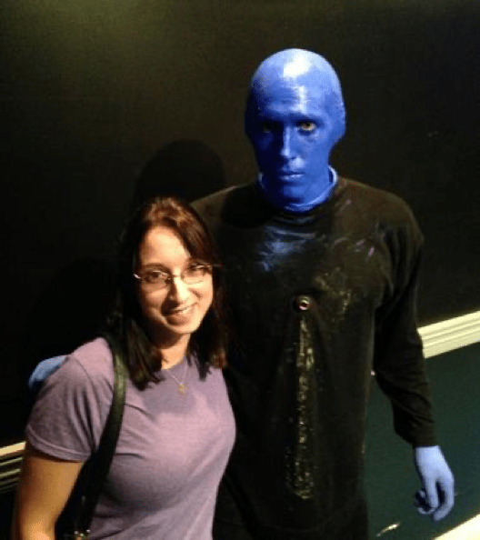
We made it down to the Monte Carlo just in time for the Blue Man Group. It was a phenomenal show – funny, entertaining, and interactive – a good choice and definitely recommended. Plus, you can pose for a photo with a sweaty blue man afterwards. And who doesn’t want that?
We spent a half hour or so at the casino, put $10 on red and won twice. That was enough for us. (About two times more than I needed, to be honest…)
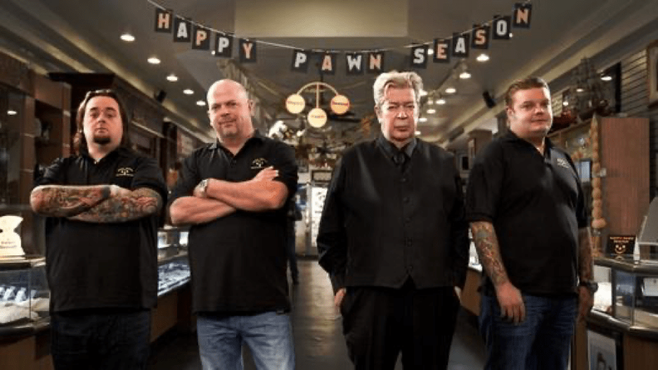
But of all of things we saw and did in Vegas, there was one thing we DIDN’T do. (No, it had nothing to do with the strip clubs, we had no desire to do those…either one of us…and yes, I believe him.) We completely forgot to see these guys:
One of Nate’s favorite shows, it had been on our list of things to see in Vegas from day one. But we had been so distracted by everything to see that we forgot to check in with Pawn Stars. How? How could we forget it? Las Vegas is like ADHD on crack. We didn’t stand a chance at remembering anything we had thought of before coming in. Should you travel this way, you’ve been forewarned. Vegas is a vortex. You won’t remember half of what you do, and you’ll likely be distracted by every– oh, look, a squirrel.
And that, ladies and gentlemen, is the real reason why what happens in Vegas stays in Vegas.
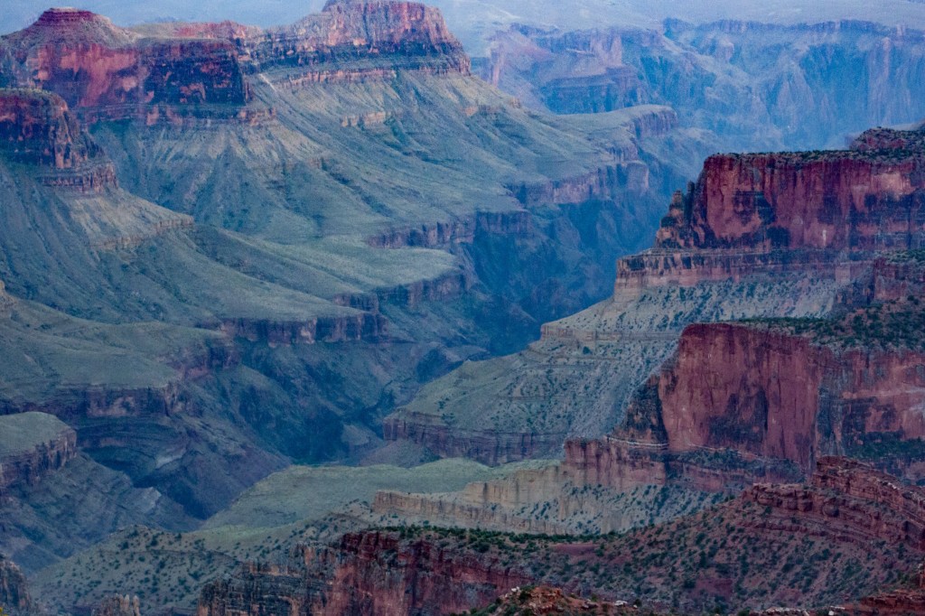
Hooray, we were finally blessed with a day when we could wake up slowly and take the day easily. I had booked two nights at the Grand Canyon and we were grateful for the down time. Showers and shopping for souvenirs before a short drive to Cape Royal where we’d been told by another camper and photographer that there’s a great view of the canyon, perfect for pictures.
View from Cape Royal. I almost didn’t want to Google this one. Made me want to cry. Photo Credit: http://cdn.c.photoshelter.com/img-get2/I00002fMl9VpSyxs/fit=1000×750/Grand-Canyon-Wotans-Throne-8334.jpg
But Cape Royal (or Cape Royale as Nate wanted to call it) was not in our future. Our plan was ultimately foiled by a turnoff for Green Lake. There was a trail off the side of the road that looked little used and we figured it had to be worth the short hike just to see what might lie ahead. Not 50 yards in, I stopped to take a photo. When we began to move forward again, I foolishly adjusted my camera and wasn’t watching the trail. I rolled my ankle on a loose rock, felt a snap, and let out a string of imaginative curses I could only have put together in pain.
It was several minutes before I could place my foot back on the ground and bear any weight on it and only when I was sure it wasn’t broken did we make our way back to the car. I won’t lie. I was in tears on the way back to the campground. I saw all of the plans I’d spent so long preparing (much of which involved hiking) fall to pieces with my five seconds of stupidity. And accompanying this regret? A flashback of my honeymoon, where I ended up with acute tendonitis in the very same ankle from walking a few miles in sandals, causing my new husband and I to miss our scheduled trip to scuba dive the coral reefs in the Bahamas. It’s twelve years later and we still haven’t done it.
I took three Ibuprofen and as soon as we got back to the camp, settled in the tent, put my leg up, and iced the ankle for three hours. I discovered it didn’t hurt at all once it had gone numb. Nice!
The good news – it wasn’t a bad enough injury to stop me from enjoying the rest of my trip and participating in everything I wanted to do, with the exception of a hike in or on the rim of the Grand Canyon.
The bad news – it’s definitely injured and will take a few months to heal. Since I’ve dealt with tendonitis frequently in my wrists, my ankles, and my knees in the past, I’m pretty sure that’s what I injured. Now, a month later, it’s a whole lot better than it was, but it’s still not great! Give me two more months at least.
The worst news – I injured it after taking this shot
That wasn’t even worth it!
The only good news from this day? At least there were several lookout points we could drive to. I did get a few decent photos, but I’ll just have to face it. The Grand Canyon was simply bigger than I was this day. I’ll suppose this means I’ll just have to return to conquer it another day! (Just twist my arm… Hmm, maybe a bad phrase to use, given that I’ve already twisted the ankle.)
We had packed up and gotten on the road by 7 am, determined not to be in the the canyons of Zion when the temperature rose above 90. We’ve certainly had enough of that to last a lifetime. Plus, we needed to reach Antelope Canyon Tours in Arizona by 9 am to make sure we’re able to get a spot on the 10 o’clock tour! But we’re in for a surprise. Two, actually.
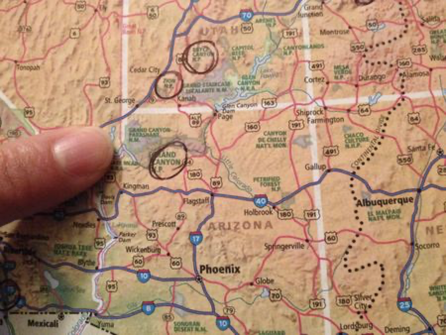
First, it wasn’t 9 am when we reached Arizona. It was 8. Huh? I swear this map shows the time zone divider clearly located between Arizona and Nevada, but whatever.
See that funny dotted red line between Nevada and Arizona? That’s the time zone marker. Notice how there is NO line between Utah and Arizona. Remember this for the future.
So, one might think showing up an hour earlier is even better for getting a seat on the tour bus, right? Not actually the case if you need reservations for the tour. Bummer. This is a huge disappointment for me especially, as Antelope Canyon was one of the highlights on my list and I couldn’t wait to visit it in person.
Antelope Canyon Tours directs us to another tour company directly across the street, but they, too, are booked.
Still, they tell us about a company directly at the entrance to the canyon which books only on a first-come/first-served basis. Well, it’s worth a try. Not even sure exactly where we were headed, we get on Rt. 98 where we’ve been told hosts the entrance to the canyon.
About ten minutes later, we found Antelope Canyon Navajo Tours and are surprised to learn that it’s $8 a person just to park the car in the lot. THEN, we could go to the kiosk and determine if they have any openings in their tours. $40 a person for the tour. Wait, what? $16 just to find out if we actually can go on a tour? We’re too desperate by this point to care.
Thankfully, when we got to the kiosk, there was plenty of space available on the 10:30 tour. And, it was now nearly 10 at this point. So, we purchased our tickets and waited an hour. Doing what? Not sitting in the sun, that’s for sure. In the air-conditioned car, we loaded photos to the laptops and spent time goofing on Facebook. 45 minutes passed quickly and, seeing that the lot has filled up and that people are waiting in the itty bit of shade provided by the kiosk, we decided to get out and join the crowd. After a 10 minute wait (during which we are soaked in sweat again), we were given assigned vehicles to ride in – open pick-up trucks, fitted with bench seating and covered cage tops.
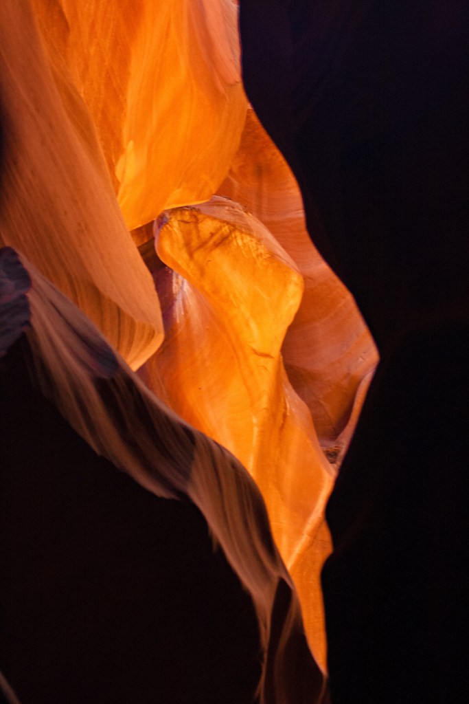
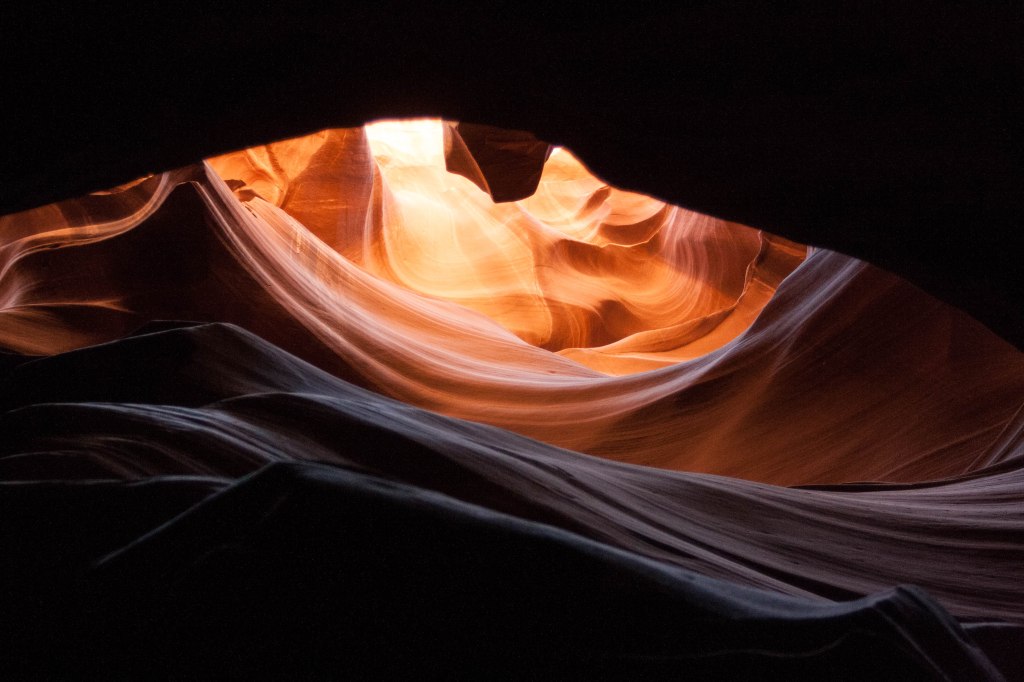
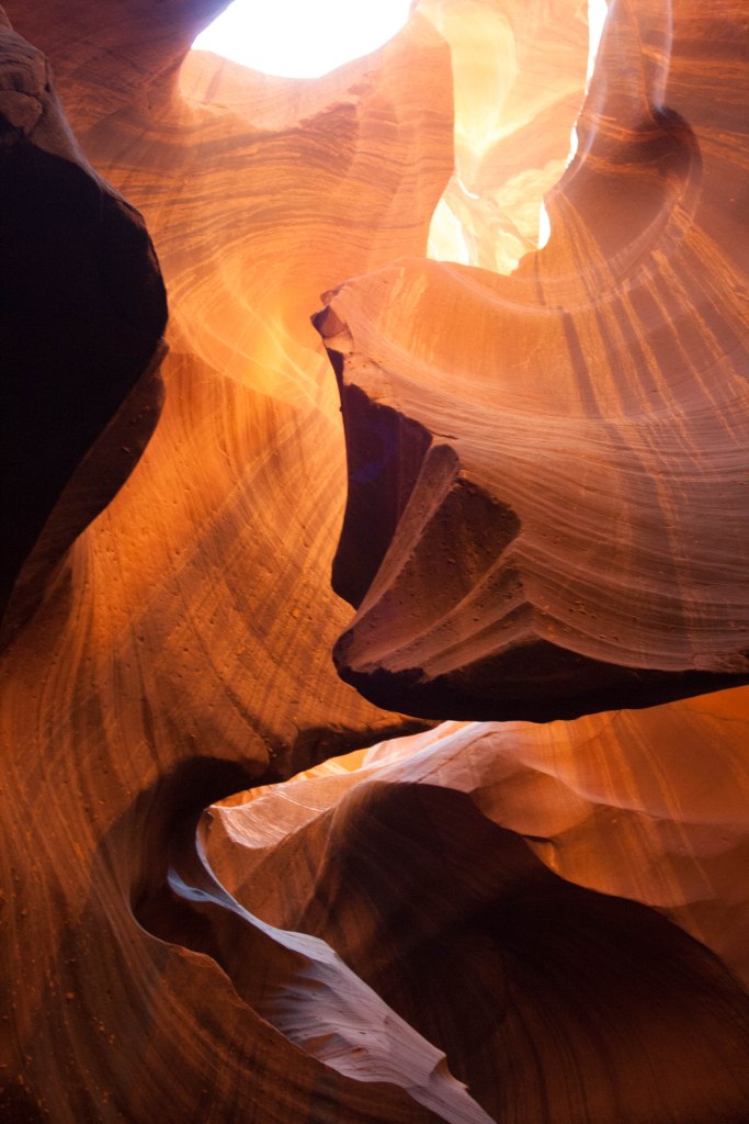
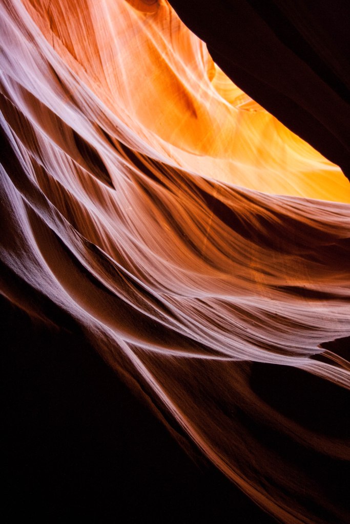
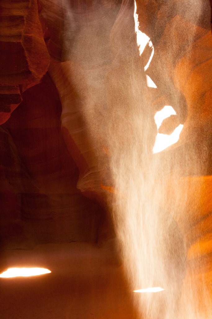
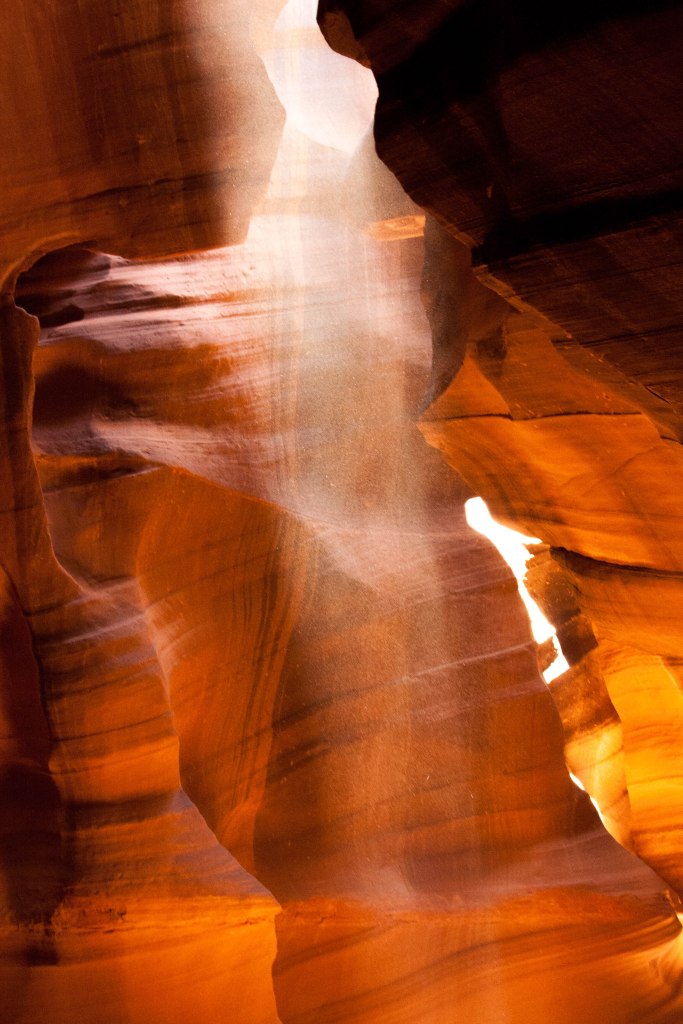
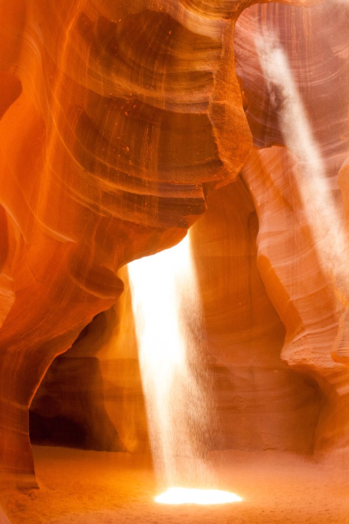
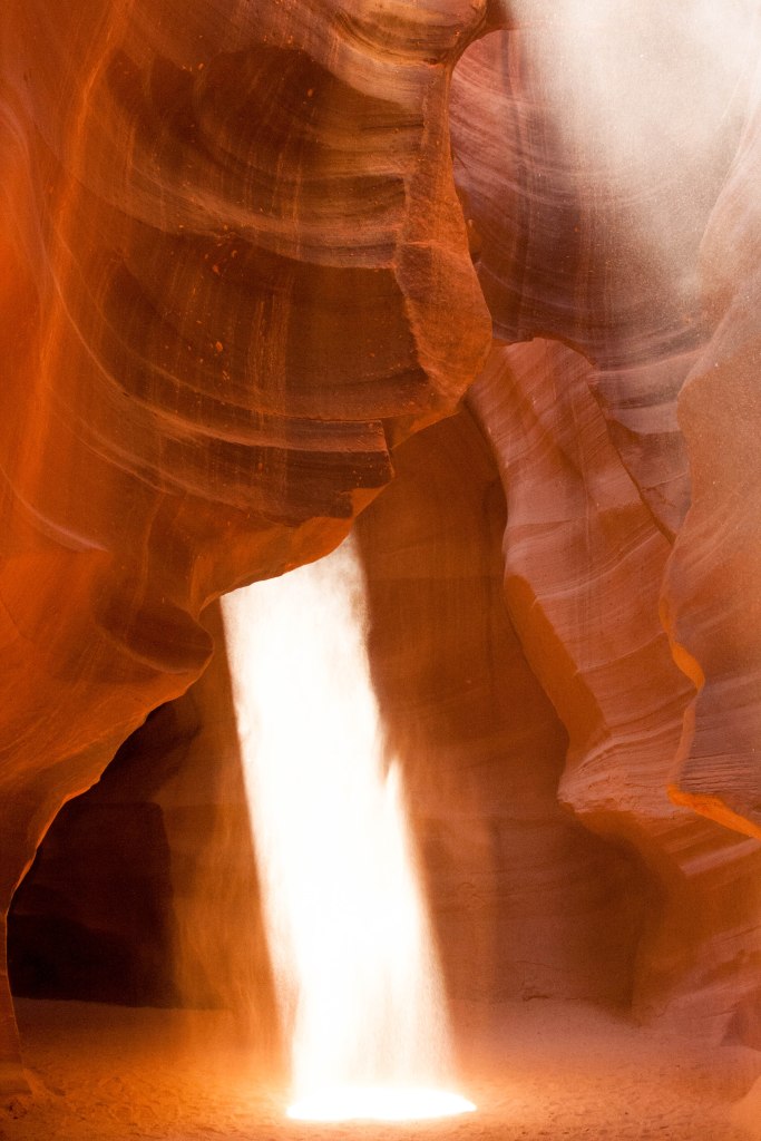
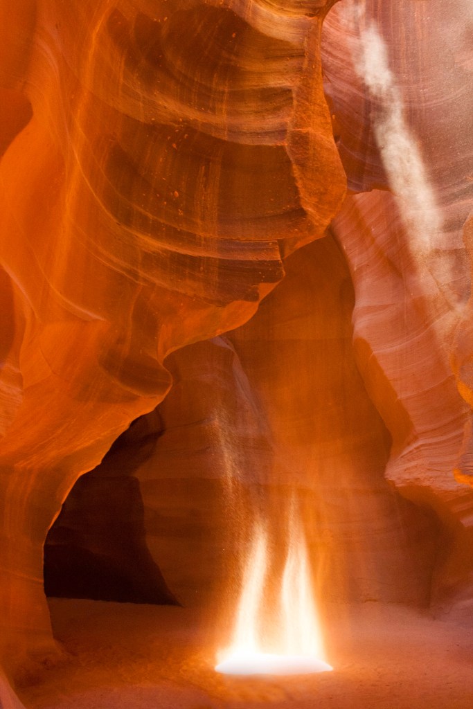
It’s a ten minute drive to the mouth of the Upper Canyon and our drivers/tour guides rather enjoyed racing each other. We hung on for dear life. Kyle, our guide, parked and brought us to the entrance of the canyon. Before we entered, he explained the best camera settings for taking photos within the canyon walls, saving me a lot of trouble of flipping back and forth and trying to figure out exactly what settings I wanted to use. I liked this guy already. In fact, Kyle ended up taking the majority of photos for many people, but I was loathe to relinquish either of my cameras, surely leading Kyle to believe that I was a bit of an ultra-possessive nutcase. (Yes, not knowing which lens would be best, I brought both my wide-angle and my regular “go to” lens.) One of the interesting differences I noticed between my perception of Antelope Canyon and the reality is that most of the notable images you’ll see are actually photos taken by looking straight up. The most spectacular sights are just above your head! I hadn’t anticipated that!
Believe it or not, Antelope Canyon isn’t very large at all. It’s quite small and only takes about half hour to tour completely. Photos of Antelope Canyon have always captivated me. What an amazing, entrancing, abandoned place! Ha. Abandoned. I’m funny.
There were people. Lots and lots of people. Remember back on Day 6 (That’d be yesterday.) when I said I wasn’t much of a “crowd” person? The tour guides for several different companies are all Navajo-led since Antelope Canyon is on Navajo lands. However, the tours run one after the next with one tour frequently immediately on the heels of another. Multiple times we had to wait to turn a corner to get to the next section of the canyon since the tour in front of us was still there. What made it even more challenging was the fact that once you came to the other end of the canyon, you had to turn around and head back again, essentially swimming against the current.
But, for this:
It was worth it. I’d would have given my left arm to see the infamous light beams. Thankfully, no one had asked for such payment and I walked away from the experience not only with all of my limbs, but with a feeling of ultimate satisfaction. Another destination to cross off the bucket list. And one that was beyond words. I do still wonder, however, what Antelope Canyon might be like without hundreds of people also experiencing its marvels at the same time. I’m probably a century too late to ever know what that experience is really like.
We made the ever-essential PB&Js and sat in the lot, contemplating our next move. It was only noon and the very last thing we wanted to do was get to our next stop, the Grand Canyon, too early in the day to face a repeat of the temperatures in Zion. I had zero desire to repeat that experience. (Dear Lord, please no sun!) So, we backtracked.
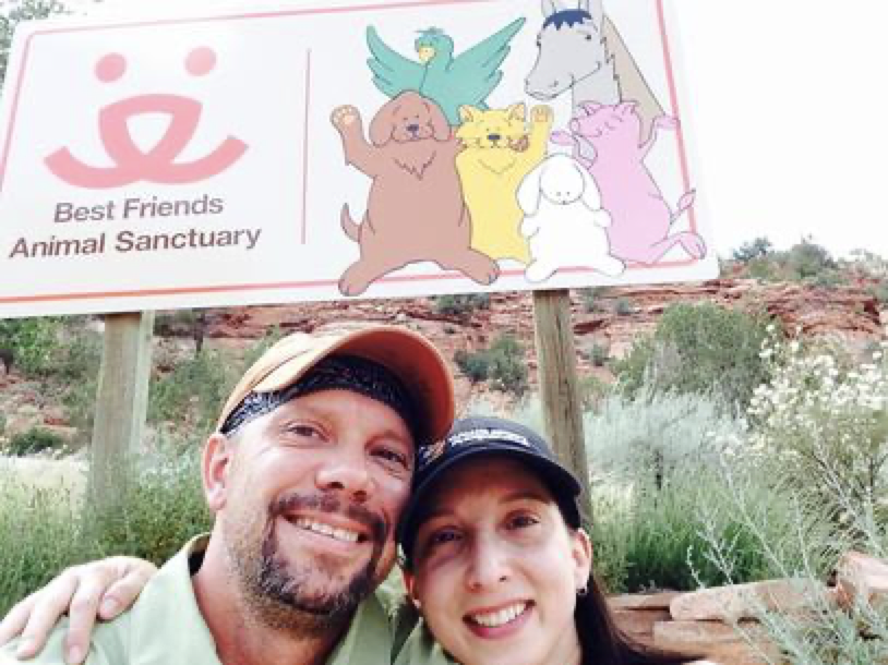
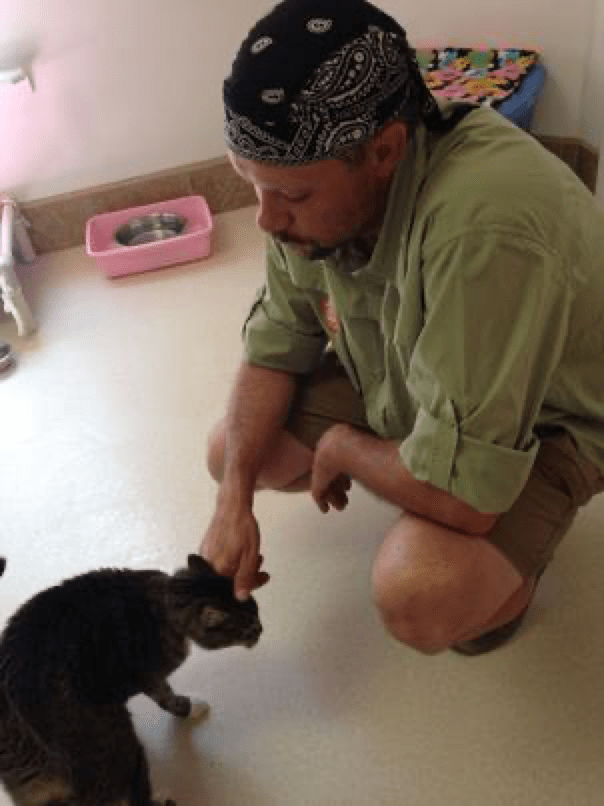
We’d passed Kanab, Utah (which I’d been pronouncing wrong my entire life…) and decided that some extra time on the clock meant we could go back that way to tour an animal welfare organization that was near and dear to my heart long before I started working in the field of animal welfare. We arrived at Best Friends Animal Sanctuary at 1 pm…er…2 pm. Right, there was that weird time change again. We got there just in time for another tour to start at 2:30. I balked only momentarily at the fact that it was 2 hours long (That does seem excessive for a tour of an animal sanctuary, right?), but signed up because, hey, I’d only be here once and – oh, right, who wants to go to the Grand Canyon and set up camp in 100 degree heat? Not us.
So, we took our Best Friends tour and for as much as I love the organization, 2 hours was definitely not necessary, despite the fact that the facility is over 3,000 acres. The 10 minutes we had in the cat houses and the 10 minutes we spent with a dog (who ignored me, thus breaking my heart forever) was the best part, hands-down – especially for me. Seven days without animal contact and I was in full withdrawal. I can also now say that I am familiar with every single building on the property. Every. Single. Building. And the two pet cemeteries. So, yes, it was a neat place to visit, but if you already know animal welfare and you’re familiar with how things go, perhaps it’s not the tour for you! (Or, in this case, me.) Regardless, I’m thrilled to have had the opportunity since I’ll never have it again. At least we were sweltering in a van with poor air conditioning as opposed to sweltering in the sun on the rim of the Grand Canyon.
This pretty much sums up our relationship. And he really must love me to agree to a 2 hour tour. Oh, that’s right, he agreed to a 3 week, 8,000+ mile road trip. Yeah, he’s my best friend.
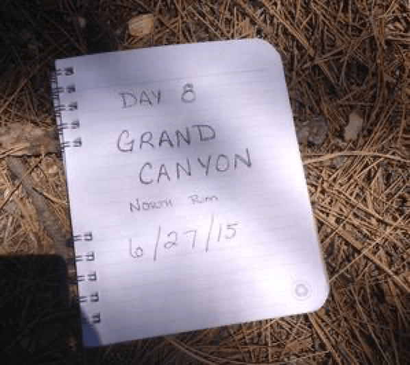
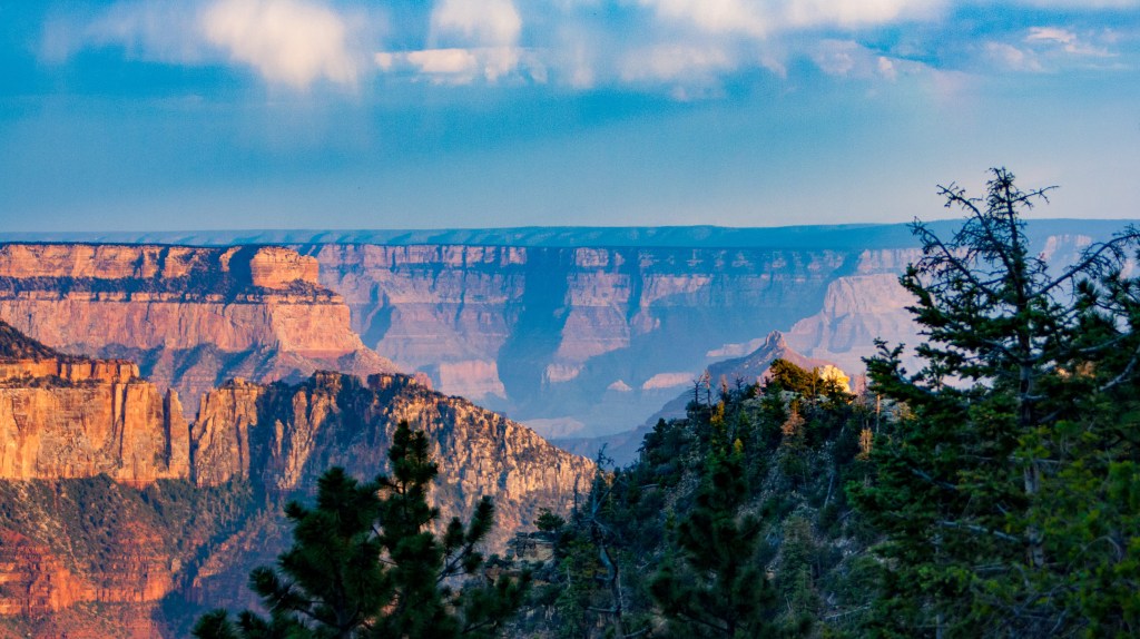
Another two and a half hour drive brought us to the Grand Canyon and imagine our shock when we saw how green the road leading to the North Rim really was. Kaibab Forest greeted us with many beautiful pines and even a full wide meadow or two. After so much desert, it was positively stunning.
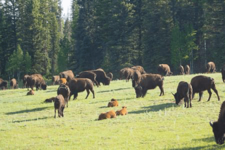
Some 60,000 acres had been decimated by fire about 8 years prior and the evidence was still plain to see, but regrowth was surely and steadily making an appearance. When we finally reached the park entrance, we were greeted by a herd of bison grazing in the meadow. I expected to see bison on this trip. Just not at the Grand Canyon.
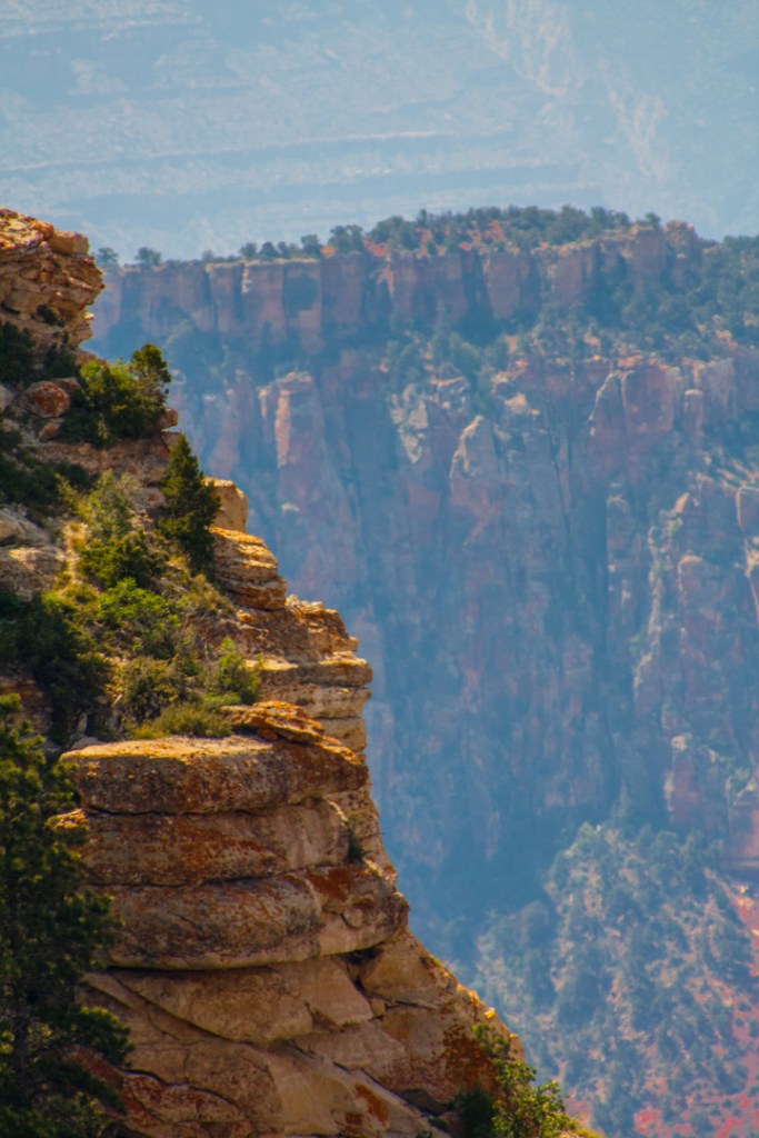
Welcome to the Grand Canyon! Wait, what?
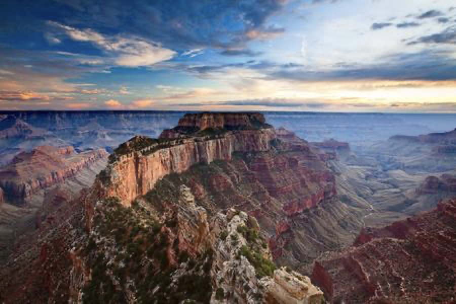
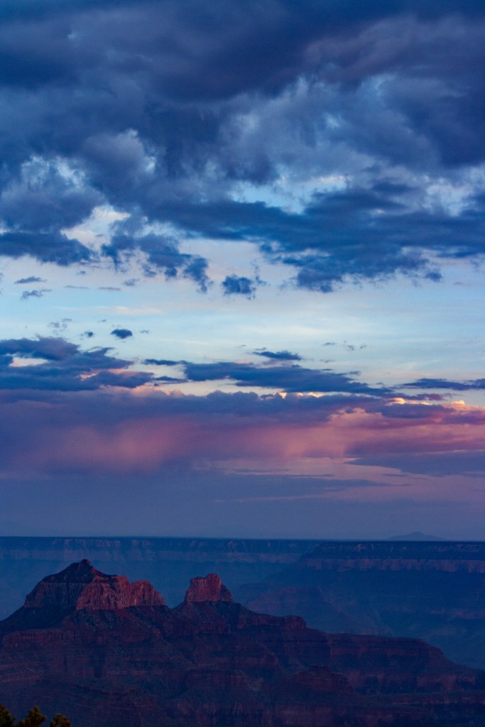
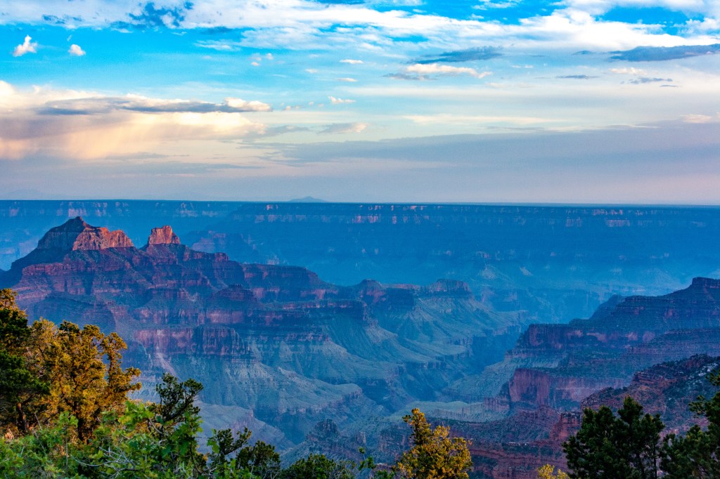
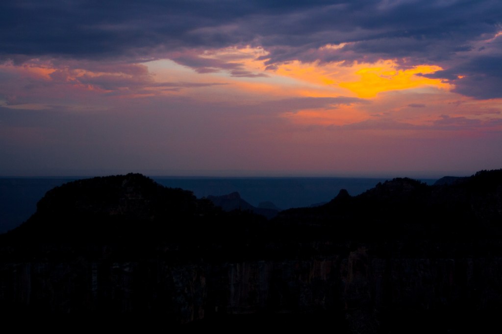
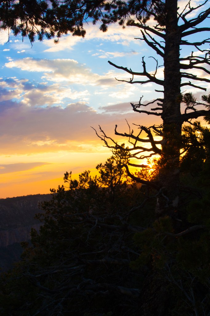
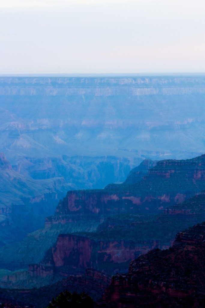
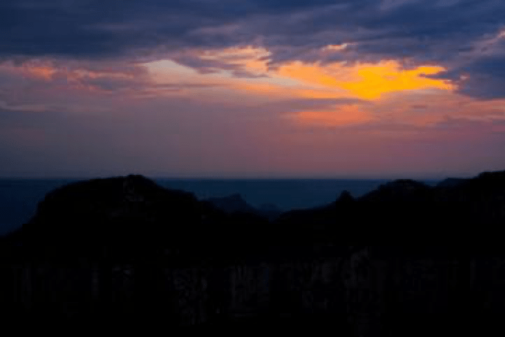
Imagine our surprise when we reach the North Rim Campground to find that the entire location was fully forested and in beautiful, sweet shade. And we delayed coming here??? What were we thinking? We found our campsite – one of the best on the grounds – perched not 50 feet from the north rim of the canyon. It was breathtaking. (Yes, I realize I use that word to describe the experience in many parks, but it is as close as I can get to explaining how it is.) 100% amazing. After setting up the tent, we headed to the edge and captured a few photos of sunset at the Grand Canyon. Another fabulous view. I’ll never be content with a Berks County sunset ever again.
Then, another night in the tent. Without sand baking us as we sleep. That’s right. Finally a cool night to close our eyes. Relief! Oh, and remember that funny time change thing? When we got to the Grand Canyon, we saw this:
Well, thanks, Arizona, for just deciding you don’t have to follow the rest of the country in daylight savings time. So, it turns out that depending on the time of year, Arizona is either in Mountain Time or Pacific Time. Who knew? (Yeah, yeah, those of you who live in Arizona knew. I know. You really should have given a girl a clue!)


