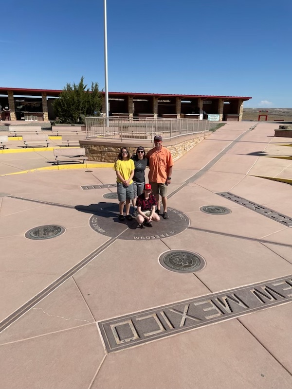
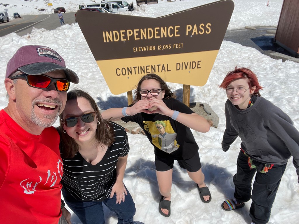
Three Deer, a Raccoon, and a Big, Fat Skunk

Day 13: 6/14/24
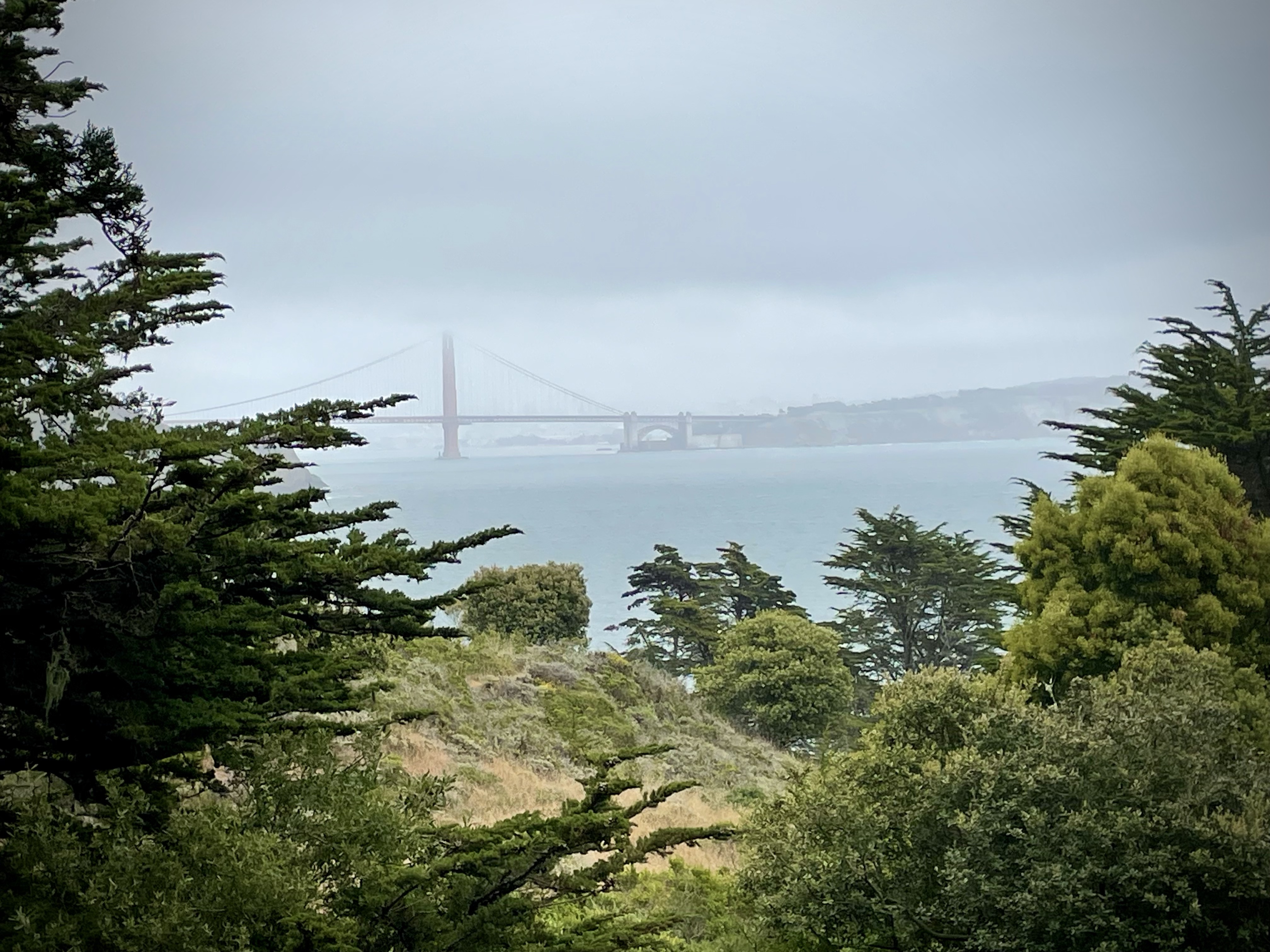
From: San Francisco, CA
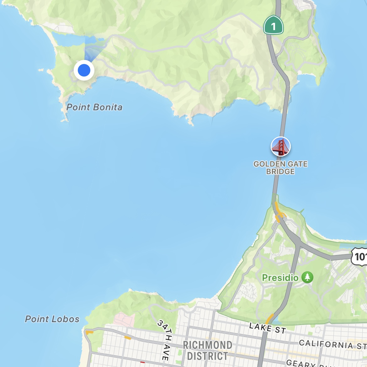
To: Crater Lake, OR
Distance: 417 miles

I’m up at 6:45 and grab a quick shower before waking the rest of the family. We enjoy a hot breakfast and are on the road a little after 8, in time to catch rush hour traffic in the area. Congested, yes, but at least it moves. San Francisco is not LA.

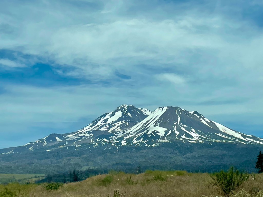
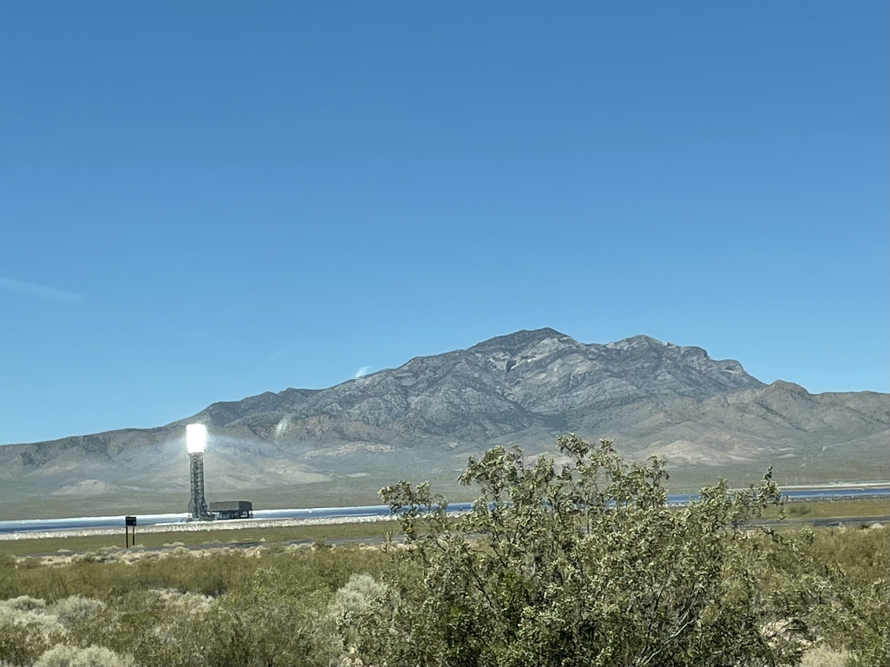
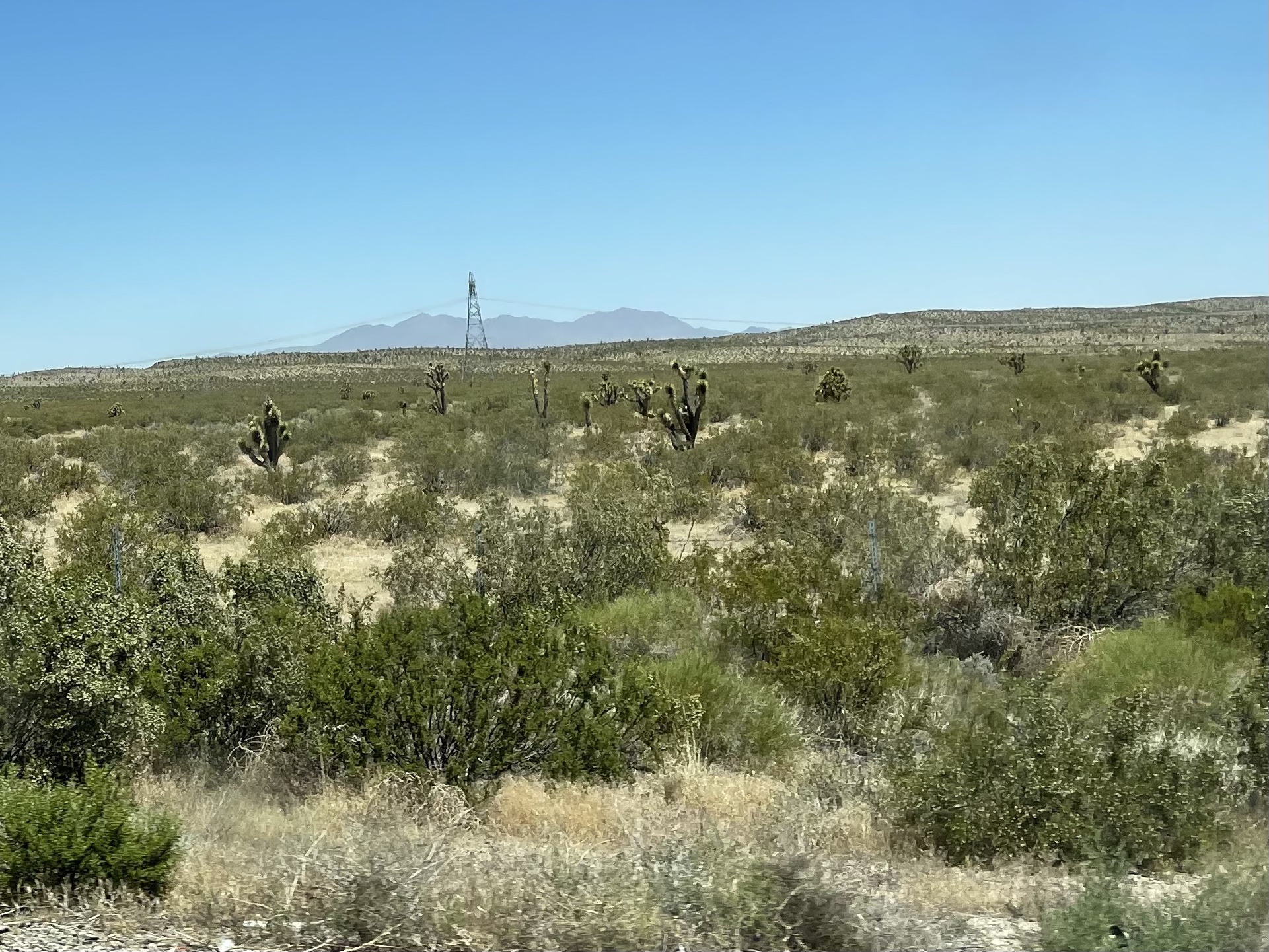
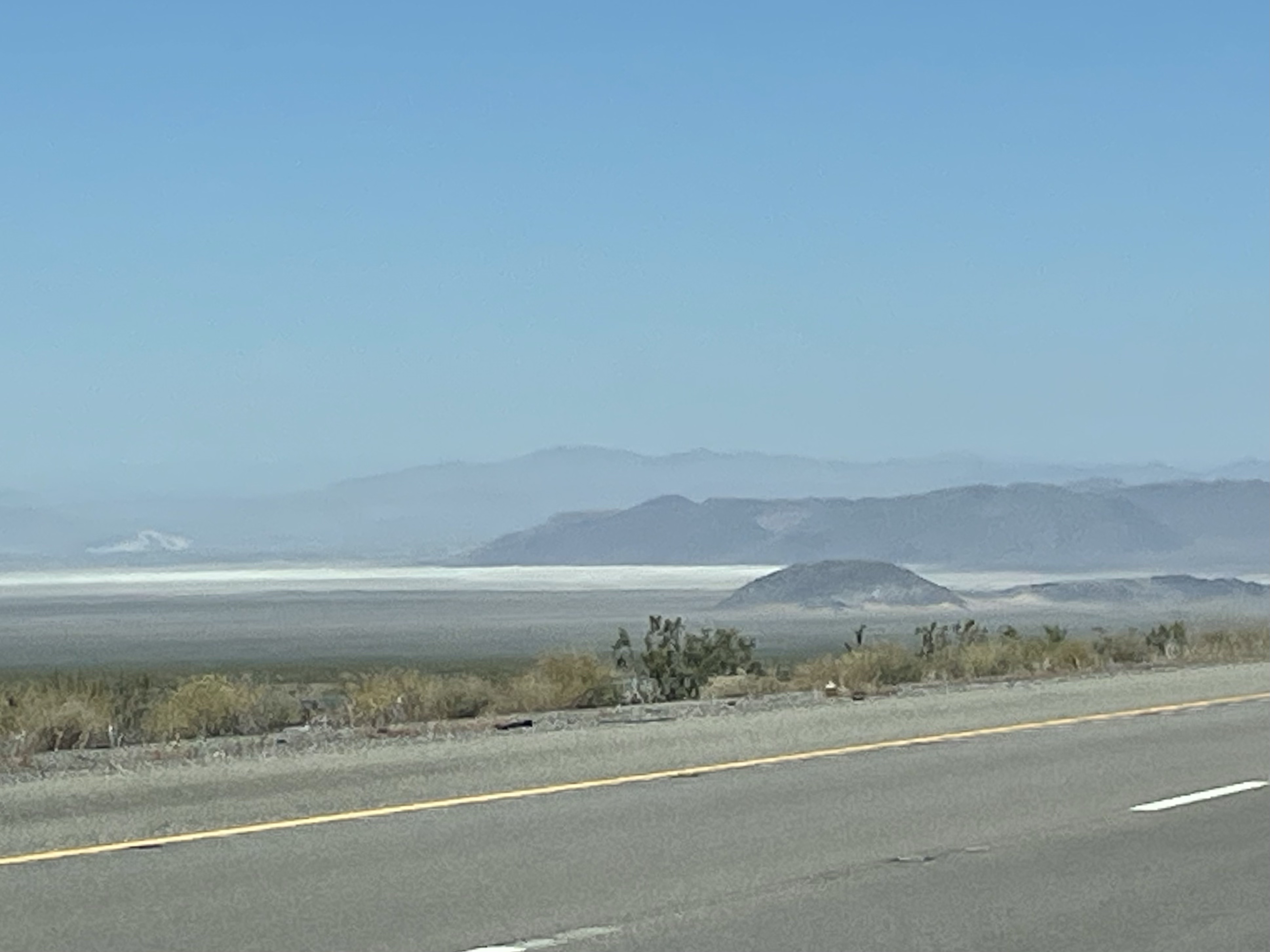
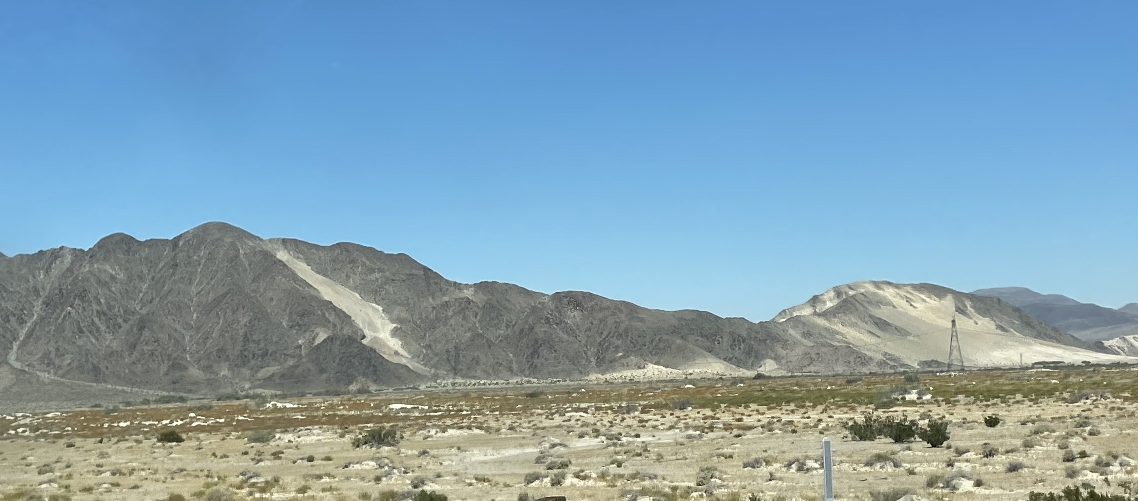
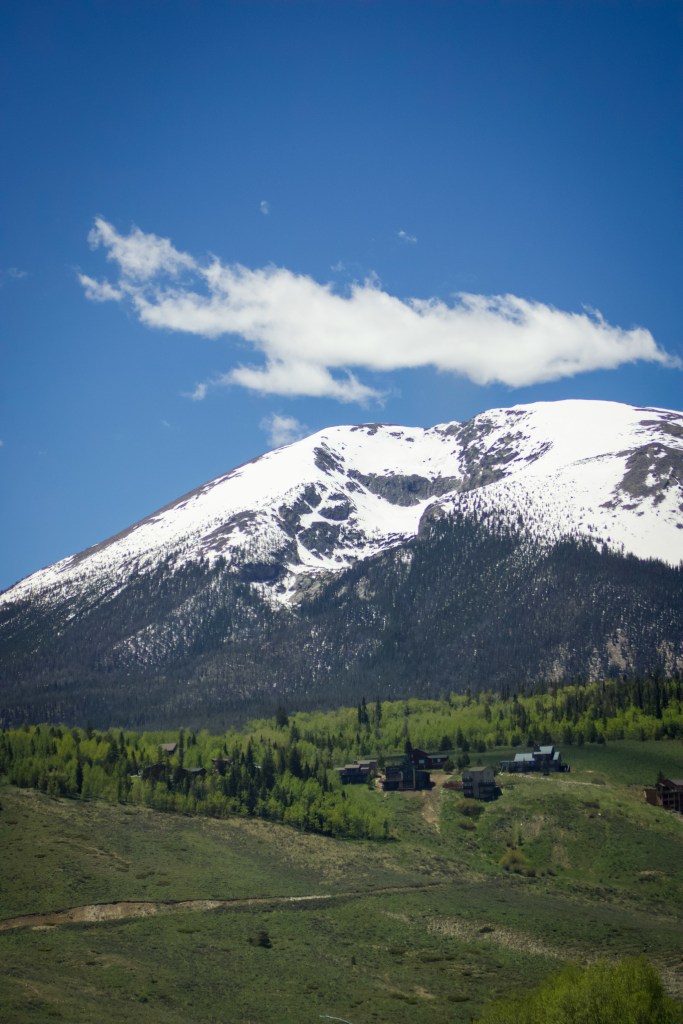
We’re in for a long drive today and the next few as we head back east again. And back to windy mountain roads after the California highways. We travel the highway that wraps around Mt. Shasta and take in the snowy peaks growing ever closer. I’m thankful Husband’s cold is mostly gone, but he’s having issues equilibrating his ears due to lingering congestion, so the ups and downs on this leg of the journey are a bit of an annoyance for him. No one else came down with his cold, and for that, we celebrate.

We exit one highway into a town called Weed, and yes, they play it up here just as you would expect they would.  “I love Weed” souvenirs abound. We do not stop to buy any. Shortly after, we cross a lake called Grass Lake that looks far more like a meadow than a lake, which is where it got its name, I’m sure. (And not because it came right after Weed.)

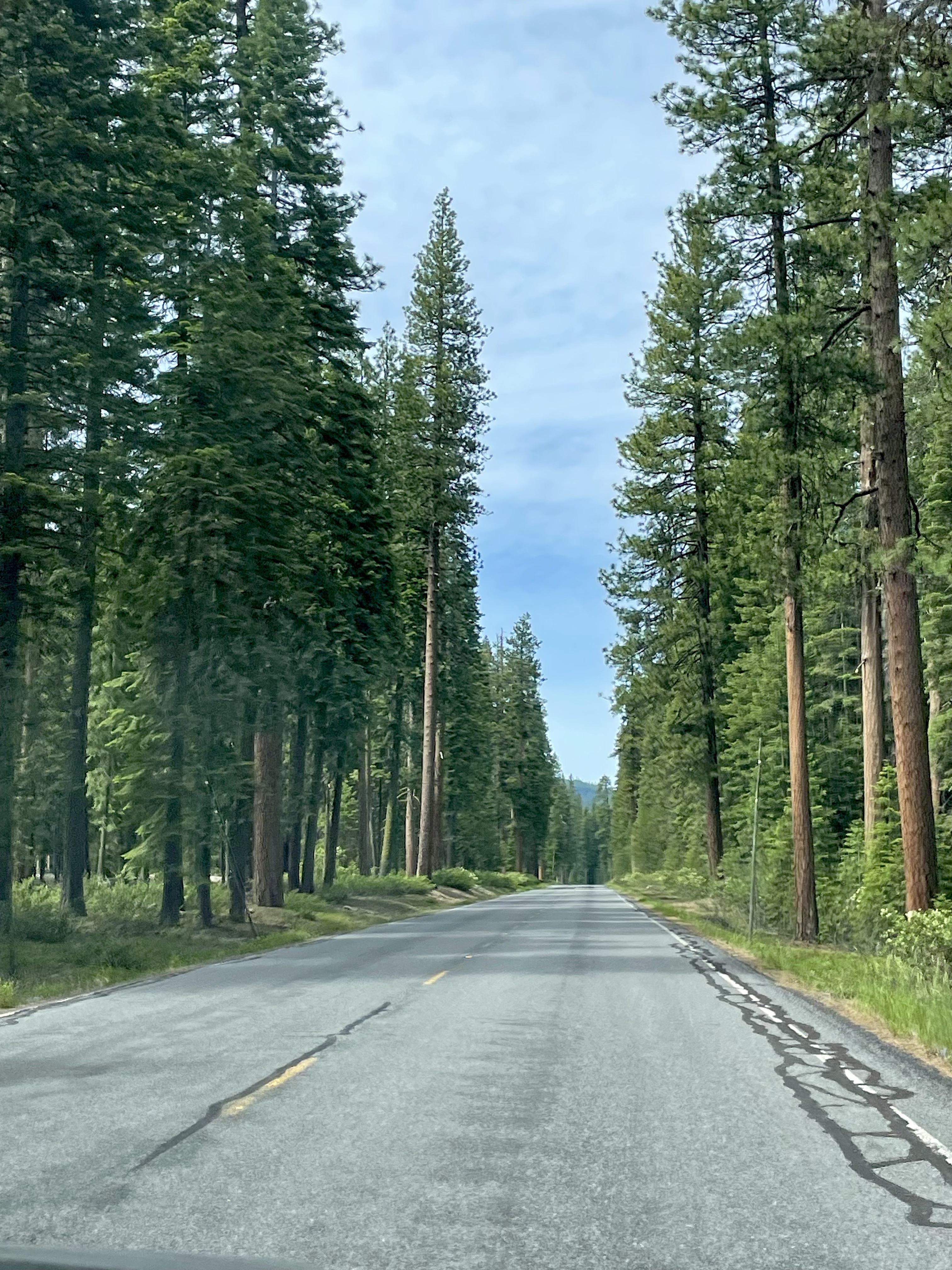
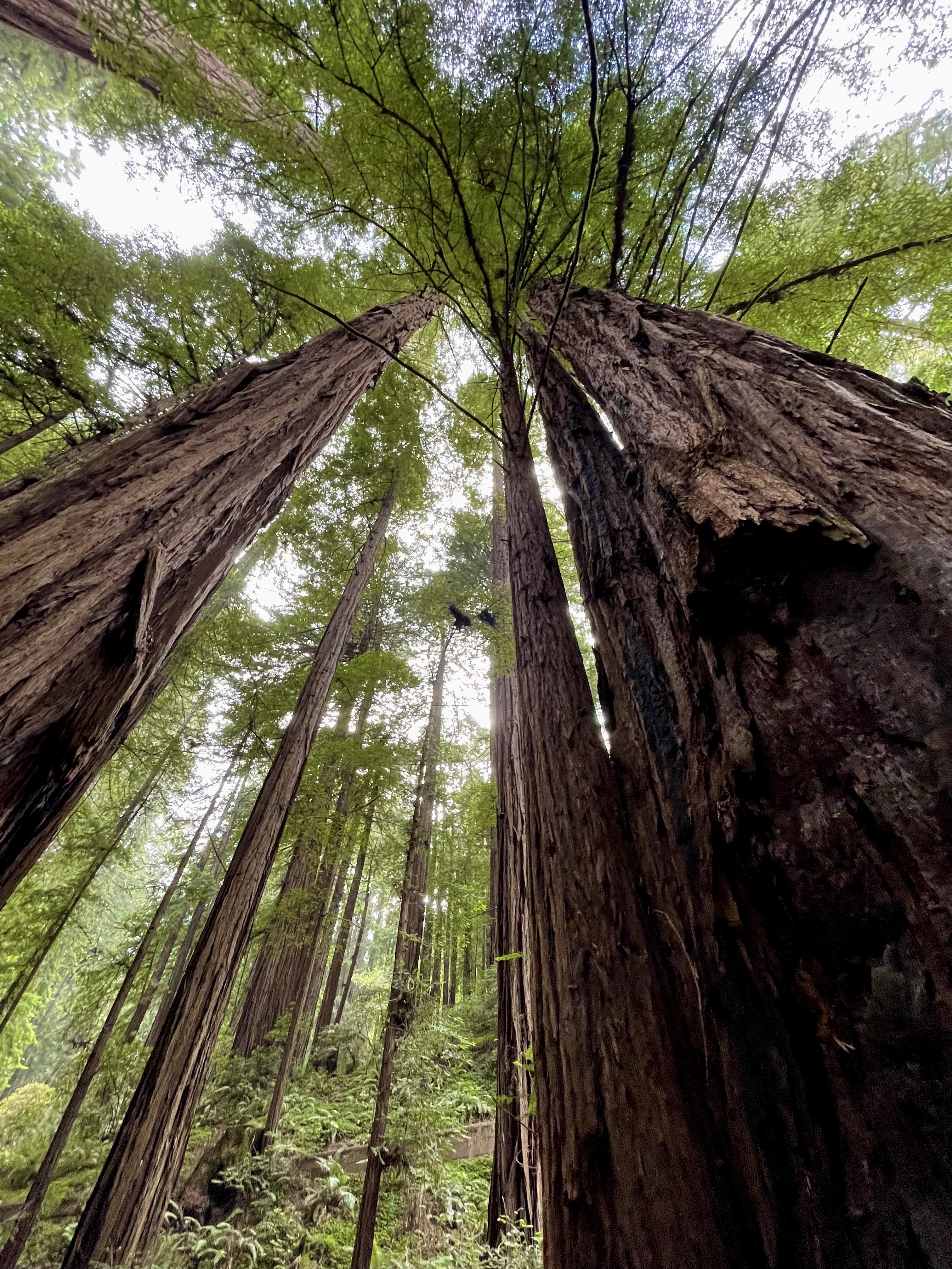
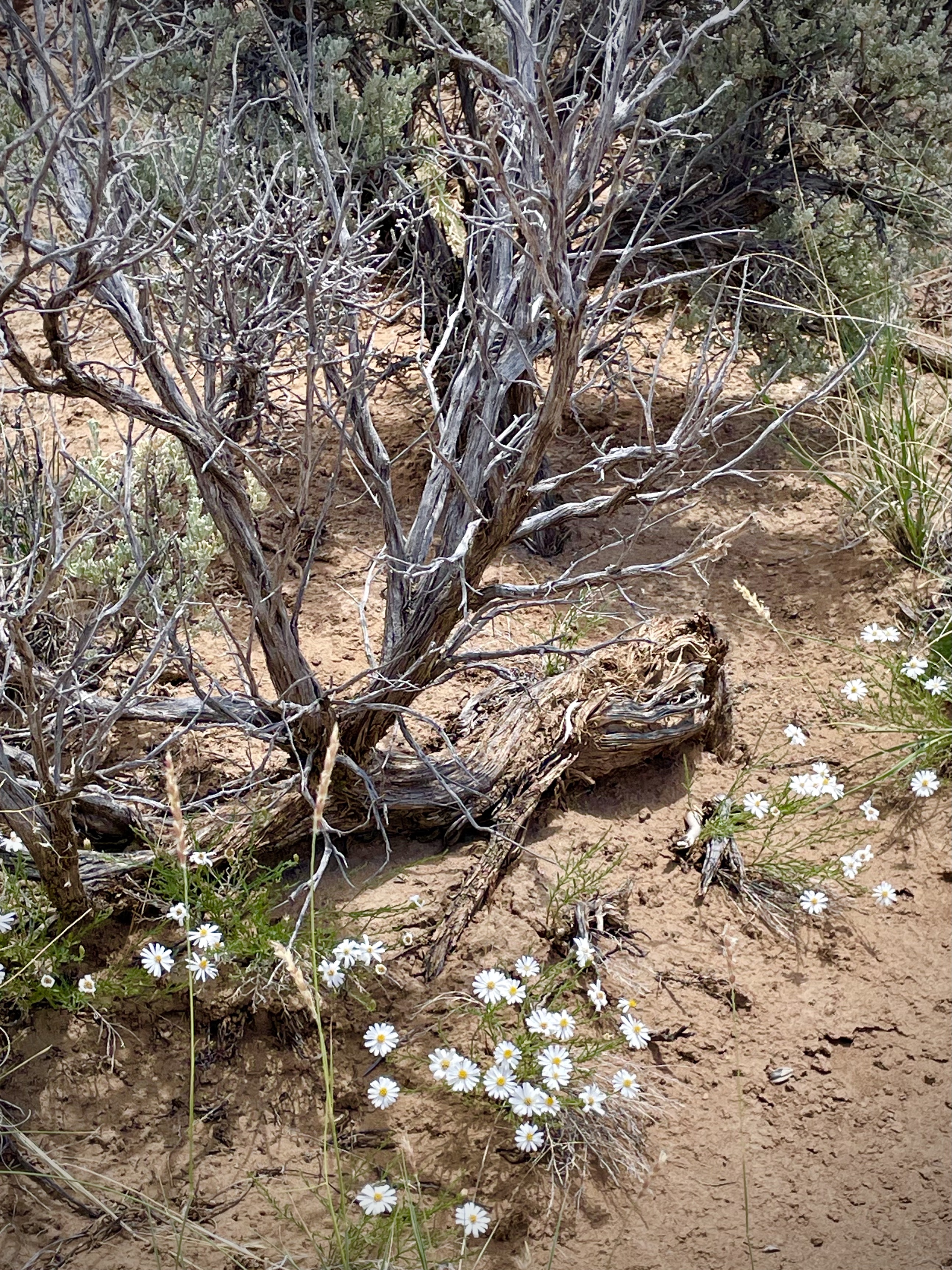
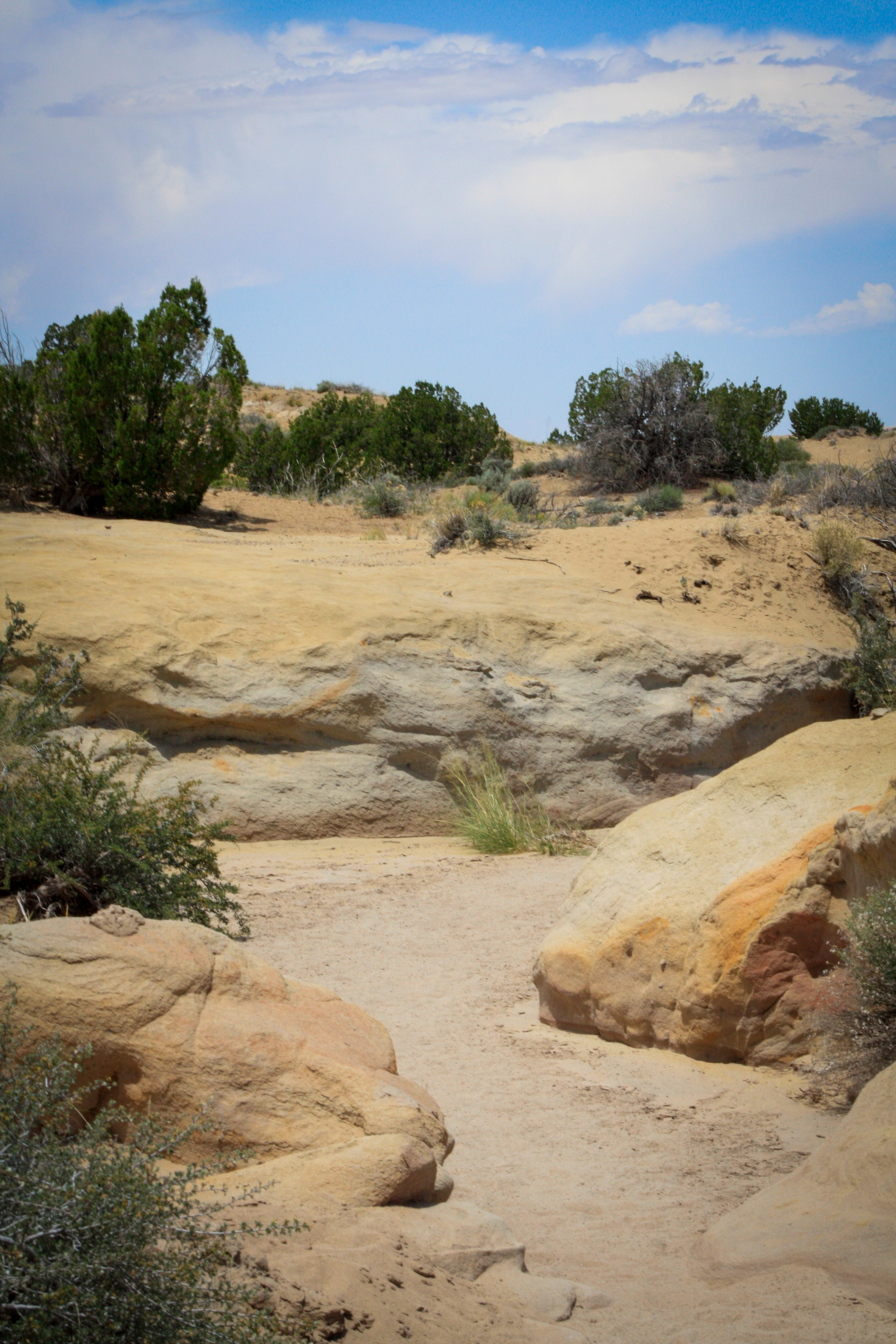
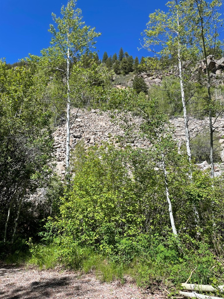
We pass the Butte Valley National Grasslands with the Cascade Mountains as a backdrop and it’s all so breathtaking. The closer we get to Crater Lake National Park, the greener our surroundings. After the golden California hills, the deep pine woods of Oregon are refreshing. Husband stops to check out the gorge where Annie Creek runs…and finds a random dollar in the weeds. Who does this? Husband. Of course.

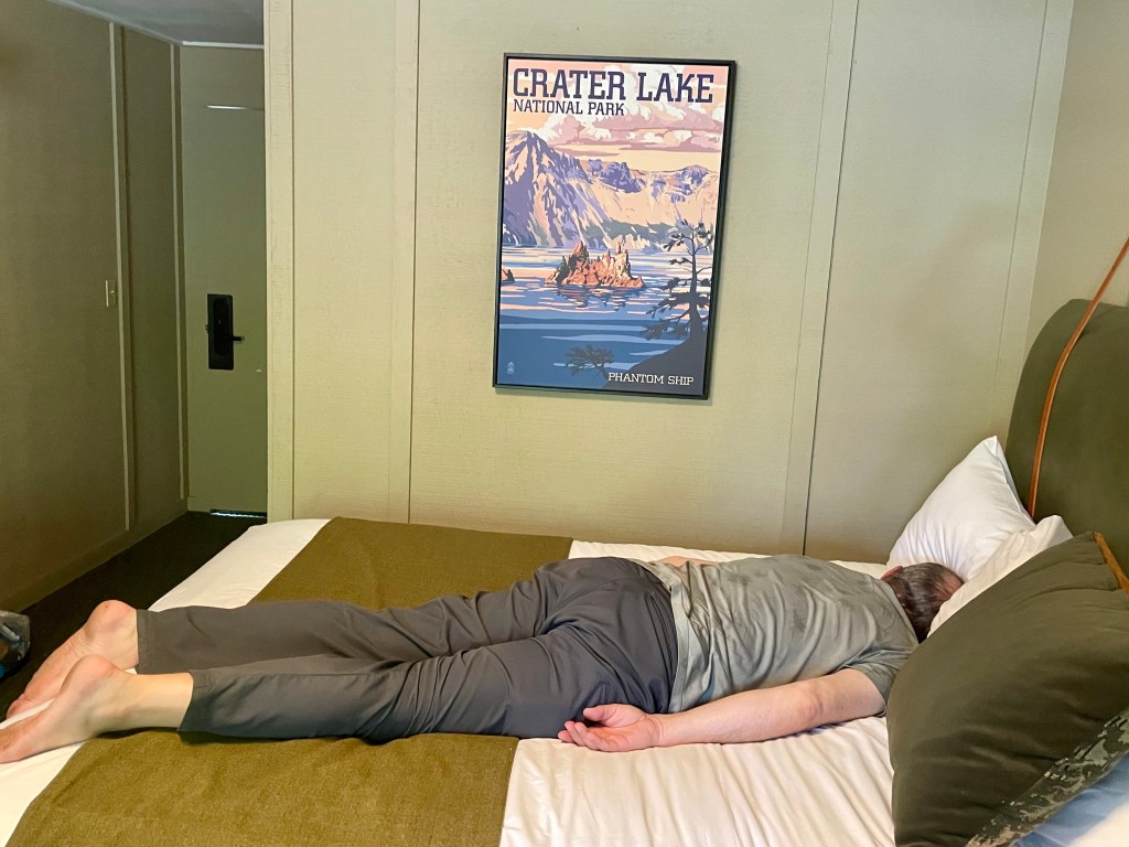
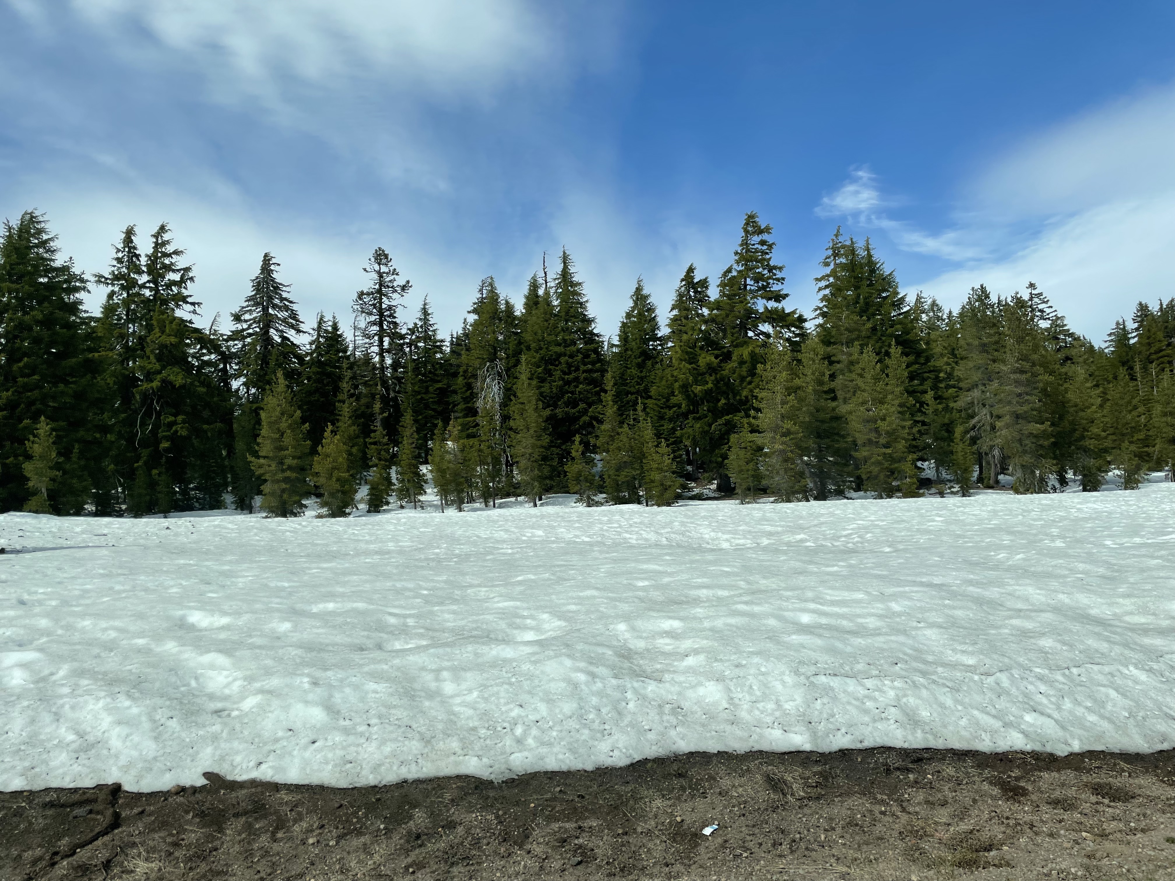
We reach Crater Lake and quickly notice the piles of snow all through the woods. It’s June 14th and there are large piles of snow in the woods. We check in and head to our adorable cabin at the Mazama Village where Husband immediately collapses facedown into a bed. I DID offer to help with the drive today. He declined. I absolve myself of his exhaustion.

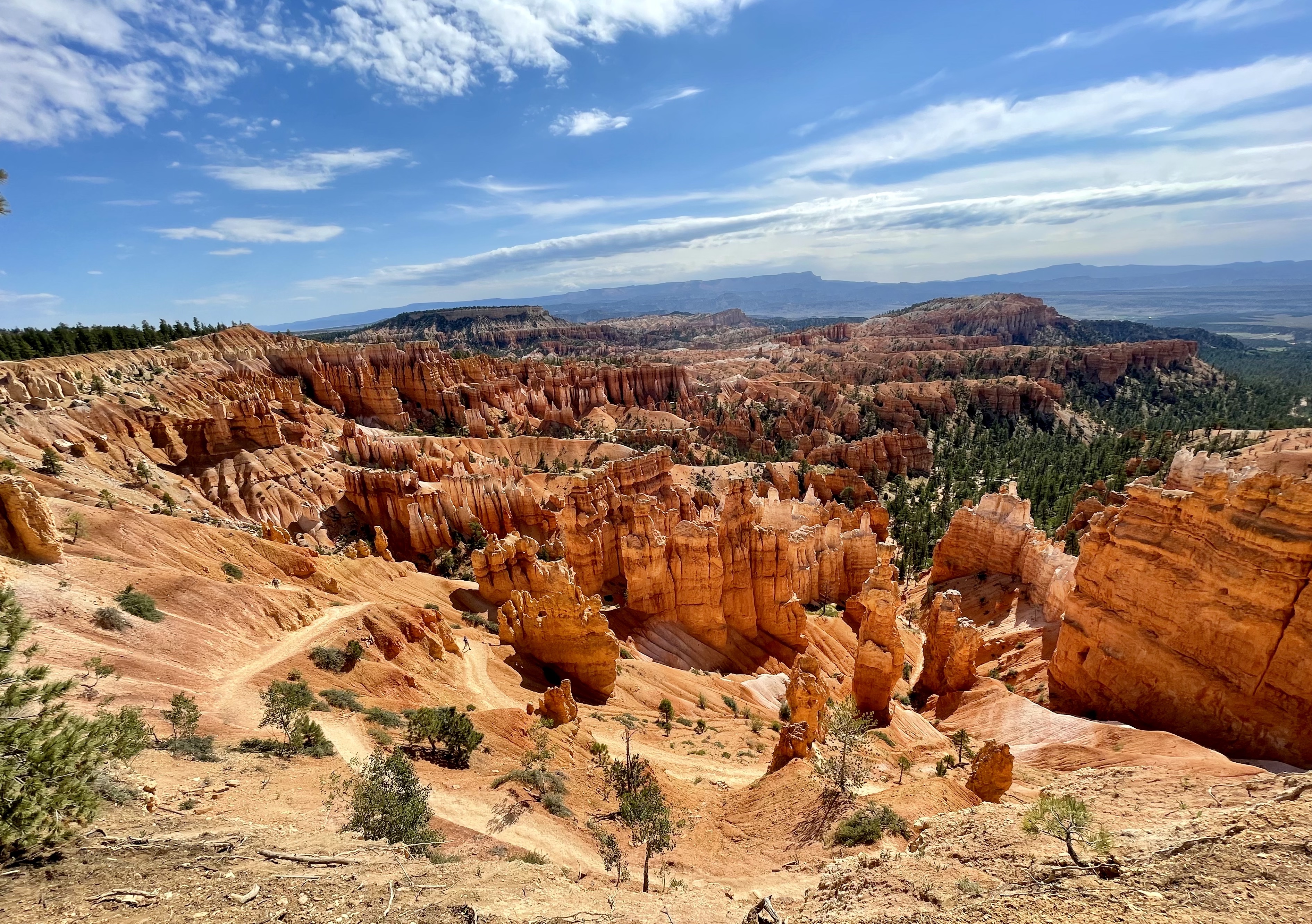
After a short rest break, we’re back in the car and headed to the crater that makes this park so amazing. But the Rim Drive is closed after two stops. Why? There’s so much snowmelt and it freezes on the roads overnight. Yes, you read that correctly. There’s a lot of snow on top of this volcano.

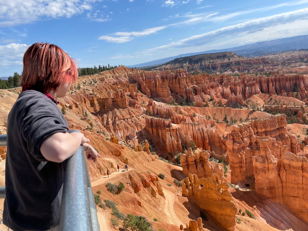
There’s no shortage of views, though. The water at Crater Lake is an insane deep blue, and so calm, it looks almost inviting. But that’s a high dive you wouldn’t want to take now or ever. Even in late summer without recent snowmelt, the water here is cold, the average temperature reaching only 55-60 degrees at the surface.

Husband and Younger Child head up a steep hiking trail for a different view of the lake and the cinder cone inside of it. I stay put since I don’t want to challenge my hip today. I’d say Older Child stays to keep me company, but I think they’re just tired of hikes at this point and need a break to check social media.

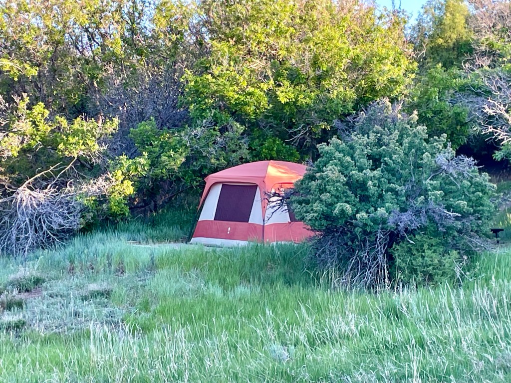
Once again, I’m kind of glad for a change in plans. We were supposed to be camping in Farewell Bend campground, but pests and diseases meant they had to take down a lot of trees, so the campground has been closed until next year. I was notified all of two weeks before our trip, but was able to panic book the single remaining cabin at the Mazama Village. (Which is closer to the crater anyway – win!)

It’s supposed to be a low of 29 degrees tonight. It’s 53 now and breezy, but not bad in the sun as I type this from the crater’s rim. 29 degrees in a tent with sleeping bags only rated for 40 degrees? No. No thank you. So this minor inconvenience ended up being a major blessing. We’ll be comfy and cozy in our cabin tonight.

The nice part about arriving with plenty of time and already having seen the bit of the park we’re able to is that we have plenty of time for doing laundry, which is sorely needed at this point. So that’s our next stop. The kids stay in the cabin and we head for laundry. I am quite certain both kids are happy to be free of us for a couple of hours. We’ve been in each other’s faces nonstop for almost two weeks now.

Husband and I are celebrating our 21st anniversary today just the way I like to. (No, not doing laundry.) Low-key adventures like the one we’ve been on are all the gift I’ll ever need. This is the gift. This life we have together. And I mean, he DID find me a ring in Muir Woods yesterday, so…

After the laundry, we hang out in the cabin. The kids draw while I read. Husband is antsy and doesn’t like sitting still, so he decides to go to the park office to ask if we’re allowed to head to the crater rim for night photos. I’m shocked to hear it’s allowed and doesn’t require a special permit! So now we have to decide what ridiculous time we’re going to get up in order to take photos. Because this opportunity won’t come again. 

Sigh. We’re insane.

So we set the alarm for 2 am, layer up, and head out into the 34 degree weather to see what we can see. Which…isn’t much. Because the entire cabin village is shrouded in thick, white fog. Maybe it will be clearer at the rim?

Friends, it will not. We take the twenty minute ride to West Rim Drive to find out the fog is so thick, we’re now basically inside of clouds. There will be no Milky Way photos over Crater Lake. Twenty minutes back down and we jump back into pajamas and into bed again. 

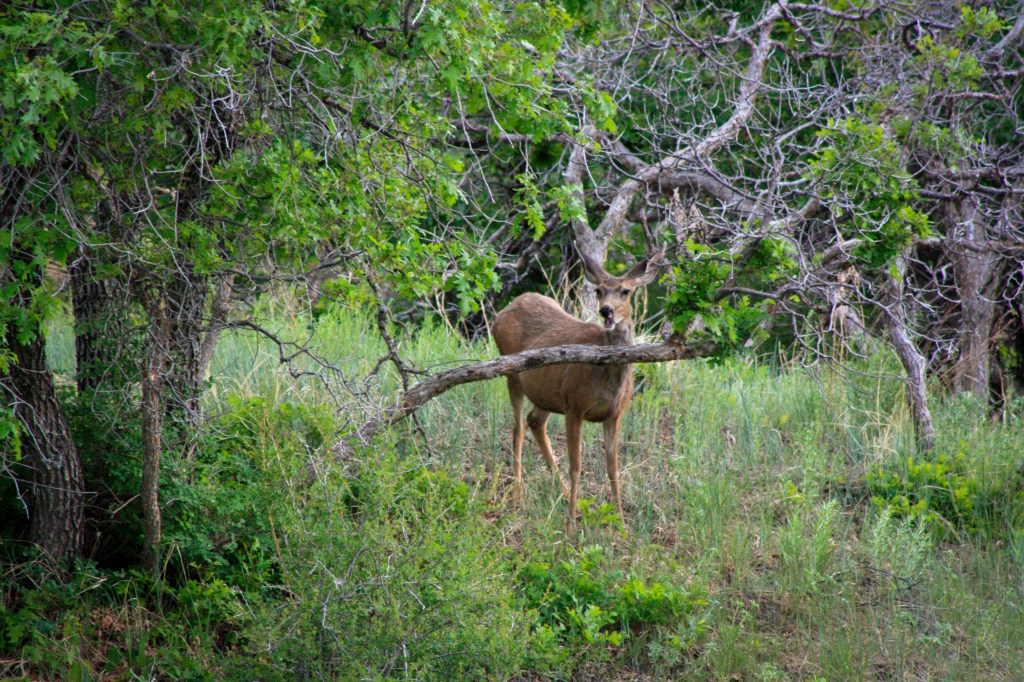
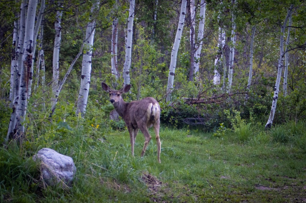
Along the way, we happened to catch sight of three deer and a raccoon, so I guess it wasn’t totally pointless?

Nah. It really was.

Pivot

Day 12: 6/13/24
From: Sequoia National Park (Potwisha Campground)
To: Golden Gate National Recreation Area (Bicentennial Campground Holiday Inn Express)
Distance: 294 miles

I am up at 5. Again. The variety of birds in the California wilderness is astounding and I have the Merlin bird app open to pass an hour before I even think about waking the kids. The California Towhee and the Acorn Woodpecker are fighting to see who can be the better alarm clock, I think.

At least the night eventually cooled down. We kept the rain fly off the tent and the windows unzipped, so the tent is comfortably cool this morning. I have no idea how long it took to get that way, but at some point in the night, as the temp fell, we all found our way inside sleeping bags.

When I get out of the tent, I notice a small shiny spring in the middle of our campsite. Husband thinks it must have come off of something we own, but I prefer to think a raven left us a gift sometime during the night since we’ve been befriending them everywhere we go. I’m going to miss the ravens when we head home.

We leave the campsite by 7:30 and hit up the visitor center for stickers by 8. Along the way, we encounter a black-tailed deer and two social ravens. See? The ravens have become our friends! Down the last stretch of the General’s Highway and back onto the main highways that will take us northwest to San Francisco we go.

We cross the Golden Gate Bridge, shrouded in fog and get a glimpse of Alcatraz. It’s 2 pm by the time we arrive at the campsite and when we pull up, we all stare in dread for a moment. Sun? No, there’s no sun here. It’s foggy, misty, windy, and 54 degrees midday. And our campsite has a 1/4 mile walk-in down a steep hill. Older child takes a spill on the gravel and scrapes up an ankle, a thigh, and both palms. To add insult to injury, at the bottom of the hill is a clearing where there is only a port-a-potty for our bathroom needs. The kids revolt.

And I don’t blame them.

The view of the Golden Gate Bridge is spectacular, but even that’s not enough for me to want to stay. It’s time to pivot. I use that wonderful cell reception to find a hotel less than a mile away. Now both kids feel bad and say they could just suck it up, but guess what? *I* don’t want to be freezing in a tent all night, have no running water, and have to use a port-a-potty. We’ve done pit toilets a few times on this trip, but this is a new low. So yeah, I look forward to the hotel, too.

From there, we head over to Muir Woods, (Which requires a parking reservation — beware! We managed to book one before heading over.) and take in the Redwoods over the course of 3 miles of trails. We stick mostly to the flat boardwalk and paved trails, which is better for my joints. 

The trees are beautiful and so very different from the sequoia we saw yesterday. Walking amidst so many at one time is magical. And I love that the path is handicap accessible. It’s heartening to see. (In fact, I was impressed just a few days ago when we saw the National Park Service laying concrete on some paths at Bryce Canyon.) It’s encouraging to know that people with disabilities aren’t being left out of seeing and appreciating the natural wonders of our world. And…Husband finds a beautiful ring that fits my finger while looking at the giant clover for a four-leaf. No four-leaf, but I’ll take the ring, thanks!

After Muir, we check into our hotel and virtually collapse. We’ll need to figure out where to order food as we won’t be making any camp meals tonight, but the warmth of a room and the promise of a bed is simply heavenly and we’re soaking in the atmosphere. The wind outside is relentless and we can hear the incessant chiming of the flagpole. Still, no one will complain as we’re just thrilled to be inside. Unfortunately, my hip subluxed getting out of the car today, so that may be my body’s sign to slow my roll a bit. I wonder if it’s due to the extreme changes in temperature. It’s not every day you go from a high of 111 degrees to 53. And colder temps are coming.

Dinner from Floodwater, the restaurant directly next to the hotel, is divine. Pizza, burgers, pork rolls, they have a bit of everything you could want. We’d hoped to play a game of Oregon Trail cards, but everyone is too tired, so we end up asleep just after 9:30 — so tired that no one even cares about the snoring. A plus.

Gold in the Dirt, Gold in the Hills

Day 11: 6/12/24
From: Las Vegas, NV
To: Sequoia National Park (Potwisha Campground) 
Distance: 391 miles

We leave Las Vegas by 8:30 and head to Goodsprings, NV to see The Pioneer Saloon. Last time Nate and I were here, we captured a video we weren’t expecting. That video is what made the kids want to come.

We reach the place an hour before they open and almost decide to skip it and just get on the road. But we’re hungry and there’s a new(er) enormous gas station/convenience store/beer distributor/casino with a White Castle where we can get breakfast.

By the time we finish with breakfast and restock our cooler with ice, the saloon is open and we can go back. 6 miles down the road again, we reach The Pioneer Saloon and the kids finally get to see the bullet holes in the wall. We show the bartender the creepy video and she says there’s still lots of recorded paranormal activity in the saloon including the presence of miners. She tells us about how Goodsprings was Vegas before Las Vegas was Vegas. It was the “it” destination. Which we knew since a plane carrying Carole Lombard and some crew members crashed into the mountains and Clark Gable drank at that very bar, hoping to hear better news than that of her death. A recovered piece of the plane is mounted to the dining room wall, but the majority of it remains in the hills, unrecoverable due to the difficult terrain.

But wait, there’s so much more than bullet holes! We didn’t know The Pioneer Saloon was featured in Fallout, and that Easy Pete from the game was inspired by a real person. We get the chance to meet Pete and he tells us all about the saloon, showing us the cool features of the saloon we knew nothing about. The original bar from 1860 is still in use and if you run your hand along the underside of the bar, you’ll feel a large hole where one could stash a gun if one were so inclined.

The parking lot? Well, people find gold there. Easy Pete dumped a few tiny nuggets from a shot glass into Younger Child’s hand, and proclaimed, “A gift, from me to you!” The kids stood in disbelief and thanked him. So we snap a few pictures and thank Pete again for sharing his experiences and knowledge of the saloon with us. 

By the way, the 3rd Annual Fallout fest is coming up in November. The first year brought about 3,000 people to the town of 176 people. The second year? 7,000. And the reason they moved it to November? People couldn’t take the heat and were passing out left and right. So anyway, it shouldn’t be 110 degrees if you want to visit in November and Easy Pete will be there to greet you.

We prepare for a long drive through the Mojave National Preserve and onward into California. Joshua trees stand out amongst the scrub and sand, like bizarre sentries from the pages of a Dr. Seuss book. And then we hit full-on “you will die if you try to cross me” desert. It’s 108 degrees and not even noon. The desolation here is intense, the mountainous terrain in the distance mean and angry-looking. The last time we drove through, these mirror solar farms didn’t exist. There’s something very creepy about glowing towers in the middle of the desert.

Most of our drive through California is much the same. But the mountains slowly change to golden hills that look like they’ve been covered in a velvet blanket. When we’re about an hour from Sequoia National Park, the family begins to wonder if I put the  correct destination into the GPS. How can we be close to Sequoia when it’s still 104 degrees outside with citrus groves and vineyards on either side of us?

But the directions are correct. Our campground is at the base of the park, before the Giant Forest. After seeing our military park pass, the park ranger at the entrance salutes Husband and thanks him for his service, almost bringing Husband to tears. Once again, we arrive when the sun is directly on our campsite. So instead of setting up in 95 degrees (it’s dropped a little), we opt to take a drive to see General Sherman. It’s 13 miles up the General’s Highway, a windy road that’s almost as bad as Independence Pass in Colorado.

But when we finally start to see the Sequoias, the kids are astonished. They almost don’t believe us when we tell them the trees they’re looking at are small compared to some of the others. So when they finally see General Sherman, their mouths drop. A walk through the Giant Forest gives us all an appreciation for the massive towering trees and how many hundreds to thousands of years they took to reach that size.

Unfortunately, we’ve also finally hit the part of the trip where mosquitoes abound. Meh. Back to the campsite by 8, we set up our tent just in time for dusk to the sound of chirping crickets and distant fellow campers. Remember those cooler temps AccuWeather told me we’d have? Lies. These temps were for the Giant Forest about 4500 ft above where we are. Instead, it’s 88 degrees with zero wind. It’s going to be a long, hot night.

The Most Expensive Day

Day 10: 6/11/24
From: Grand Canyon National Park, AZ
To: Las Vegas, NV
Distance: 272 miles

It worked! Husband sleeping in car and rest of family sleeping in tent resulted in sleep for everyone. Husband has some DayQuil and has been feeling significantly better even before taking it, but now even more so.

We spend a lazy morning making eggs and pancakes and doing dishes before breaking down camp and heading out a little after 9 am. We reach Las Vegas around 2 p.m. and the heat and crowds are both insane. It’s 111 degrees when we pull in, but people are everywhere. Since we have an hour to kill before checking in, we hit up the one place we missed the last time we came to this city. Husband is a happy camper. We get to visit the shop from History Channel’s Pawn Stars. Husband buys a few “souvenirs,” and then we head to the Luxor to check in.

I booked this hotel because I thought the kids would get a kick out of staying in a pyramid. I’m not wrong. They love it. Of course, they love almost everything here. It’s insane. We get to the hotel at 3 and figure we’re perfectly on time, not realizing the check-in process would take almost an hour since the line is so long, it looks like an airport ticket counter. While waiting, we discuss plans for the evening. Since it’s so hot, we scrap the idea of walking the strip, and on a whim, we buy Blue Man tickets while standing in line for check-in.

When we finally get to the rooms, we collapse into beds, nap, take showers, watch tv, and generally exist before heading to the food court for dinner, which is a $50 extra-large pizza that would be $18 at home. Ah, Vegas prices. Finished with dinner, it’s time for the show, which is conveniently in the same hotel. (Why do you think we really booked it? I don’t want to go anywhere today. We’ve done enough.) We get to our seats about 15 minutes early, and are asked almost immediately if we want an upgrade. Free? Yes! Of course, yes! We’re led to seats 4 rows from the front and we marvel at our good luck. What a treat! So glad for the folks who work this show. These seats are incredible.

The show? Even more incredible. The kids were smiling from ear to ear for the entire hour and a half. I swear I’ve never heard such laughter in my life. But Husband and I were doing the same. It’s impossible not to. We always knew the kids would love this show. They haven’t stopped talking about it since we left the theater. The Blue Man Group is the perfect mix of art, music, athleticism, and comedy. So much talent, it’s insane.

Afterwards, we figure we’ll walk the strip for a bit, but it’s still 99 degrees out. The breeze makes it bearable, but not by much. We get about a mile down the road when Younger Child and I call it quits and head back to the hotel so they can text with friends and I can catch up on the blog I haven’t been able to post because we’ve had no reception for days. Older Child and Husband decide they need to ride The Big Apple rollercoaster. That’s a hard pass from me, so an escape to the room is perfect. They come back proclaiming the ride more “intense” than they expected.

We each claim a bed of our own and for one night, everyone enjoys the comfort of a queen-sized bed.

Small Miracles

Day 9: 6/10/24
From: Bryce Canyon, UT
To: Grand Canyon National Park, AZ
Distance: 158 miles

I wake at 5:30, very glad I took my sky photos last night because this morning is all cloud cover. The clouds that have rolled in end up preventing us from seeing sunrise over the hoodoos as we had hoped. We still take a 2 mile hike along the rim regardless, just taking in the scenery. On the way back to our campsite, we spot a raven who decides to have a conversation with us, clacking his beak, cawing, and cooing. Older child caws back. They go on like this for a few minutes in an unexpected interaction that put smiles on all of our faces.

Back to the tent for a nap before we leave Bryce. Later? A short trip to the Grand Canyon. (Short = 3 hours in the car) The naps only last about an hour before we get up and break down camp. And because the sun is now shining (where was it before?!) we take a walk to Sunrise Point again. But Husband wants to visit the lookout point we saw last time we were here, so we head to Sunset Point, where the kids enjoy the same view and become as entranced with the canyon as we are. It takes effort to pull them away and get on the road. How to leave behind those towering orange spires and the ravens that soar among them… it’s oh-so-difficult.

We stop to buy car stickers from a souvenir shop nearby and say hello to the saddled up horses waiting for riders to show up for their trail rides. It takes everything in me not to hop out of the car and pet them.

We make one more stop at a rock shop and an antique place in Orderville, UT before we get into the heavy driving for the day. And we still manage to reach the Grand Canyon by 1 pm because time change. Again. Arizona doesn’t do daylight savings time. Bison greet us shortly after we enter the park. And something we didn’t realize last time (because we’d never seen wild bison before) — these bison are MUCH smaller than the bison in Yellowstone. 

We get to our campsite and set up, but since the tent is in direct sun and will be for hours, we head out to the closest lookout point to take in the view, and get a family photo taken by a French-Canadian from Montreal who just finished hiking 400 miles from Phoenix to the Grand Canyon. My aching joints can’t even comprehend that this is possible.

Kids marvel at how wonderful most fellow campers are/have been over the last few days. Everyone leaves their stuff their campsites and trusts that no one will “mess with it.” In fact, along one hike, we end up talking with other hikers at the lookout point and everyone chimes in on their favorite national parks. The kids agree that the kind of person who camps the National Parks is generally a kindred spirit and we relish that we’ve had pleasant conversations with so many people we’ll never meet again, but who kind-of-sort-of make us like humanity again. 

After a stop by the local store to pick up lunch and taking much needed showers, we play a game of Oregon Trail, where 2/4 of us make it to the end this time. Then we head to the lookout points at the lodge. We opt to take the Angel Point trail, which is generally paved, but is also a very steep grade downward which is tough on my joints, so I bail about halfway to the end, sit on a rock, and take a selfie. Because why not?

The Grand Canyon is as it ever was — large and impressive, its distance almost incomprehensible. I’ve hiked 5 miles today on mostly dirt trails, something I haven’t done in several years, something I haven’t been *able* to do. I am elated. Exhausted, but elated. Having a dynamic disability makes it difficult to plan ahead. Sure, I planned to stop in all these different locations over the course of three weeks, but I had no idea whether or not I’d be able to full enjoy them the way I wanted to. Even now, I still have no idea what the next two weeks will bring. But I am grateful, so, so grateful right now that I have been able to get out and immerse myself in these oh-so-miraculous places that exist on this planet we call home. 5 miles may not be much for most people, but for me? It’s worth celebrating like it’s 500.

As it gets dark, our family heads back to camp. Sadly, Husband is coming down with a cold. At least I know it wasn’t the same one I had right before we left, so I can avoid feeling guilty. But I still feel bad. Maybe this is the real reason behind the terrible snoring?!? One can hope.

Even if it didn’t stop him from hiking Bryce Canyon this morning and the Grand Canyon this evening. Husband even ventures out with me before bed to take a few night sky photos (See? Even sick, he’s still my hero.) and then it’s time for bed. 

Fingers crossed he feels better in the morning! 

Canyons (x2)

Day 8: 6/9/24
From: Mesa Verde National Park, CO
To: Bryce Canyon, UT by way of Four Corners National Monument and Antelope Canyon, AZ
Distance: 382 miles

7 a.m. seems to be our regular wake up time. We break down camp and head to The Knife’s Edge Cafe down by the camp office to order breakfast we don’t have to prepare ourselves. Then we’re on the road by 9. Without any reception, we can’t map out our destination, so we head west and figure the phone’s GPS will eventually kick in.

It’s only an hour before we reach Four Corners to take cheesy family photos of the four of us standing in four different states at once. Then we do a little shopping from the Navajo sellers and as much as we’d like to buy lots from every vendor, we have to keep in mind the fact that we have no place to put it in the car.

Older Child wants to know what happens if you’re murdered in 4 states at once. Which authorities get called?

Back on the road to our second stop at Antelope Canyon. Arizona doesn’t do daylight savings time, but this time, I was prepared. We end up arriving two hours early for our tour of Upper Antelope Canyon, which gives us time to grab lunch, frozen yogurt for dessert, and gluten-free cereal for one kid for tomorrow morning.

Then, we’re off on bouncy vans through the desert to the mouth of the canyon with our tour guide Amar. Amar is a wealth of knowledge, funny, and personable, and the kids are as intrigued as the adults on this venture. I am surprised to see much has changed in the canyon since we were last here nine years ago. I shouldn’t be. The canyon floods 9-12 times a year on average from flash floods that occur after major storms. In fact, the entire canyon is about 3 ft deeper than it was a decade ago.

After the tour, we head back to Page, AZ to pick up a few Antelope Canyon stickers for the car and Older Child’s sketchbook. After 3,000+ miles, I *finally* get to take the wheel as Husband is still battling that same lingering headache. It’s 2 1/2 hours to Bryce Canyon and the driving isn’t complicated. The roads are wide open and by the time we’re an hour out from Bryce, there’s almost no one on the road. After all, who drives into a campground at 8 p.m.? Us. Apparently.

We’re set up by 8:30 and then take a quick walk to the rim of the canyon just in time to catch the sun on some of the desert features in the distance, though not on the hoodoos themselves. Dinner is mostly scavenged, but we do get to have a small fire while we eat, which is nice. The last time Husband and I went cross-country, we just didn’t have much time for fires.

We’re ready to collapse into sleeping bags by 10 p.m., but the stars are very tempting and I wonder if I can catch starlight or the Milky Way over the hoodoos. I’m not sure it’s possible, but it’s worth a try, so Husband and I trek to the rim to try. Kids opt to stay put, and I can’t really blame them. A week into our trip and everyone is a bit exhausted.

Husband and I don’t see the Milky Way (mostly obscured by cloud cover), but the view is spectacular nonetheless. Stars and clouds over the hoodoos make for some beautiful night sky photography.

I look forward to sharing the images when I get home and have time to process them! For now, settle for a few daytime shots from our day.

Family Time Across the Centuries

Day 7: 6/8/24
Mesa Verde National Park, CO
Distance: 30-ish miles?

We wake at 7 am and head to the cliff dwelling viewing areas before the heat and the crowds. It makes for a perfect morning. Our first stop is Cliff Palace. When we get to the viewing platform, our eyes are immediately drawn to a carved out dwelling across the canyon. “Is that it?” Husband asks, prepared to be underwhelmed. “It’s hardly anything,” one of the children chirp.

I turn to my left and before me is the incredible sight that we came for – Cliff Palace, a pueblo dwelling in the canyon walls, the very existence of which seems impossible. “That’s because you’re looking the wrong direction.” I say, and everyone turns to see what I’ve been staring at. It’s enough to take your breath away, this incredible feat. How were such places built? How were such things *possible?* These dwellings are 1000 years old and older. It’s incredible to think how they were made, and how many Indigenous families must have climbed up and down those cliffs with nothing but ladders and hand and footholds? How many families spent hours and days together in these shared rooms, bonding over stories and work and time together?

We take a stop to check out The House of Many Windows, which we think sounds both like a mystical place and a horror movie — depends on who you ask within our party. The “windows” are actually doors, and only 4 of the original 15 are able to be seen today. Our next stop is Balcony House, which requires a 1.2 mile walk to view from afar. It’s early enough that we see next to no one along the partially-shaded trail. This hike is *much* better than yesterday’s. The Balcony House parking lot is located directly above Balcony House, leading to a lot of confusion among many of the tourists now behind us on their way to view the dwellings, but last night’s ranger talk included instructions on the best way to view some of the sites, so we were prepared.

Then we swing by the museum to see some artifacts once found inside the dwellings and to pick up stickers for the roof box. We’ve been slowly adding as we go and loving the accumulating adventure. Our final stop is a quick view from directly behind the museum — Spruce Tree House. A raven nest sits directly above Spruce Tree House, and the couple are home and keeping their young warm.

We head back to camp for showers, laundry, and internet. A trip to the local town for groceries while the sun is high and hot, then back to the tent for working on photos and art and for maybe (definitely) catching a nap before getting dinner and watching a deer in the meadow beside us.

We pass the evening playing Toasted or Roasted (a game we picked up at the Grand Canyon 9 years ago) and the Oregon Trail card game. Spoiler: Only one of us (Older Child) made it to Oregon. Younger Child died from a rattlesnake bite about 10% of the way into the game. Husband died of dysentery about 40% of the way through. And I died of dysentery 92% of the way into the game.

We laughed and laughed. And we’re really, really glad not to be on the *actual* Oregon Trail. I like our Subaru, thank you very much. It’s been a good trip so far. We may not live in cliff dwellings like the Indigenous people a thousand years ago, but this trip is a treasure for our close-knit family.

Into the Fire

Day 6: 6/7/24
From: Santa Fe, NM
To: Mesa Verde National Park, CO by way of Bisti/De-Na-Zin Wilderness Area, NM
Distance: 318 miles

Up at 7, but Husband was up half the night with a migraine brought on by the IPA he had with his shrimp tacos last night. Maybe there’s some obscure rule that says we can’t *all* get good sleep at the same time. Because I slept like a baby. It was amazing.

We head to the breakfast buffet at the inn, which is delicious and loaded with an array of southwestern goodies. Pinto beans, mixed veggies, chili, plus your regular fare like eggs, biscuits and gravy, fresh fruit, cereal, pastries, and oatmeal. We eat in the beautiful courtyard where I’ve decided I’d like to set up permanent residence.

Then we’re on the road to Cabela’s for a seamless pickup of the air mat I ordered yesterday. Mat in hand, we head northward to the Bisti/De-Na-Zin Wilderness Area, the land changes drastically again. We drive through several reservations which are nothing more than rock, dirt, and scrub brush from the road. Breathtaking and lonesome.

Along the way, we pass someone in the desert who’s riding a bike loaded with supplies. “Where is he going?” I ask. “Where is he *coming* from???” He’s coming from the same whole lot of nowhere we just came from. I can’t imagine riding a bike on a desert highway. We soon figure out he’s heading towards the town of Cuba, NM just a few miles down the road.

By the time we’re 45 minutes from our destination, the surrounding land is low grass and scrub. Younger Child says it’s “Minecraft terrain.” Indeed. A half hour out and we start pointing out angry alien faces in rocks. 

We travel twelve miles down a dirt and gravel road to the Bisti/De-Na-Zin Wilderness Area and park, load up on sunscreen and water, and head out into the wilderness in hopes of seeing this:

What we didn’t plan on: Being there at the beginning of the hottest part of the day, there being NO maps at all of the trails, and the distance would would have to travel to see what we were hoping to see. 

So in the end, we didn’t see it. But we still walked 2 miles in blistering heat with no shade and got some cool pictures regardless, plus saw 75 million year old petrified wood. Still, everyone is surely wondering what Mom was thinking putting this one on our list, but when Mom planned this in January, it wasn’t a real feel temperature of 100 degrees.

We get back to the car, down more water, and blast the A/C for the next hour, stopping at lunchtime not to eat lunch, but to eat ice cream at a gas station. Because ice cream is the only food that even remotely sounds good right now. 3/4 of us have heat-related headaches. Older Child says Dad must have played his headache card last night.

We did get to see some horses in the wilderness area. Wild? Or Navajo owned? We don’t know. And without cell service, we can’t find out…

Older Child and I drank several bottles of water to try to get rid of the heat headaches…and found out later we both desperately had to visit a restroom but there’s nothing nearby. It was a fun hour.

We got to Morefield Campground in Mesa Verde National Park and were immediately greeted with stunning 360 degree views. There is no direction that isn’t incredible.

A short time later, we set up camp in a beautiful site with sun and shade and trees. A gust of wind tries to take our tent away before we have it staked down, but we hold on.

Minutes after we arrive, both kids are approached by a kid from another camp site who asks if they want to play tag with him. They help us finish setting up and then head over to play for a half hour before dinner. Older Child jokes they want to play snake tag, where you run around in the grass with no shoes on and see who gets bitten by a snake first. Yes, my kids are weird. They ended up not playing any kind of tag, snake or otherwise. Instead, they played Mancala and lost twice to an 11-year-old named Caleb.

A quick camp meal and some local exploring for Husband and kids, while I play with photos on my computer at the camp picnic table and receive a visit from a sweet black-tailed doe. At 9, we head to the amphitheater for a presentation by a park ranger about some of the animals in the park.

When we get back to our campsite, Mom makes another *very* bad decision. Older child is concerned about a noise in the grass and trees behind our tent so I take a flashlight behind to look and then fake freaking out at a bear. The kids *lose* it and it’s a mixture of laughter and tears for the next hour as adrenaline clears system. I am an awful mother. This is the kind of prank their dad would pull, not me… I may never get over feeling guilty over this one.

To try to ease the tension, I pull out my camera and show the kids the earth’s rotation by focusing on the North Star and keeping the shutter open to create star trails. They are intrigued and we agree we’ll try it again tomorrow night with a little more preparation beforehand.

For now, bed. An early wake up so we can head out to see the Pueblo dwellings along the mountain in the morning. Animals are also most active early in the morning, so who knows? If we’re lucky, maybe we’ll see a bear on the way…

Bound for Santa Fe

Day 5: 6/6/24
From: Aspen, Colorado (Difficult Campground)
To: Santa Fe, NM
Distance: 300 miles

I’m up at 4 am. Why am I up at 4 am? Because my body is not used to camping. I made the executive decision somewhere in the blackness of night that I would flip my sleeping position so I could try to escape Husband’s snores, my head now at everyone else’s feet. It worked for the most part, but I’m generally a light sleeper and so I still wake with every shift of sleeping bags. The cold forest air has my head stuffy this morning, so allergy meds were my first go-to. (I thought about taking a Sudafed, but as we’re camping at an elevation of 8,000 ft, I’d rather not make my heart explode. It’s already working double time to keep up as it is.)

Up and out of the campground by 8 am, but not before first admiring a mule deer at a camp site next to us. It turns out Independence Pass isn’t as bad when driving the other direction. Or maybe it’s that we’re fresh off a night of sleep and haven’t been driving for 6 hours before getting to it this time. Who can say?

We make a quick stop in the teeny “town” of Twin Peaks so Husband can grab a coffee from a van and get to see an awesome magpie who lives nearby. They are big, gorgeous, incredibly smart birds in the raven family and I’m so glad I had the chance to see one live!

Before we head to Santa Fe, we need to find a Cabela’s. Husband cannot sleep on this creaky air mat again. It kept everyone waking every time he moved last night. A quick trip to Albuquerque tomorrow on our way to Mesa Verde National Park only adds 20 minutes to our drive, and there, we’ll find an air mat like mine waiting at curbside pickup at Cabela’s because the internet is a wonderful thing and I ordered one as soon as I had reception again.

On the way to New Mexico, we encounter a dust devil in southern Colorado. Fun! (And much better than encountering a tornado.)

We arrive in Santa Fe at a lovely inn in the middle of town around 2:30 pm, but check in isn’t until 4, so we walk the street and peruse the shops until our room is ready. There are so many vendors both outdoors and in with an array of beautiful artwork, pottery, jewelry, clothing, and so much more. You could easily spend a week shopping and half a year’s salary here.

We stop by the Loretto Chapel, but don’t go in since we’ve already gotten a call that our room is ready. But locals tell us about the “miraculous staircase,” so I make a point to find out more online. Neat? Yes. But we’re not terribly sad we missed viewing the inside in person. It’s plenty gorgeous from the outside.

Our room at the inn is lovely and inviting with a fireplace we almost certainly won’t use, and a walled porch with a gate that leads to a courtyard garden that separates the guest rooms from each other.

After hot showers and a rest, Husband and Older Child go out for dinner with promises to bring back food for me and Younger Child, who are just too beat to keep going today. I update the blog with all of yesterday’s activity, since we had zero reception for much of our adventures in the Rocky Mountains.

Aaaaand, by 9 pm we realize our air conditioning is broken. I figured we’d be sweltering during this trip. I just didn’t figure it would be while in an adorable inn in the middle of Santa Fe. I kind of figured it would be later when we were camping and hiking in the desert. Maintenance leaves at 8, so a poor security guard who doesn’t know anything about A/C repair is sent to our room. He does his very best to make it manageable. (It was getting rough when outside seemed cool at 80 degrees…) A few minutes later, he returns with a standing fan to help move the air in the room. We are very grateful.

Within a half hour, the room is tolerable and we are finally ready to get to bed. It’s been a low key night watching television after so much activity over the last few days.

Tomorrow, we head *back* to Colorado. But nowhere near Aspen this time, so we will NOT be heading over Independence Pass. Whew!

Moving Up in the World

Day 4: 6/5/24
From: Cedar Bluff State Park, KS
To: Aspen, CO (Difficult Campground)
Distance: 528 miles

Up at 6 and out the door by 7:30 with a quick stop for groceries at Malay’s Market in WaKeeney, KS, Christmas City of the High Plains. There are three checkout lanes; This One, That One, and The Middle One. I love the humor. And friends. They bring your groceries to the car FOR you, even if you just have three bags. Hey, Kansans, I do have one question though. What is chewable nugget ice and why?

Halfway to the next stop and the kids marvel at the number of bugs splattered on the windshield. I’d forgotten about this part. Eastern Colorado is much like Kansas, but with ever-so-slightly barely rolling hills that prevent you from seeing very far.

But we spot the Rocky Mountains off in the distance to our left and that brings promise that the land will change drastically not long from now. We expect the heat of the day to give way to a chilly evening tenting at a campground not far from Maroon Bells-Snowmass Wilderness where cell reception is spotty. So if you don’t see this post until later, that’s why…

The Rockies are in sight for so long that it’s almost a shock when we’re finally close enough to really see the features. (Especially after so much flat.) I can’t help but think about what pioneers much have thought as they traveled the continent on horses and in wagons when they saw these massive looming snowcapped mountains in front of them. I’ve come to understand that I will never possess the kind of fortitude it takes to uproot your family and immigrate to a new and wild place.

We take a quick lunch break at a scenic overlook just outside of Golden, Colorado where we meet up with this little fella, who didn’t seem to mind at all that we were there.

Up into the Rockies, we go, into the Arapaho National Forest. Younger Child is amazed by the signs to beware of elk and bighorn sheep. But we don’t see any right away. Then, just as Husband is mentioning how he’s usually pretty good at spotting wildlife, we round a corner to a small herd of bighorn sheep eating grass *right* next to the white line of the road. He really IS good.

The temperature has dropped from 87 degrees F to 59, and our car A/C has switched to heat. A small stop in the town of Silverthorne for fuel and nausea relief from the curving, twisting mountain roads. Being in Silverthorne is a bit like being in the middle of the Austrian Alps. Here’s a town. And here are large, snowy peaks surrounding the town on all sides. (Not like the Alps? Here are a bunch of fast food restaurants and gas stations.)

We opt to take Independence Pass again and I have to wonder what we were thinking. By the time we pass Arkansas Headwaters, Younger Child and I keep the windows open to keep from letting the windy roads get the better of us. I remind myself that this was the hardest drive of our cross-country trip last time. These roads are tough! After this, it should be easy sailing by comparison!

I start to get excited as we near the top, though, as the birch trees have begun to show up. Aspen, soon! But first, a snowball fight at 12,095 feet. In shorts, t-shirts, and sandals. Ah, that’s right. *That’s* why we took Independence Pass! 

View from the tent

We arrive at the campground with the help of a downloaded offline map and get ourselves set up by 4 pm. (Kids are less than impressed with the campground pit toilets. This is their first encounter with them and they are underwhelmed to say the least.) But there’s just one problem when it comes to figuring out where to head next. Maroon Lake isn’t on my map and I can’t use the internet to find it. 

So we head to Aspen for dinner (and cell service) to discover that Maroon Lake is actually an hour away. Which…just isn’t in the cards after an 8 hour drive that included Independence Pass today.

We’ll have to be content shopping in Aspen and hanging at the campground this evening. And when I say “shopping,” know that I mean dinner at the Silverpeak Grill and gelato from the Paradise Bakery. Plus a couple of souvenir stickers. Certainly, we didn’t pick up goods from Prada, Ralph Lauren, Dior, Gucci, or any of the other posh stores we can’t afford. It turned out to be a good afternoon despite having to reroute  our original plans.

Older Child is a little disappointed about missing Maroon Bells, but they don’t really want to spend another 2 hours driving there and back. No one does. When we get back to the campground, Husband and Older Child head out for a hike in the day use area of the White River National Forest while Younger Child and I relax in the tent. Sleep will hit hard tonight.

Oh. 

And did I mention we need to drive back over Independence Pass again tomorrow on our way to New Mexico?

<sobs>